Vineyards, Florida Weather
Issued: 2:32 am EDT May 4, 2024 Latitude: 26.2278652 Longitude: -81.7092521 View on Google Maps
|
|
|
|
|
|
|
|
|
|
 |
 |
 |
 |
 |
 |
|
|
| High: °F |
Low: °F |
High: °F |
High: °F |
High: °F |
High: °F |
High: °F |
High: °F |
| Low: °F |
Low: °F |
Low: °F |
Low: °F |
Low: °F |
|
| Thunderstorms |
Thunderstorms |
Thunderstorms |
Thunderstorms |
Thunderstorms |
Sunny |
Sunny |
Sunny |
Current Conditions at
NAPLES - (KAPF)
72°
Clear
as of 5:53 AM EDST
Rel. Humidity: 94%
Dew Point: 70°F
Visibility: 10 Miles
Pressure: 29.96 in.
Flight Rule: VFR
Wind Data
6 MPH
060° Northeast
Cloud Level(s): Clear
Current Conditions at
FT MYERS SW APT - (KRSW)
68°
Clear
as of 5:53 AM EDST
Rel. Humidity: 100%
Dew Point: 68°F
Visibility: 10 Miles
Pressure: 29.97 in.
Flight Rule: VFR
Cloud Level(s): Clear
Current Conditions at
FT MYERS PAGE FLD - (KFMY)
70°
Clear
as of 5:53 AM EDST
Rel. Humidity: 88%
Dew Point: 66°F
Visibility: 10 Miles
Pressure: 29.96 in.
Flight Rule: VFR
Cloud Level(s): Clear
Current Conditions at
FORT LAUDERDALE EXEC - (KFXE)
77°
Clear
as of 5:53 AM EDST
Rel. Humidity: 73%
Dew Point: 68°F
Visibility: 10 Miles
Pressure: 29.96 in.
Flight Rule: VFR
Cloud Level(s): Clear
|
Today... A 30 percent chance of showers and thunderstorms, mainly after 4pm. Mostly sunny, with a high near 89. East wind 6 to 9 mph becoming southwest in the afternoon. |
|
|
Tonight... A chance of showers and thunderstorms before 11pm, then a slight chance of showers between 11pm and 2am. Partly cloudy, with a low around 70. Light and variable wind becoming east around 6 mph after midnight. Chance of precipitation is 30%. |
|
|
Sunday... A 40 percent chance of showers and thunderstorms after 2pm. Mostly sunny, with a high near 90. East wind 6 to 10 mph. |
|
|
Sunday Night... A 30 percent chance of showers and thunderstorms before 8pm. Partly cloudy, with a low around 70. East wind around 6 mph. |
|
|
Monday... A 20 percent chance of showers and thunderstorms after 2pm. Mostly sunny, with a high near 91. East wind 7 to 10 mph. |
|
 |
Monday Night... A 10 percent chance of showers and thunderstorms before 8pm. Partly cloudy, with a low around 70. East wind 8 to 10 mph. |
|
|
Tuesday... A 20 percent chance of showers and thunderstorms after 2pm. Sunny, with a high near 90. East wind around 10 mph becoming south in the afternoon. |
|
 |
Tuesday Night... Mostly clear, with a low around 71. Southwest wind around 8 mph becoming southeast after midnight. |
|
|
Wednesday... Sunny, with a high near 91. East wind 8 to 11 mph becoming south in the afternoon. |
|
|
Wednesday Night... Mostly clear, with a low around 71. |
|
|
Thursday... Sunny, with a high near 91. |
|
|
Thursday Night... Mostly clear, with a low around 72. |
|
|
Friday... Sunny, with a high near 91. |
|
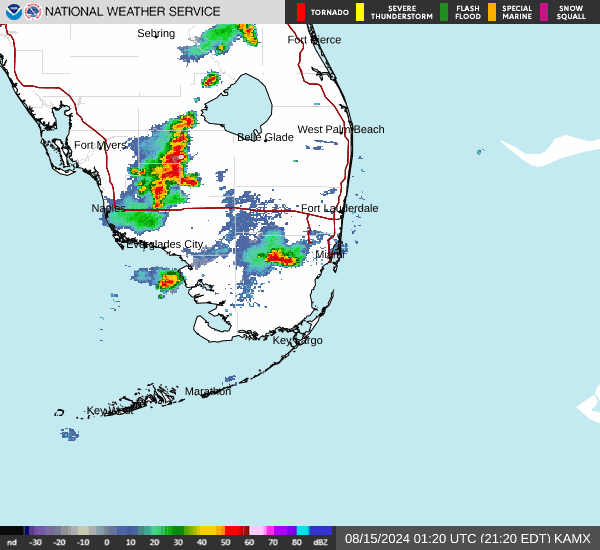
Current Radar Image
Sun Almanac for Vineyards, Florida
Sunrise: 06:47 AM
Sunset: 8:01 PM
Civil Sunrise:06:22 AM
Civil Sunset: 8:25 PM
Nautical Sunrise: 05:53 AM
Nautical Sunset: 8:54 PM
Astro Sunrise: 05:23 AM
Astro Sunset: 9:24 PM
Florida's Current Temperatures
 Florida's Satellite Image
 Florida's Current Wind Direction
| National Summary |
of upper and lower values of current conditions amongst 7045 locations
in the contiguous United States |
|
High
Temp |
81° |
Fort Lauderdale Intl, Florida
and 2 other locations
|
|
Low
Temp |
30° |
Powell, Wyoming
and 31 other locations
|
|
Wind
Speed |
29mph |
Aurora, Nebraska
and 2 other locations
|
|
Wind
Gust |
40mph |
Clinton, Oklahoma
|
|
Wind
Chill |
21° |
Cody, Wyoming
|
|
High
Pressure |
30.82Hg |
Ottawa, Ohio
|
|
Low
Pressure |
29.53Hg |
The Dalles, Oregon
|
|
| # Locations Reporting Snow |
1 |
|
| # Locations Reporting Rain |
173 |
|
| # Locations Reporting Thunderstorms / Lightning |
3 |
|
| # Locations Reporting Fog |
54 |
|
| Average Temperature in the Contiguous USA |
56° |
|
Any use of the information on this page is at your own risk. This information should not be relied upon in life-threatening situations, potential financial loss situations or in lieu of any officially disseminated information. Visit the
National Weather Service for official information.