Wyanett, Minnesota Weather
No Watches or Warnings for Wyanett
Issued: 8:12 am CDT Apr 29, 2024 Latitude: 45.586908 Longitude: -93.4507881 View on Google Maps
|
|
|
|
|
|
|
|
|
|
 |
 |
 |
 |
 |
 |
|
|
| High: °F |
Low: °F |
High: °F |
High: °F |
High: °F |
High: °F |
High: °F |
High: °F |
| Low: °F |
Low: °F |
Low: °F |
Low: °F |
Low: °F |
|
| Rain |
Partly Cloudy |
Rain |
Mostly Sunny |
Thunderstorms |
Partly Sunny |
Partly Sunny |
Mostly Sunny |
Current Conditions at
PRINCETON - (KPNM)
Cloudy
Mist
as of 8:35 AM CDST
Rel. Humidity: 93%
Dew Point: 37°F
Visibility: 2 1/2 Miles
Pressure: 29.71 in.
Flight Rule: IFR
Cloud Level(s): Solid Overcast at 600ft
Current Conditions at
CAMBRIDGE MUNICIPAL - (KCBG)
37°
Cloudy
Light Drizzle
as of 8:35 AM CDST
Rel. Humidity: 93%
Dew Point: 36°F
Visibility: 2 1/2 Miles
Pressure: 29.71 in.
Flight Rule: IFR
Wind Data
6 MPH
050° Northeast
Cloud Level(s): Solid Overcast at 500ft
Current Conditions at
MORA MUNICIPAL - (KJMR)
37°
Cloudy
Light Drizzle
as of 8:35 AM CDST
Rel. Humidity: 100%
Dew Point: 37°F
Visibility: 1 3/4 Miles
Pressure: 29.75 in.
Flight Rule: IFR
Wind Data
3 MPH
060° Northeast
Cloud Level(s): Solid Overcast at 500ft
Current Conditions at
RUSH CITY - (KROS)
37°
Cloudy
Mist
as of 8:35 AM CDST
Rel. Humidity: 93%
Dew Point: 36°F
Visibility: 1 3/4 Miles
Pressure: 29.72 in.
Flight Rule: LIFR
Wind Data
7 MPH
050° Northeast
Cloud Level(s): Solid Overcast at 400ft
|
Today... A chance of showers before 1pm, then a chance of drizzle between 1pm and 3pm, then a chance of showers after 3pm. Patchy fog before 1pm. Otherwise, cloudy, with a high near 48. Northeast wind around 10 mph becoming west northwest in the afternoon. Chance of precipitation is 50%. New precipitation amounts of less than a tenth of an inch possible. |
|
|
Tonight... Cloudy, then gradually becoming partly cloudy, with a low around 35. West wind 5 to 10 mph. |
|
|
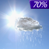
Tuesday... Showers likely after 4pm. Mostly sunny, with a high near 67. West wind 5 to 10 mph becoming southeast in the afternoon. Chance of precipitation is 70%. |
|
 |
Tuesday Night... Showers and possibly a thunderstorm before 1am, then a slight chance of showers and thunderstorms between 1am and 4am, then a slight chance of showers after 4am. Low around 45. East southeast wind 10 to 15 mph becoming west after midnight. Winds could gust as high as 25 mph. Chance of precipitation is 90%. New rainfall amounts between a half and three quarters of an inch possible. |
|
|
Wednesday... Mostly sunny, with a high near 67. West southwest wind 10 to 15 mph. |
|
 |
Wednesday Night... A 30 percent chance of showers, mainly after 1am. Mostly cloudy, with a low around 47. Southwest wind 5 to 15 mph becoming east in the evening. |
|
|
Thursday... Showers likely, with thunderstorms also possible after 1pm. Mostly cloudy, with a high near 59. Breezy, with an east northeast wind 15 to 20 mph, with gusts as high as 30 mph. Chance of precipitation is 60%. New rainfall amounts between a quarter and half of an inch possible. |
|
 |
Thursday Night... A 40 percent chance of showers and thunderstorms. Mostly cloudy, with a low around 44. Breezy, with a northeast wind 10 to 20 mph becoming west northwest after midnight. Winds could gust as high as 30 mph. |
|
|
Friday... A 30 percent chance of showers, mainly after 1pm. Partly sunny, with a high near 59. West wind around 15 mph, with gusts as high as 25 mph. |
|
|
Friday Night... A 30 percent chance of showers. Mostly cloudy, with a low around 41. West wind 10 to 15 mph, with gusts as high as 25 mph. |
|
|
Saturday... A 40 percent chance of showers. Partly sunny, with a high near 58. West wind 10 to 15 mph. |
|
 |
Saturday Night... A 30 percent chance of showers. Partly cloudy, with a low around 39. West northwest wind 10 to 15 mph. |
|
|
Sunday... Mostly sunny, with a high near 65. West wind 10 to 15 mph. |
|
Current Radar Image
Sun Almanac for Wyanett, Minnesota
Sunrise: 06:03 AM
Sunset: 8:19 PM
Civil Sunrise:05:31 AM
Civil Sunset: 8:51 PM
Nautical Sunrise: 04:50 AM
Nautical Sunset: 9:32 PM
Astro Sunrise: 04:05 AM
Astro Sunset: 10:17 PM
Minnesota's Current Temperatures
 Minnesota's Satellite Image
 Minnesota's Current Wind Direction
| National Summary |
of upper and lower values of current conditions amongst 7232 locations
in the contiguous United States |
|
High
Temp |
81° |
North Perry Arpt, Florida
and 6 other locations
|
|
Low
Temp |
1° |
Imperial Beach NAS, California
|
|
Wind
Speed |
32mph |
Duluth Sky Harbor, Minnesota
|
|
Wind
Gust |
38mph |
Duluth Sky Harbor, Minnesota
and 1 other location
|
|
Wind
Chill |
0° |
Berthoud Pass, Colorado
|
|
High
Pressure |
30.27Hg |
Pagosa Springs, Colorado
|
|
Low
Pressure |
29.64Hg |
Glencoe, Minnesota
|
|
| # Locations Reporting Snow |
13 |
|
| # Locations Reporting Rain |
124 |
|
| # Locations Reporting Fog |
54 |
|
| Average Temperature in the Contiguous USA |
57° |
|
Any use of the information on this page is at your own risk. This information should not be relied upon in life-threatening situations, potential financial loss situations or in lieu of any officially disseminated information. Visit the
National Weather Service for official information.


