No Watches or Warnings for Ward
Issued: 1:16 am EDT May 6, 2024 Latitude: 30.3040869 Longitude: -84.7029663 View on Google Maps
|
|
|
|
|
|
|
|
|
|
 |
 |
 |
|
|
 |
 |
 |
| Low: °F |
High: °F |
High: °F |
High: °F |
High: °F |
High: °F |
High: °F |
High: °F |
| Low: °F |
Low: °F |
Low: °F |
Low: °F |
Low: °F |
Low: °F |
|
| Morning Fog |
Thunderstorms |
Mostly Sunny |
Mostly Sunny |
Mostly Sunny |
Thunderstorms |
Sunny |
Thunderstorms |
Current Conditions at
TALLAHASSEE - (KTLH)
72°
Clear
as of 12:53 AM EDST
Rel. Humidity: 88%
Dew Point: 68°F
Visibility: 10 Miles
Pressure: 30.03 in.
Flight Rule: VFR
Cloud Level(s): Clear
Current Conditions at
APALACHICOLA - (KAAF)
72°
Mostly Clear
as of 12:53 AM EDST
Rel. Humidity: 94%
Dew Point: 70°F
Visibility: 9 Miles
Pressure: 30.03 in.
Flight Rule: VFR
Cloud Level(s): Few at 1200ft
Current Conditions at
MARIANNA - (KMAI)
72°
Clear
as of 11:53 PM CDST
Rel. Humidity: 83%
Dew Point: 66°F
Visibility: 10 Miles
Pressure: 30.02 in.
Flight Rule: VFR
Wind Data
3 MPH
210° Southwest
Cloud Level(s): Clear
Current Conditions at
BAINBRIDGE - (KBGE)
72°
Clear
as of 1:15 AM EDST
Rel. Humidity: 88%
Dew Point: 68°F
Visibility: 10 Miles
Pressure: 30.04 in.
Flight Rule: VFR
Wind Data
5 MPH
230° Southwest
Cloud Level(s): Clear
|
Overnight... Patchy fog after 2am. Otherwise, partly cloudy, with a low around 67. Calm wind. |
|
|
Monday... A 20 percent chance of showers and thunderstorms after 2pm. Areas of fog before 9am. Otherwise, partly sunny, with a high near 90. Light and variable wind becoming south southwest 5 to 10 mph in the morning. |
|
 |
Monday Night... Mostly clear, with a low around 67. South southwest wind around 5 mph becoming calm after midnight. |
|
|
Tuesday... Mostly sunny, with a high near 90. Light south wind becoming south southwest 5 to 10 mph in the morning. |
|
 |
Tuesday Night... Partly cloudy, with a low around 70. South southwest wind around 5 mph. |
|
|
Wednesday... Mostly sunny, with a high near 91. |
|
|
Wednesday Night... Mostly clear, with a low around 71. |
|
|
Thursday... Mostly sunny, with a high near 92. |
|
|
Thursday Night... Partly cloudy, with a low around 72. |
|
|
Friday... A 50 percent chance of showers and thunderstorms. Partly sunny, with a high near 88. Breezy. |
|
|
Friday Night... Mostly clear, with a low around 60. |
|
|
Saturday... Sunny, with a high near 83. |
|
|
Saturday Night... Partly cloudy, with a low around 58. |
|
|
Sunday... A 20 percent chance of showers and thunderstorms. Mostly sunny, with a high near 83. |
|
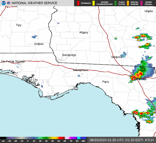
Current Radar Image
Sun Almanac for Ward, Florida
Sunrise: 06:51 AM
Sunset: 8:20 PM
Civil Sunrise:06:25 AM
Civil Sunset: 8:46 PM
Nautical Sunrise: 05:54 AM
Nautical Sunset: 9:17 PM
Astro Sunrise: 05:22 AM
Astro Sunset: 9:49 PM
Florida's Current Temperatures
 Florida's Satellite Image
 Florida's Current Wind Direction
| National Summary |
of upper and lower values of current conditions amongst 6983 locations
in the contiguous United States |
|
High
Temp |
84° |
Key West NAS, Florida
|
|
Low
Temp |
30° |
Evanston, Wyoming
and 5 other locations
|
|
Wind
Speed |
47mph |
Pagosa Springs, Colorado
|
|
Wind
Gust |
63mph |
Pagosa Springs, Colorado
|
|
Wind
Chill |
14° |
Pagosa Springs, Colorado
|
|
High
Pressure |
30.17Hg |
San Carlos, California
and 1 other location
|
|
Low
Pressure |
29.36Hg |
Malta, Montana
|
|
| # Locations Reporting Snow |
7 |
|
| # Locations Reporting Rain |
121 |
|
| # Locations Reporting Fog |
35 |
|
| Average Temperature in the Contiguous USA |
59° |
|
Any use of the information on this page is at your own risk. This information should not be relied upon in life-threatening situations, potential financial loss situations or in lieu of any officially disseminated information. Visit the
National Weather Service for official information.