Wakemup, Minnesota Weather
Issued: 9:58 am CDT Apr 29, 2024 Latitude: 47.9240821 Longitude: -92.6451691 View on Google Maps
|
|
|
|
|
|
|
|
|
|
 |
 |
 |
 |
 |
|
|
 |
| High: °F |
Low: °F |
High: °F |
High: °F |
High: °F |
High: °F |
High: °F |
High: °F |
| Low: °F |
Low: °F |
Low: °F |
Low: °F |
Low: °F |
|
| Rain |
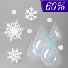
Rain, Snow, & Sleet |
Mostly Cloudy |
Rain |
Rain |
Rain |
Rain |
Rain |
Current Conditions at
COOK - (KCQM)
36°
Cloudy
as of 9:35 AM CDST
Rel. Humidity: 86%
Dew Point: 32°F
Visibility: 7 Miles
Pressure: 29.79 in.
Flight Rule: MVFR
Cloud Level(s): Broken at 1100ft, Solid Overcast at 1400ft
Current Conditions at
ORR - (KORB)
34°
Cloudy
Mist
as of 9:33 AM CDST
Rel. Humidity: 100%
Dew Point: 34°F
Visibility: 5 Miles
Pressure: 29.79 in.
Flight Rule: IFR
Cloud Level(s): Solid Overcast at 900ft
Current Conditions at
CRANE LAKE - (KCDD)
34°
Cloudy
as of 9:34 AM CDST
Rel. Humidity: 93%
Dew Point: 32°F
Visibility: 10 Miles
Pressure: 29.86 in.
Flight Rule: MVFR
Cloud Level(s): Solid Overcast at 1300ft
Current Conditions at
EVELETH MUNICIPAL - (KEVM)
Cloudy
as of 9:35 AM CDST
Rel. Humidity: 93%
Dew Point: 34°F
Visibility: 10 Miles
Pressure: 29.79 in.
Flight Rule: MVFR
Cloud Level(s): Solid Overcast at 1000ft
|
Today... Showers, mainly after 3pm. High near 42. East wind 5 to 10 mph, with gusts as high as 20 mph. Chance of precipitation is 90%. New precipitation amounts between a tenth and quarter of an inch possible. |
|
|
Tonight... Rain showers and sleet likely before 9pm, then a slight chance of rain showers, snow showers, and sleet between 9pm and 10pm. Cloudy, with a low around 32. Northeast wind around 5 mph becoming calm in the evening. Chance of precipitation is 60%. Little or no snow and sleet accumulation expected. |
|
|
Tuesday... Mostly cloudy, with a high near 56. Northwest wind around 5 mph becoming southeast in the afternoon. |
|
 |
Tuesday Night... Showers. Low around 40. East wind 5 to 10 mph. Chance of precipitation is 90%. New precipitation amounts between a half and three quarters of an inch possible. |
|
|
Wednesday... A 30 percent chance of showers, mainly before 1pm. Mostly sunny, with a high near 61. Breezy, with a southwest wind 10 to 20 mph, with gusts as high as 30 mph. |
|
 |
Wednesday Night... Partly cloudy, with a low around 38. Breezy, with a west wind 5 to 15 mph becoming southeast after midnight. Winds could gust as high as 20 mph. |
|
|
Thursday... A chance of showers, mainly after 1pm. Mostly cloudy, with a high near 58. Breezy, with an east wind 10 to 15 mph, with gusts as high as 20 mph. |
|
 |
Thursday Night... A chance of showers. Mostly cloudy, with a low around 41. Breezy, with an east wind 10 to 15 mph, with gusts as high as 20 mph. |
|
|
Friday... A chance of showers. Mostly cloudy, with a high near 52. Breezy, with an east wind 10 to 15 mph becoming west in the afternoon. Winds could gust as high as 25 mph. |
|
|
Friday Night... A chance of showers. Mostly cloudy, with a low around 37. Breezy, with a west wind around 15 mph, with gusts as high as 25 mph. |
|
|
Saturday... A chance of showers. Mostly cloudy, with a high near 52. Breezy, with a west wind around 15 mph, with gusts as high as 25 mph. |
|
|
Saturday Night... A chance of showers. Mostly cloudy, with a low around 36. Breezy, with a west wind 10 to 15 mph, with gusts as high as 20 mph. |
|
|
Sunday... A slight chance of showers. Mostly sunny, with a high near 58. Breezy, with a west wind 10 to 15 mph, with gusts as high as 20 mph. |
|
Current Radar Image
Sun Almanac for Wakemup, Minnesota
Sunrise: 05:54 AM
Sunset: 8:21 PM
Civil Sunrise:05:20 AM
Civil Sunset: 8:56 PM
Nautical Sunrise: 04:37 AM
Nautical Sunset: 9:39 PM
Astro Sunrise: 03:47 AM
Astro Sunset: 10:29 PM
Minnesota's Current Temperatures
 Minnesota's Satellite Image
 Minnesota's Current Wind Direction
| National Summary |
of upper and lower values of current conditions amongst 7108 locations
in the contiguous United States |
|
High
Temp |
88° |
Baltimore Inner Harbor, Maryland
|
|
Low
Temp |
19° |
Berthoud Pass, Colorado
|
|
Wind
Speed |
31mph |
Duluth Sky Harbor, Minnesota
|
|
Wind
Gust |
41mph |
Salt Point, Louisiana
|
|
Wind
Chill |
3° |
Berthoud Pass, Colorado
|
|
High
Pressure |
30.28Hg |
Pagosa Springs, Colorado
|
|
Low
Pressure |
29.64Hg |
Glencoe, Minnesota
and 1 other location
|
|
| # Locations Reporting Snow |
11 |
|
| # Locations Reporting Rain |
112 |
|
| # Locations Reporting Thunderstorms / Lightning |
3 |
|
| # Locations Reporting Fog |
28 |
|
| Average Temperature in the Contiguous USA |
59° |
|
Any use of the information on this page is at your own risk. This information should not be relied upon in life-threatening situations, potential financial loss situations or in lieu of any officially disseminated information. Visit the
National Weather Service for official information.


