No Watches or Warnings for Waiakoa
Issued: 6:03 am HST May 2, 2024 Latitude: 20.7600466 Longitude: -156.3277245 View on Google Maps
|
|
|
|
|
|
|
|
|
|
 |
 |
|
|
 |
|
|
|
| High: °F |
Low: °F |
High: °F |
High: °F |
High: °F |
High: °F |
High: °F |
High: °F |
| Low: °F |
Low: °F |
Low: °F |
Low: °F |
Low: °F |
|
| Mostly Sunny |
Cloudy |
Mostly Sunny |
Mostly Sunny |
Rain |
Rain |
Mostly Sunny |
Mostly Sunny |
Current Conditions at
KAHULUI/MAUI - (PHOG)
82°
Partly Cloudy
as of 1:54 PM HDST
Rel. Humidity: 58%
Dew Point: 66°F
Visibility: 10 Miles
Pressure: 29.99 in.
Flight Rule: VFR
Wind Data
22 MPH
Gust: 35 MPH
050° Northeast
Cloud Level(s): Few at 2000ft, Scattered at 5000ft
Current Conditions at
LANAI/LANI CITY - (PHNY)
72°
Cloudy
as of 2:18 PM HDST
Rel. Humidity: 68%
Dew Point: 61°F
Visibility: 10 Miles
Pressure: 30.06 in.
Flight Rule: VFR
Wind Data
7 MPH
310° Northwest
Cloud Level(s): Scattered at 2700ft, Solid Overcast at 3500ft
Current Conditions at
KONA/KEAHOLE - (PHKO)
82°
Mostly Cloudy
as of 1:53 PM HDST
Rel. Humidity: 54%
Dew Point: 64°F
Visibility: 10 Miles
Pressure: 29.98 in.
Flight Rule: VFR
Cloud Level(s): Broken at 5500ft
|
This Afternoon... Mostly sunny, with a high near 74. East wind around 9 mph. |
|
|
Tonight... Partly cloudy, with a low around 55. East northeast wind 9 to 14 mph, with gusts as high as 18 mph. |
|
|
Friday... Mostly sunny, with a high near 73. East wind around 14 mph, with gusts as high as 18 mph. |
|
|
Friday Night... Partly cloudy, with a low around 55. East northeast wind around 13 mph. |
|
|
Saturday... Mostly sunny, with a high near 73. East northeast wind 9 to 13 mph. |
|
 |
Saturday Night... Isolated showers. Partly cloudy, with a low around 55. East northeast wind around 11 mph. Chance of precipitation is 20%. |
|
|
Sunday... Isolated showers before noon. Mostly sunny, with a high near 73. East wind around 10 mph. Chance of precipitation is 20%. |
|
|
Sunday Night... Isolated showers. Partly cloudy, with a low around 56. East northeast wind around 11 mph. Chance of precipitation is 20%. |
|
|
Monday... Isolated showers before noon. Mostly sunny, with a high near 72. East northeast wind 8 to 11 mph. Chance of precipitation is 20%. |
|
|
Monday Night... Partly cloudy, with a low around 56. East northeast wind around 10 mph. |
|
|
Tuesday... Mostly sunny, with a high near 72. East wind 5 to 10 mph. |
|
|
Tuesday Night... Isolated showers. Partly cloudy, with a low around 56. East northeast wind around 9 mph. Chance of precipitation is 20%. |
|
|
Wednesday... Mostly sunny, with a high near 73. East wind 8 to 10 mph. |
|
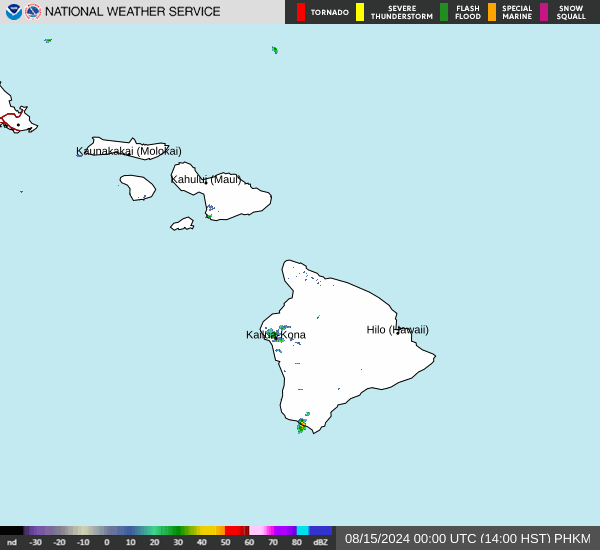
Current Radar Image
Sun Almanac for Waiakoa, Hawaii
Sunrise: 06:54 AM
Sunset: 7:50 PM
Civil Sunrise:06:31 AM
Civil Sunset: 8:14 PM
Nautical Sunrise: 06:03 AM
Nautical Sunset: 8:41 PM
Astro Sunrise: 05:35 AM
Astro Sunset: 9:09 PM
Hawaii's Current Temperatures
 Hawaii's Satellite Image
 Hawaii's Current Wind Direction
| National Summary |
of upper and lower values of current conditions amongst 6987 locations
in the contiguous United States |
|
High
Temp |
99° |
Del Rio, Texas
|
|
Low
Temp |
34° |
Echo, Montana
and 3 other locations
|
|
Wind
Speed |
52mph |
Salida Mountain, Colorado
|
|
Wind
Gust |
60mph |
Salida Mountain, Colorado
|
|
Wind
Chill |
16° |
Salida Mountain, Colorado
|
|
Heat
Index |
104° |
Laredo AFB, Texas
|
|
High
Pressure |
30.73Hg |
Ottawa, Ohio
|
|
Low
Pressure |
29.60Hg |
Laughlin AFB, Texas
|
|
| # Locations Reporting Snow |
3 |
|
| # Locations Reporting Rain |
100 |
|
| # Locations Reporting Thunderstorms / Lightning |
9 |
|
| # Locations Reporting Fog |
1 |
|
| Average Temperature in the Contiguous USA |
70° |
|
Any use of the information on this page is at your own risk. This information should not be relied upon in life-threatening situations, potential financial loss situations or in lieu of any officially disseminated information. Visit the
National Weather Service for official information.