No Watches or Warnings for Techek
Issued: 4:12 pm AKDT May 1, 2024 Latitude: 63.4833333 Longitude: -162.0333333 View on Google Maps
|
|
|
|
|
|
|
|
|
|
 |
 |
 |
 |
 |
|
 |
|
| Low: °F |
High: °F |
High: °F |
High: °F |
High: °F |
High: °F |
High: °F |
High: °F |
| Low: °F |
Low: °F |
Low: °F |
Low: °F |
Low: °F |
Low: °F |
|
| Rain |
Mostly Sunny |
Rain & Snow |
Rain & Snow |
Rain & Snow |
Rain & Snow |
Snow |
Snow |
Current Conditions at
UNALAKLEET - (PAUN)
Mostly Cloudy
as of 8:56 PM ADST
Rel. Humidity: 56%
Dew Point: 30°F
Visibility: 10 Miles
Pressure: 30.01 in.
Flight Rule: VFR
Cloud Level(s): Broken at 9000ft
Current Conditions at
GOLOVIN - (PAGL)
Mostly Cloudy
as of 8:56 PM ADST
Rel. Humidity: 56%
Dew Point: 28°F
Visibility: 10 Miles
Pressure: 30.05 in.
Flight Rule: VFR
Wind Data
10 MPH
Gust: 18 MPH
010° North
Cloud Level(s): Scattered at 6000ft, Broken at 12000ft
Current Conditions at
SAINT MARY'S - (PASM)
Mostly Cloudy
as of 8:56 PM ADST
Rel. Humidity: 65%
Dew Point: 34°F
Visibility: 10 Miles
Pressure: 29.91 in.
Flight Rule: VFR
Cloud Level(s): Few at 3900ft, Broken at 5000ft
|
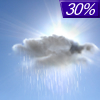
Tonight... A 30 percent chance of rain, mainly between 10pm and 1am. Cloudy, then gradually becoming partly cloudy, with a low around 33. Northeast wind 15 to 20 mph. |
|
|
Thursday... Mostly sunny, with a high near 37. Northeast wind around 15 mph. |
|
 |
Thursday Night... A 10 percent chance of snow after 4am. Partly cloudy, with a low around 32. Northeast wind around 20 mph. |
|
|
Friday... A slight chance of rain and snow before 7am, then a slight chance of rain. Partly sunny, with a high near 38. Northeast wind around 15 mph. Chance of precipitation is 20%. |
|
 |
Friday Night... A 50 percent chance of rain. Mostly cloudy, with a low around 32. Northeast wind around 20 mph. |
|
|
Saturday... Rain and snow likely before 1pm, then a chance of snow. Mostly cloudy, with a high near 35. Chance of precipitation is 60%. Little or no snow accumulation expected. |
|
 |
Saturday Night... A 50 percent chance of snow. Cloudy, with a low around 29. |
|
|
Sunday... A chance of snow before 4pm, then a chance of rain and snow. Cloudy, with a high near 36. |
|
|
Sunday Night... A chance of rain and snow before 10pm, then a chance of snow. Mostly cloudy, with a low around 24. |
|
|
Monday... A chance of snow before 4pm, then a chance of rain and snow. Partly sunny, with a high near 34. |
|
|
Monday Night... A chance of rain and snow. Mostly cloudy, with a low around 26. |
|
|
Tuesday... A chance of snow. Mostly cloudy, with a high near 34. |
|
|
Tuesday Night... A chance of snow. Mostly cloudy, with a low around 29. |
|
|
Wednesday... A chance of snow. Mostly cloudy, with a high near 38. |
|
Alaska's Current Temperatures
 Alaska's Satellite Image
 Alaska's Current Wind Direction
| National Summary |
of upper and lower values of current conditions amongst 6882 locations
in the contiguous United States |
|
High
Temp |
82° |
Lake Havasu City, Arizona
and 5 other locations
|
|
Low
Temp |
30° |
Thermopolis, Wyoming
and 15 other locations
|
|
Wind
Speed |
32mph |
Brewster Field, Nebraska
|
|
Wind
Gust |
46mph |
Berthoud Pass, Colorado
and 1 other location
|
|
Wind
Chill |
19° |
Rock Springs, Wyoming
and 1 other location
|
|
High
Pressure |
30.20Hg |
Fortuna, California
|
|
Low
Pressure |
29.55Hg |
Hays, Kansas
|
|
| # Locations Reporting Snow |
5 |
|
| # Locations Reporting Rain |
101 |
|
| # Locations Reporting Thunderstorms / Lightning |
17 |
|
| # Locations Reporting Fog |
4 |
|
| Average Temperature in the Contiguous USA |
59° |
|
Any use of the information on this page is at your own risk. This information should not be relied upon in life-threatening situations, potential financial loss situations or in lieu of any officially disseminated information. Visit the
National Weather Service for official information.


