Tanglewydle, Virginia Weather
Issued: 11:30 am EDT May 7, 2024 Latitude: 36.6106939 Longitude: -79.3753003 View on Google Maps
|
|
|
|
|
|
|
|
|
|
 |
 |
 |
 |
 |
 |
|
|
| High: °F |
Low: °F |
High: °F |
High: °F |
High: °F |
High: °F |
High: °F |
High: °F |
| Low: °F |
Low: °F |
Low: °F |
Low: °F |
Low: °F |
|
| Thunderstorms |
Thunderstorms |
Thunderstorms |
Thunderstorms |
Rain |
Sunny |
Sunny |
Sunny |
Current Conditions at
DANVILLE - (KDAN)
75°
Clear
as of 11:53 AM EDST
Rel. Humidity: 69%
Dew Point: 64°F
Visibility: 10 Miles
Pressure: 29.85 in.
Flight Rule: VFR
Cloud Level(s): Clear
Current Conditions at
ROXBORO - (KTDF)
73°
Mostly Cloudy
as of 12:25 PM EDST
Rel. Humidity: 69%
Dew Point: 63°F
Visibility: 10 Miles
Pressure: 29.87 in.
Flight Rule: MVFR
Cloud Level(s): Broken at 2300ft, Broken at 3100ft, Broken at 4200ft
Current Conditions at
MARTINSVILLE - (KMTV)
75°
Mostly Cloudy
as of 12:35 PM EDST
Rel. Humidity: 64%
Dew Point: 63°F
Visibility: 10 Miles
Pressure: 29.88 in.
Flight Rule: VFR
Wind Data
6 MPH
210° Southwest
Cloud Level(s): Broken at 5000ft
Current Conditions at
BURLINGTON - (KBUY)
77°
Clear
as of 11:54 AM EDST
Rel. Humidity: 65%
Dew Point: 64°F
Visibility: 10 Miles
Pressure: 29.87 in.
Flight Rule: VFR
Cloud Level(s): Clear
|
This Afternoon... A slight chance of showers and thunderstorms between 2pm and 5pm. Mostly sunny, with a high near 85. West wind around 9 mph. Chance of precipitation is 20%. |
|
|
Tonight... A chance of showers and thunderstorms, mainly before 10pm. Partly cloudy, with a low around 66. Southwest wind around 6 mph. Chance of precipitation is 30%. New precipitation amounts of less than a tenth of an inch, except higher amounts possible in thunderstorms. |
|
|
Wednesday... A slight chance of showers, then a chance of showers and thunderstorms after 11am. Mostly sunny, with a high near 88. West wind 6 to 9 mph. Chance of precipitation is 30%. New rainfall amounts of less than a tenth of an inch, except higher amounts possible in thunderstorms. |
|
 |
Wednesday Night... A chance of showers and thunderstorms. Mostly cloudy, with a low around 65. Southwest wind around 7 mph. Chance of precipitation is 40%. New rainfall amounts between a tenth and quarter of an inch, except higher amounts possible in thunderstorms. |
|
|
Thursday... A chance of showers and thunderstorms, then showers and possibly a thunderstorm after 2pm. High near 85. Southwest wind 8 to 18 mph, with gusts as high as 29 mph. Chance of precipitation is 80%. New rainfall amounts between a quarter and half of an inch possible. |
|
 |
Thursday Night... Showers likely and possibly a thunderstorm before 8pm, then a chance of showers and thunderstorms, mainly between 8pm and midnight. Partly cloudy, with a low around 60. Chance of precipitation is 60%. New rainfall amounts of less than a tenth of an inch, except higher amounts possible in thunderstorms. |
|
|
Friday... A chance of showers after 2pm. Mostly sunny, with a high near 75. Chance of precipitation is 40%. |
|
 |
Friday Night... A chance of showers before 8pm. Mostly clear, with a low around 48. Chance of precipitation is 30%. |
|
|
Saturday... Sunny, with a high near 73. |
|
 |
Saturday Night... Partly cloudy, with a low around 49. |
|
|
Sunday... Sunny, with a high near 75. |
|
 |
Sunday Night... Mostly clear, with a low around 48. |
|
|
Monday... Sunny, with a high near 77. |
|
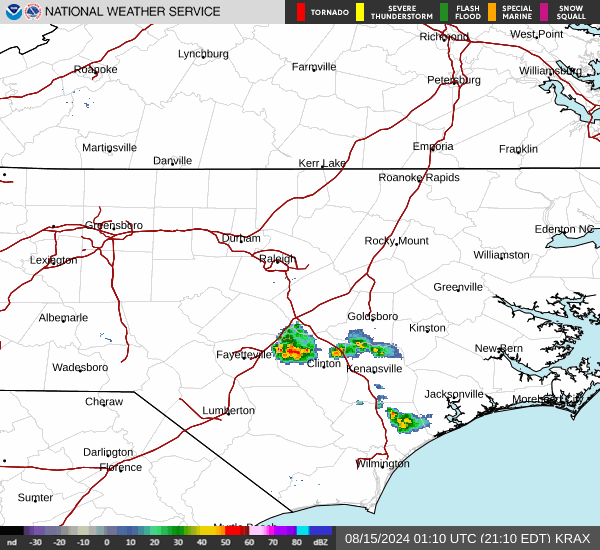
Current Radar Image
Sun Almanac for Tanglewydle, Virginia
Sunrise: 06:17 AM
Sunset: 8:11 PM
Civil Sunrise:05:48 AM
Civil Sunset: 8:40 PM
Nautical Sunrise: 05:14 AM
Nautical Sunset: 9:14 PM
Astro Sunrise: 04:37 AM
Astro Sunset: 9:51 PM
Virginia's Current Temperatures
 Virginia's Satellite Image
 Virginia's Current Wind Direction
| National Summary |
of upper and lower values of current conditions amongst 7180 locations
in the contiguous United States |
|
High
Temp |
90° |
Jacksonville Cecil Fld, Florida
and 3 other locations
|
|
Low
Temp |
30° |
Yellowstone, Wyoming
and 3 other locations
|
|
Wind
Speed |
64mph |
Salida Mountain, Colorado
|
|
Wind
Gust |
73mph |
Salida Mountain, Colorado
|
|
Wind
Chill |
21° |
Dubois Municipal, Wyoming
and 1 other location
|
|
Heat
Index |
100° |
Harlingen, Texas
|
|
High
Pressure |
30.33Hg |
Newport, Oregon
and 1 other location
|
|
Low
Pressure |
28.97Hg |
Mobridge, South Dakota
|
|
| # Locations Reporting Snow |
14 |
|
| # Locations Reporting Rain |
94 |
|
| # Locations Reporting Thunderstorms / Lightning |
5 |
|
| # Locations Reporting Fog |
1 |
|
| Average Temperature in the Contiguous USA |
68° |
|
Any use of the information on this page is at your own risk. This information should not be relied upon in life-threatening situations, potential financial loss situations or in lieu of any officially disseminated information. Visit the
National Weather Service for official information.