Sunrise, Minnesota Weather
No Watches or Warnings for Sunrise
Issued: 11:49 pm CDT Apr 27, 2024 Latitude: 45.5469049 Longitude: -92.8549364 View on Google Maps
|
|
|
|
|
|
|
|
|
|
 |
 |
 |
 |
 |
 |
|
|
| Low: °F |
High: °F |
High: °F |
High: °F |
High: °F |
High: °F |
High: °F |
High: °F |
| Low: °F |
Low: °F |
Low: °F |
Low: °F |
Low: °F |
Low: °F |
|
| Cloudy |
Rain |
Rain |
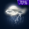
Thunderstorms |
Rain |
Partly Sunny |
Partly Sunny |
Partly Sunny |
Current Conditions at
RUSH CITY - (KROS)
Cloudy
as of 12:15 AM CDST
Rel. Humidity: 81%
Dew Point: 41°F
Visibility: 10 Miles
Pressure: 30.01 in.
Flight Rule: VFR
Wind Data
9 MPH
030° Northeast
Cloud Level(s): Solid Overcast at 3400ft
Current Conditions at
OSCEOLA - (KOEO)
50°
Cloudy
as of 11:55 PM CDST
Rel. Humidity: 87%
Dew Point: 46°F
Visibility: 10 Miles
Pressure: 30.01 in.
Flight Rule: MVFR
Cloud Level(s): Broken at 1800ft, Solid Overcast at 2400ft
Current Conditions at
CAMBRIDGE MUNICIPAL - (KCBG)
46°
Cloudy
as of 12:15 AM CDST
Rel. Humidity: 81%
Dew Point: 41°F
Visibility: 10 Miles
Pressure: 30.00 in.
Flight Rule: VFR
Cloud Level(s): Scattered at 1900ft, Solid Overcast at 3300ft
Current Conditions at
ANOKA COUNTY ARPT - (KANE)
52°
Cloudy
as of 12:15 AM CDST
Rel. Humidity: 76%
Dew Point: 45°F
Visibility: 10 Miles
Pressure: 29.97 in.
Flight Rule: MVFR
Wind Data
10 MPH
020° North
Cloud Level(s): Scattered at 1500ft, Solid Overcast at 2300ft
|
Overnight... Cloudy, with a low around 42. North northeast wind around 10 mph. |
|
|
Sunday... Showers, mainly after 2pm. High near 49. East northeast wind around 15 mph, with gusts as high as 25 mph. Chance of precipitation is 80%. New precipitation amounts between a tenth and quarter of an inch possible. |
|
 |
Sunday Night... Showers and possibly a thunderstorm. Steady temperature around 45. East wind 10 to 15 mph, with gusts as high as 25 mph. Chance of precipitation is 100%. New rainfall amounts between a quarter and half of an inch possible. |
|
|
Monday... Showers likely, mainly before 1pm. Cloudy, with a high near 53. East wind 10 to 15 mph becoming west southwest in the afternoon. Chance of precipitation is 60%. New precipitation amounts of less than a tenth of an inch possible. |
|
 |
Monday Night... Mostly cloudy, with a low around 37. West wind 5 to 10 mph. |
|
|
Tuesday... Showers likely and possibly a thunderstorm after 1pm. Increasing clouds, with a high near 70. South wind 5 to 15 mph. Chance of precipitation is 60%. New rainfall amounts between a tenth and quarter of an inch, except higher amounts possible in thunderstorms. |
|
 |
Tuesday Night... Showers and thunderstorms likely before 10pm, then showers likely and possibly a thunderstorm between 10pm and 1am, then a slight chance of showers and thunderstorms after 1am. Mostly cloudy, then gradually becoming mostly clear, with a low around 45. South wind around 15 mph becoming west southwest after midnight. Chance of precipitation is 70%. New rainfall amounts between a quarter and half of an inch possible. |
|
|
Wednesday... A 20 percent chance of showers. Mostly sunny, with a high near 68. West southwest wind around 15 mph, with gusts as high as 25 mph. |
|
 |
Wednesday Night... A 20 percent chance of showers. Mostly cloudy, with a low around 44. West wind around 10 mph becoming northeast after midnight. |
|
|
Thursday... A 30 percent chance of showers, mainly after 1pm. Partly sunny, with a high near 63. North northeast wind 10 to 15 mph. |
|
|
Thursday Night... A 20 percent chance of showers. Mostly cloudy, with a low around 40. North northeast wind 10 to 15 mph. |
|
|
Friday... A 20 percent chance of showers. Partly sunny, with a high near 58. North wind around 15 mph becoming west northwest in the afternoon. |
|
 |
Friday Night... A 30 percent chance of showers. Mostly cloudy, with a low around 39. North wind 10 to 15 mph. |
|
|
Saturday... A 40 percent chance of showers. Partly sunny, with a high near 57. North northeast wind 10 to 15 mph, with gusts as high as 25 mph. |
|
Current Radar Image
Sun Almanac for Sunrise, Minnesota
Sunrise: 06:03 AM
Sunset: 8:15 PM
Civil Sunrise:05:30 AM
Civil Sunset: 8:47 PM
Nautical Sunrise: 04:50 AM
Nautical Sunset: 9:28 PM
Astro Sunrise: 04:05 AM
Astro Sunset: 10:13 PM
Minnesota's Current Temperatures
 Minnesota's Satellite Image
 Minnesota's Current Wind Direction
| National Summary |
of upper and lower values of current conditions amongst 6858 locations
in the contiguous United States |
|
High
Temp |
84° |
Del Rio, Texas
|
|
Low
Temp |
1° |
Imperial Beach NAS, California
|
|
Wind
Speed |
33mph |
Mckinney, Texas
|
|
Wind
Gust |
47mph |
Abilene, Texas
|
|
Wind
Chill |
10° |
Pagosa Springs, Colorado
|
|
High
Pressure |
30.38Hg |
Montauk, New York
|
|
Low
Pressure |
29.56Hg |
Fort Sill, Oklahoma
|
|
| # Locations Reporting Snow |
8 |
|
| # Locations Reporting Rain |
188 |
|
| # Locations Reporting Thunderstorms / Lightning |
24 |
|
| # Locations Reporting Fog |
7 |
|
| Average Temperature in the Contiguous USA |
58° |
|
Any use of the information on this page is at your own risk. This information should not be relied upon in life-threatening situations, potential financial loss situations or in lieu of any officially disseminated information. Visit the
National Weather Service for official information.


