Stanton, Minnesota Weather
No Watches or Warnings for Stanton
Issued: 5:51 pm CDT Apr 27, 2024 Latitude: 44.4719109 Longitude: -93.0229887 View on Google Maps
|
|
|
|
|
|
|
|
|
|
 |
 |
 |
 |
 |
 |
|
|
| Low: °F |
High: °F |
High: °F |
High: °F |
High: °F |
High: °F |
High: °F |
High: °F |
| Low: °F |
Low: °F |
Low: °F |
Low: °F |
Low: °F |
Low: °F |
|
| Rain |
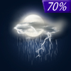
Thunderstorms |
Thunderstorms |
Thunderstorms |
Rain |
Partly Sunny |
Partly Sunny |
Partly Sunny |
Current Conditions at
STANTON AIRFIELD - (KSYN)
59°
Cloudy
as of 6:15 PM CDST
Rel. Humidity: 67%
Dew Point: 48°F
Visibility: 10 Miles
Pressure: 29.87 in.
Flight Rule: MVFR
Cloud Level(s): Solid Overcast at 2800ft
Current Conditions at
AIRLAKE - (KLVN)
57°
Cloudy
as of 6:15 PM CDST
Rel. Humidity: 67%
Dew Point: 46°F
Visibility: 10 Miles
Pressure: 29.89 in.
Flight Rule: VFR
Cloud Level(s): Solid Overcast at 3100ft
Current Conditions at
FARIBAULT MUNICIPAL - (KFBL)
57°
Cloudy
as of 6:15 PM CDST
Rel. Humidity: 76%
Dew Point: 50°F
Visibility: 10 Miles
Pressure: 29.87 in.
Flight Rule: VFR
Wind Data
3 MPH
300° Northwest
Cloud Level(s): Solid Overcast at 3200ft
Current Conditions at
OWATONNA - (KOWA)
59°
Cloudy
as of 6:13 PM CDST
Rel. Humidity: 77%
Dew Point: 52°F
Visibility: 10 Miles
Pressure: 29.88 in.
Flight Rule: VFR
Cloud Level(s): Scattered at 2500ft, Solid Overcast at 3700ft
|
Tonight... A 20 percent chance of showers after 3am. Cloudy, with a low around 46. Northwest wind around 10 mph becoming northeast after midnight. |
|
|
Sunday... Showers likely, then showers and possibly a thunderstorm after 1pm. High near 51. Breezy, with an east northeast wind 10 to 20 mph, with gusts as high as 30 mph. Chance of precipitation is 100%. New rainfall amounts between a quarter and half of an inch possible. |
|
 |
Sunday Night... Showers and possibly a thunderstorm, mainly before 1am, then a chance of showers and thunderstorms after 1am. Low around 45. Breezy, with an east wind 10 to 20 mph, with gusts as high as 30 mph. Chance of precipitation is 100%. New rainfall amounts between a tenth and quarter of an inch, except higher amounts possible in thunderstorms. |
|
|
Monday... A chance of showers and thunderstorms. Cloudy, with a high near 53. Breezy, with a south wind 10 to 20 mph becoming west in the afternoon. Winds could gust as high as 25 mph. Chance of precipitation is 40%. |
|
 |
Monday Night... Mostly cloudy, then gradually becoming mostly clear, with a low around 40. West wind 5 to 15 mph. |
|
|
Tuesday... Showers likely and possibly a thunderstorm between 1pm and 4pm, then showers and thunderstorms likely after 4pm. Increasing clouds, with a high near 74. Breezy, with a south wind 5 to 10 mph increasing to 15 to 20 mph in the afternoon. Winds could gust as high as 30 mph. Chance of precipitation is 60%. New rainfall amounts between a quarter and half of an inch possible. |
|
 |
Tuesday Night... Showers and thunderstorms likely before 10pm, then showers likely and possibly a thunderstorm between 10pm and 1am, then a slight chance of showers and thunderstorms after 1am. Mostly cloudy, then gradually becoming mostly clear, with a low around 46. Breezy, with a west wind 10 to 20 mph, with gusts as high as 25 mph. Chance of precipitation is 70%. New rainfall amounts between a quarter and half of an inch possible. |
|
|
Wednesday... A 30 percent chance of showers. Mostly sunny, with a high near 71. West wind 10 to 15 mph. |
|
 |
Wednesday Night... A 30 percent chance of showers, mainly before 1am. Mostly cloudy, with a low around 46. West northwest wind around 10 mph becoming east southeast after midnight. |
|
|
Thursday... A 30 percent chance of showers. Partly sunny, with a high near 63. Northeast wind 10 to 15 mph. |
|
 |
Thursday Night... A 20 percent chance of showers and thunderstorms. Mostly cloudy, with a low around 43. North northeast wind around 15 mph. |
|
|
Friday... A 20 percent chance of showers. Partly sunny, with a high near 62. West northwest wind around 15 mph. |
|
|
Friday Night... A 30 percent chance of showers. Mostly cloudy, with a low around 41. Northwest wind around 15 mph. |
|
|
Saturday... A 40 percent chance of showers. Partly sunny, with a high near 59. East northeast wind around 15 mph, with gusts as high as 25 mph. |
|
Current Radar Image
Sun Almanac for Stanton, Minnesota
Sunrise: 06:07 AM
Sunset: 8:12 PM
Civil Sunrise:05:36 AM
Civil Sunset: 8:44 PM
Nautical Sunrise: 04:57 AM
Nautical Sunset: 9:23 PM
Astro Sunrise: 04:14 AM
Astro Sunset: 10:06 PM
Minnesota's Current Temperatures
 Minnesota's Satellite Image
 Minnesota's Current Wind Direction
| National Summary |
of upper and lower values of current conditions amongst 6924 locations
in the contiguous United States |
|
High
Temp |
97° |
Del Rio, Texas
and 2 other locations
|
|
Low
Temp |
1° |
Imperial Beach NAS, California
|
|
Wind
Speed |
33mph |
Las Cruces, New Mexico
|
|
Wind
Gust |
45mph |
Mcallen, Texas
and 1 other location
|
|
Wind
Chill |
8° |
Pagosa Springs, Colorado
|
|
Heat
Index |
102° |
Laredo AFB, Texas
|
|
High
Pressure |
30.82Hg |
Ottawa, Ohio
|
|
Low
Pressure |
29.54Hg |
Laughlin AFB, Texas
|
|
| # Locations Reporting Snow |
7 |
|
| # Locations Reporting Rain |
122 |
|
| # Locations Reporting Thunderstorms / Lightning |
20 |
|
| # Locations Reporting Fog |
2 |
|
| Average Temperature in the Contiguous USA |
66° |
|
Any use of the information on this page is at your own risk. This information should not be relied upon in life-threatening situations, potential financial loss situations or in lieu of any officially disseminated information. Visit the
National Weather Service for official information.


