Spreckelsville, Hawaii Weather
No Watches or Warnings for Spreckelsville
|
|
|
|
|
|
|
|
 |
 |
|
 |
 |
|
|
|
| Low: °F |
High: °F |
High: °F |
High: °F |
High: °F |
High: °F |
High: °F |
High: °F |
| Low: °F |
Low: °F |
Low: °F |
Low: °F |
Low: °F |
Low: °F |
|
| Cloudy |
Rain |
Rain |
Partly Sunny |
Mostly Sunny |
Rain |
Rain |
Rain |
Current Conditions at
KAHULUI/MAUI - (PHOG)
70°
Mostly Cloudy
as of 1:54 AM HDST
Rel. Humidity: 83%
Dew Point: 64°F
Visibility: 10 Miles
Pressure: 30.07 in.
Flight Rule: VFR
Cloud Level(s): Scattered at 4400ft, Broken at 6500ft
Current Conditions at
LANAI/LANI CITY - (PHNY)
66°
Mostly Cloudy
as of 2:25 AM HDST
Rel. Humidity: 93%
Dew Point: 64°F
Visibility: 10 Miles
Pressure: 30.13 in.
Flight Rule: MVFR
Cloud Level(s): Broken at 1400ft
Current Conditions at
KONA/KEAHOLE - (PHKO)
77°
Cloudy
as of 1:53 AM HDST
Rel. Humidity: 69%
Dew Point: 66°F
Visibility: 10 Miles
Pressure: 30.06 in.
Flight Rule: VFR
Cloud Level(s): Solid Overcast at 4900ft
|
Overnight... Partly cloudy, with a low around 67. East wind 8 to 14 mph, with gusts as high as 18 mph. |
|
|
Saturday... Isolated showers before noon. Mostly sunny, with a high near 83. Breezy, with an east northeast wind 8 to 18 mph, with gusts as high as 25 mph. Chance of precipitation is 20%. |
|
|
Saturday Night... Partly cloudy, with a low around 67. East wind 9 to 14 mph, with gusts as high as 18 mph. |
|
|
Sunday... Isolated showers before noon. Mostly sunny, with a high near 84. East wind 9 to 11 mph. Chance of precipitation is 20%. |
|
 |
Sunday Night... Isolated showers before midnight. Mostly cloudy, with a low around 67. East wind 8 to 10 mph. Chance of precipitation is 20%. |
|
|
Monday... Partly sunny, with a high near 84. East wind 9 to 11 mph. |
|
|
Monday Night... Partly cloudy, with a low around 67. East wind 7 to 10 mph. |
|
|
Tuesday... Mostly sunny, with a high near 84. East wind 8 to 11 mph. |
|
 |
Tuesday Night... Isolated showers before midnight. Partly cloudy, with a low around 67. East wind around 9 mph. Chance of precipitation is 20%. |
|
|
Wednesday... Isolated showers before noon. Mostly sunny, with a high near 84. East wind 9 to 13 mph. Chance of precipitation is 20%. |
|
|
Wednesday Night... Isolated showers. Partly cloudy, with a low around 67. East wind 8 to 10 mph. Chance of precipitation is 20%. |
|
|
Thursday... Isolated showers. Mostly sunny, with a high near 84. East wind 8 to 10 mph. Chance of precipitation is 20%. |
|
|
Thursday Night... Isolated showers. Partly cloudy, with a low around 67. East wind 7 to 11 mph. Chance of precipitation is 20%. |
|
|
Friday... Isolated showers. Mostly sunny, with a high near 84. Breezy, with an east wind 11 to 16 mph, with gusts as high as 22 mph. Chance of precipitation is 20%. |
|
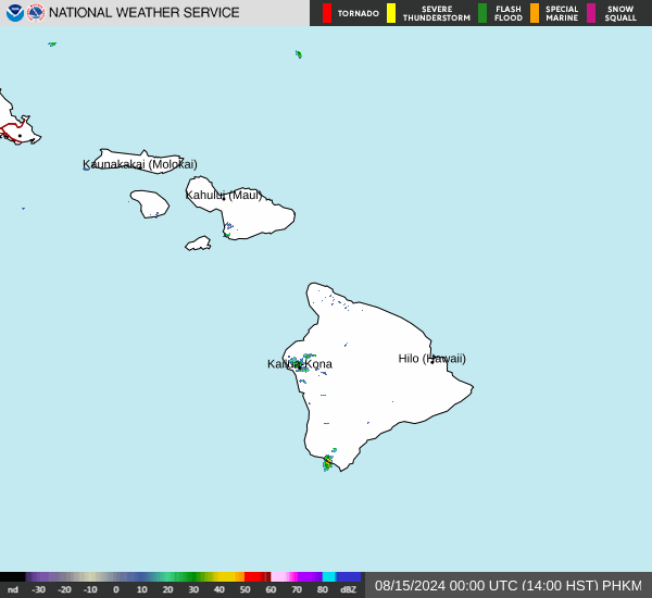
Current Radar Image
Sun Almanac for Spreckelsville, Hawaii
Sunrise: 06:57 AM
Sunset: 7:49 PM
Civil Sunrise:06:34 AM
Civil Sunset: 8:12 PM
Nautical Sunrise: 06:07 AM
Nautical Sunset: 8:39 PM
Astro Sunrise: 05:39 AM
Astro Sunset: 9:07 PM
Hawaii's Current Temperatures
 Hawaii's Satellite Image
 Hawaii's Current Wind Direction
| National Summary |
of upper and lower values of current conditions amongst 7148 locations
in the contiguous United States |
|
High
Temp |
81° |
Corpus Christi NAS, Texas
|
|
Low
Temp |
1° |
Imperial Beach NAS, California
|
|
Wind
Speed |
67mph |
Lakeland Arpt, Florida
|
|
Wind
Gust |
45mph |
El Paso, Texas
|
|
Wind
Chill |
-14° |
Imperial BeachNAS, California
|
|
High
Pressure |
30.82Hg |
Ottawa, Ohio
|
|
Low
Pressure |
29.41Hg |
Minneapolis Flying Cloud, Minnesota
|
|
| # Locations Reporting Snow |
16 |
|
| # Locations Reporting Rain |
138 |
|
| # Locations Reporting Thunderstorms / Lightning |
14 |
|
| # Locations Reporting Fog |
5 |
|
| Average Temperature in the Contiguous USA |
55° |
|
Any use of the information on this page is at your own risk. This information should not be relied upon in life-threatening situations, potential financial loss situations or in lieu of any officially disseminated information. Visit the
National Weather Service for official information.