Shevlin, Minnesota Weather
No Watches or Warnings for Shevlin
Issued: 6:01 am CDT Apr 28, 2024 Latitude: 47.5302332 Longitude: -95.258623 View on Google Maps
|
|
|
|
|
|
|
|
|
|
 |
 |
 |
 |
 |
 |
|
|
| High: °F |
Low: °F |
High: °F |
High: °F |
High: °F |
High: °F |
High: °F |
High: °F |
| Low: °F |
Low: °F |
Low: °F |
Low: °F |
Low: °F |
|
| Cloudy |
Rain, Snow, & Sleet |
Rain, Snow, & Sleet |
Rain |
Mostly Sunny |
Partly Sunny |
Partly Sunny |
Partly Sunny |
Current Conditions at
BEMIDJI - (KBJI)
Cloudy
as of 5:35 AM CDST
Rel. Humidity: 93%
Dew Point: 36°F
Visibility: 10 Miles
Pressure: 30.06 in.
Flight Rule: MVFR
Wind Data
12 MPH
060° Northeast
Cloud Level(s): Solid Overcast at 1200ft
Current Conditions at
FOSSTON - (KFSE)
Cloudy
as of 5:35 AM CDST
Rel. Humidity: 86%
Dew Point: 34°F
Visibility: 10 Miles
Pressure: 30.07 in.
Flight Rule: MVFR
Cloud Level(s): Solid Overcast at 1400ft
Current Conditions at
PARK RAPIDS - (KPKD)
Cloudy
as of 5:21 AM CDST
Rel. Humidity: 80%
Dew Point: 36°F
Visibility: 10 Miles
Pressure: 30.02 in.
Flight Rule: MVFR
Wind Data
10 MPH
060° Northeast
Cloud Level(s): Solid Overcast at 1500ft
Current Conditions at
WASKISH - (KVWU)
39°
Cloudy
as of 5:35 AM CDST
Rel. Humidity: 86%
Dew Point: 36°F
Visibility: 10 Miles
Pressure: 30.10 in.
Flight Rule: MVFR
Cloud Level(s): Solid Overcast at 1600ft
|
Today... Cloudy, with a high near 51. East wind 7 to 14 mph, with gusts as high as 21 mph. |
|
|
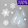
Tonight... Rain showers, possibly mixed with sleet before 4am, then rain showers and snow showers, possibly mixed with sleet between 4am and 5am, then snow showers, possibly mixed with rain after 5am. Low around 33. East wind 10 to 15 mph, with gusts as high as 28 mph. Chance of precipitation is 100%. New snow and sleet accumulation of less than a half inch possible. |
|
|
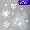
Monday... Rain showers and snow showers likely, possibly mixed with sleet, becoming all rain after 9am. Cloudy, with a high near 43. East northeast wind 6 to 9 mph becoming north in the afternoon. Winds could gust as high as 20 mph. Chance of precipitation is 60%. New snow and sleet accumulation of less than a half inch possible. |
|
 |
Monday Night... A 30 percent chance of showers before 7pm. Mostly cloudy, with a low around 31. Northwest wind 6 to 9 mph becoming west southwest after midnight. New precipitation amounts of less than a tenth of an inch possible. |
|
|
Tuesday... Showers after 1pm. High near 58. Light south wind becoming south southeast 9 to 14 mph in the morning. Winds could gust as high as 20 mph. Chance of precipitation is 80%. New precipitation amounts between a tenth and quarter of an inch possible. |
|
 |
Tuesday Night... Showers likely and possibly a thunderstorm. Partly cloudy, with a low around 39. Breezy, with a west southwest wind 11 to 21 mph, with gusts as high as 30 mph. Chance of precipitation is 60%. New precipitation amounts of less than a tenth of an inch, except higher amounts possible in thunderstorms. |
|
|
Wednesday... Mostly sunny, with a high near 63. Breezy, with a west southwest wind 16 to 22 mph, with gusts as high as 32 mph. |
|
 |
Wednesday Night... A 20 percent chance of showers. Mostly cloudy, with a low around 37. West wind 9 to 14 mph becoming north northwest after midnight. Winds could gust as high as 21 mph. |
|
|
Thursday... A 30 percent chance of showers, mainly after 1pm. Partly sunny, with a high near 55. North wind 9 to 13 mph, with gusts as high as 20 mph. |
|
|
Thursday Night... A 20 percent chance of showers. Mostly cloudy, with a low around 35. North wind 10 to 13 mph, with gusts as high as 18 mph. |
|
|
Friday... A 30 percent chance of showers. Partly sunny, with a high near 51. North wind 10 to 15 mph, with gusts as high as 22 mph. |
|
|
Friday Night... A 30 percent chance of showers. Mostly cloudy, with a low around 34. North wind 13 to 15 mph, with gusts as high as 22 mph. |
|
|
Saturday... A 40 percent chance of showers. Partly sunny, with a high near 50. North northwest wind 14 to 16 mph, with gusts as high as 25 mph. |
|
Current Radar Image
Sun Almanac for Shevlin, Minnesota
Sunrise: 06:08 AM
Sunset: 8:29 PM
Civil Sunrise:05:33 AM
Civil Sunset: 9:03 PM
Nautical Sunrise: 04:51 AM
Nautical Sunset: 9:46 PM
Astro Sunrise: 04:02 AM
Astro Sunset: 10:34 PM
Minnesota's Current Temperatures
 Minnesota's Satellite Image
 Minnesota's Current Wind Direction
| National Summary |
of upper and lower values of current conditions amongst 6256 locations
in the contiguous United States |
|
High
Temp |
81° |
Corpus Christi NAS, Texas
|
|
Low
Temp |
1° |
Imperial Beach NAS, California
|
|
Wind
Speed |
33mph |
Creston, Iowa
|
|
Wind
Gust |
53mph |
Creston, Iowa
|
|
Wind
Chill |
0° |
Berthoud Pass, Colorado
|
|
High
Pressure |
30.33Hg |
Albemarle, North Carolina
and 3 other locations
|
|
Low
Pressure |
29.64Hg |
Zapata Cnty A/P, Texas
and 3 other locations
|
|
| # Locations Reporting Snow |
8 |
|
| # Locations Reporting Rain |
178 |
|
| # Locations Reporting Thunderstorms / Lightning |
16 |
|
| # Locations Reporting Fog |
30 |
|
| Average Temperature in the Contiguous USA |
55° |
|
Any use of the information on this page is at your own risk. This information should not be relied upon in life-threatening situations, potential financial loss situations or in lieu of any officially disseminated information. Visit the
National Weather Service for official information.


