No Watches or Warnings for Selma
Issued: 10:41 pm PDT May 1, 2024 Latitude: 42.2790023 Longitude: -123.615901 View on Google Maps
|
|
|
|
|
|
|
|
|
|
 |
 |
 |
 |
 |
|
 |
|
| Low: °F |
High: °F |
High: °F |
High: °F |
High: °F |
High: °F |
High: °F |
High: °F |
| Low: °F |
Low: °F |
Low: °F |
Low: °F |
Low: °F |
Low: °F |
|
| Rain |
Rain |
Rain |
Thunderstorms |
Snow |
Rain |
Snow |
Snow |
Current Conditions at
SEXTON SUMMIT - (KSXT)
43°
Cloudy
Light Rain
as of 10:56 PM PDST
Rel. Humidity: 70%
Dew Point: 34°F
Visibility: 10 Miles
Pressure: 30.07 in.
Flight Rule: MVFR
Cloud Level(s): Broken at 2400ft, Solid Overcast at 3000ft
Current Conditions at
BROOKINGS ARPT - (KBOK)
48°
Cloudy
Light Rain
as of 10:56 PM PDST
Rel. Humidity: 93%
Dew Point: 46°F
Visibility: 10 Miles
Pressure: 30.17 in.
Flight Rule: MVFR
Cloud Level(s): Solid Overcast at 1900ft
Current Conditions at
CRESCENT CITY - (KCEC)
52°
Cloudy
as of 11:28 PM PDST
Rel. Humidity: 76%
Dew Point: 45°F
Visibility: 10 Miles
Pressure: 30.17 in.
Flight Rule: MVFR
Cloud Level(s): Broken at 2200ft, Solid Overcast at 3800ft
|
Tonight... Rain, mainly after 2am. Low around 42. South southwest wind around 7 mph. Chance of precipitation is 80%. New precipitation amounts of less than a tenth of an inch possible. |
|
|
Thursday... Rain likely, mainly before 8am. Partly sunny, with a high near 64. Southwest wind around 8 mph. Chance of precipitation is 70%. New precipitation amounts of less than a tenth of an inch possible. |
|
 |
Thursday Night... A 20 percent chance of rain after 11pm. Mostly cloudy, with a low around 39. West southwest wind 5 to 7 mph becoming calm in the evening. |
|
|
Friday... A 50 percent chance of rain. Mostly cloudy, with a high near 66. Light south southwest wind increasing to 5 to 10 mph in the afternoon. |
|
 |
Friday Night... Rain. Low around 40. South southwest wind 7 to 10 mph. Chance of precipitation is 100%. New precipitation amounts between three quarters and one inch possible. |
|
|
Saturday... Rain before 11am, then showers likely and possibly a thunderstorm after 11am. Snow level 5000 feet lowering to 3700 feet in the afternoon . High near 51. Chance of precipitation is 90%. New rainfall amounts between a quarter and half of an inch possible. |
|
 |
Saturday Night... A 50 percent chance of showers, mainly before 11pm. Snow level 3500 feet. Mostly cloudy, with a low around 37. |
|
|
Sunday... A slight chance of showers. Snow level 3500 feet rising to 4700 feet in the afternoon. Partly sunny, with a high near 56. |
|
|
Sunday Night... A chance of showers, mainly after 11pm. Mostly cloudy, with a low around 39. |
|
|
Monday... Rain likely, mainly after 11am. Mostly cloudy, with a high near 55. |
|
|
Monday Night... A chance of showers. Snow level 4700 feet lowering to 3600 feet after midnight . Mostly cloudy, with a low around 38. |
|
|
Tuesday... A chance of showers. Snow level 3300 feet rising to 4200 feet in the afternoon. Partly sunny, with a high near 59. |
|
|
Tuesday Night... A chance of showers. Snow level 4400 feet lowering to 3300 feet after midnight . Mostly cloudy, with a low around 37. |
|
|
Wednesday... A chance of showers. Snow level 3100 feet rising to 4500 feet in the afternoon. Partly sunny, with a high near 64. |
|
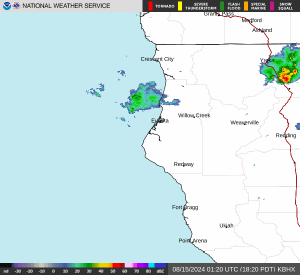
Current Radar Image
Sun Almanac for Selma, Oregon
Sunrise: 06:07 AM
Sunset: 8:16 PM
Civil Sunrise:05:36 AM
Civil Sunset: 8:46 PM
Nautical Sunrise: 04:59 AM
Nautical Sunset: 9:24 PM
Astro Sunrise: 04:17 AM
Astro Sunset: 10:06 PM
Oregon's Current Temperatures
 Oregon's Satellite Image
 Oregon's Current Wind Direction
| National Summary |
of upper and lower values of current conditions amongst 7032 locations
in the contiguous United States |
|
High
Temp |
82° |
Needles, California
and 4 other locations
|
|
Low
Temp |
30° |
Powell, Wyoming
and 19 other locations
|
|
Wind
Speed |
30mph |
Aurora, Nebraska
|
|
Wind
Gust |
48mph |
Longview, Texas
and 1 other location
|
|
Wind
Chill |
18° |
Elk Mountain, Wyoming
|
|
High
Pressure |
30.79Hg |
Ottawa, Ohio
|
|
Low
Pressure |
29.58Hg |
Great Bend, Kansas
|
|
| # Locations Reporting Snow |
5 |
|
| # Locations Reporting Rain |
113 |
|
| # Locations Reporting Thunderstorms / Lightning |
15 |
|
| # Locations Reporting Fog |
14 |
|
| Average Temperature in the Contiguous USA |
58° |
|
Any use of the information on this page is at your own risk. This information should not be relied upon in life-threatening situations, potential financial loss situations or in lieu of any officially disseminated information. Visit the
National Weather Service for official information.