No Watches or Warnings for Sebring
|
|
|
|
|
|
|
|
 |
 |
 |
|
|
|
|
|
| Low: °F |
High: °F |
High: °F |
High: °F |
High: °F |
High: °F |
High: °F |
High: °F |
| Low: °F |
Low: °F |
Low: °F |
Low: °F |
Low: °F |
Low: °F |
|
| Thunderstorms |
Thunderstorms |
Sunny |
Sunny |
Thunderstorms |
Sunny |
Sunny |
Sunny |
Current Conditions at
WINTER HAVEN - (KGIF)
81°
Clear
as of 7:53 PM EDST
Rel. Humidity: 61%
Dew Point: 66°F
Visibility: 10 Miles
Pressure: 29.93 in.
Flight Rule: VFR
Cloud Level(s): Clear
Current Conditions at
LAKELAND ARPT - (KLAL)
82°
Partly Cloudy
as of 7:50 PM EDST
Rel. Humidity: 54%
Dew Point: 64°F
Visibility: 10 Miles
Pressure: 29.91 in.
Flight Rule: VFR
Cloud Level(s): Scattered at 8000ft
Current Conditions at
PUNTA GORDA - (KPGD)
75°
Mostly Cloudy
as of 7:53 PM EDST
Rel. Humidity: 78%
Dew Point: 68°F
Visibility: 10 Miles
Pressure: 29.92 in.
Flight Rule: VFR
Cloud Level(s): Few at 7000ft, Broken at 10000ft
Current Conditions at
ORLANDO INTL - (KMCO)
79°
Mostly Clear
as of 7:53 PM EDST
Rel. Humidity: 65%
Dew Point: 66°F
Visibility: 10 Miles
Pressure: 29.93 in.
Flight Rule: VFR
Cloud Level(s): Few at 6000ft, Few at 12000ft, Few at 25000ft
|
Tonight... A 20 percent chance of showers and thunderstorms before midnight. Partly cloudy, with a low around 68. Southeast wind 5 to 8 mph. |
|
|
Thursday... A 20 percent chance of showers and thunderstorms after 3pm. Sunny, with a high near 89. East wind 5 to 10 mph. |
|
 |
Thursday Night... Mostly clear, with a low around 68. East wind 6 to 10 mph. |
|
|
Friday... Sunny, with a high near 90. East wind 6 to 10 mph. |
|
|
Friday Night... Mostly clear, with a low around 68. East wind 6 to 11 mph. |
|
|
Saturday... Sunny, with a high near 89. East wind 6 to 11 mph. |
|
|
Saturday Night... Mostly clear, with a low around 68. East wind 7 to 13 mph, with gusts as high as 18 mph. |
|
|
Sunday... A 20 percent chance of showers and thunderstorms after 2pm. Sunny, with a high near 89. East southeast wind 8 to 13 mph, with gusts as high as 18 mph. |
|
 |
Sunday Night... A 10 percent chance of showers and thunderstorms before 8pm. Mostly clear, with a low around 68. East southeast wind 8 to 11 mph, with gusts as high as 18 mph. |
|
|
Monday... Sunny, with a high near 90. |
|
|
Monday Night... Mostly clear, with a low around 68. |
|
|
Tuesday... Sunny, with a high near 92. |
|
|
Tuesday Night... Mostly clear, with a low around 69. |
|
|
Wednesday... Sunny, with a high near 92. |
|
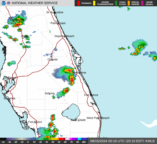
Current Radar Image
Sun Almanac for Sebring, Florida
Sunrise: 06:46 AM
Sunset: 8:00 PM
Civil Sunrise:06:21 AM
Civil Sunset: 8:24 PM
Nautical Sunrise: 05:52 AM
Nautical Sunset: 8:54 PM
Astro Sunrise: 05:22 AM
Astro Sunset: 9:24 PM
Florida's Current Temperatures
 Florida's Satellite Image
 Florida's Current Wind Direction
| National Summary |
of upper and lower values of current conditions amongst 6891 locations
in the contiguous United States |
|
High
Temp |
95° |
Presidio, Texas
|
|
Low
Temp |
30° |
Driggs-Reed Mem, Idaho
and 1 other location
|
|
Wind
Speed |
31mph |
Riverton, Wyoming
|
|
Wind
Gust |
45mph |
Borger, Texas
|
|
Wind
Chill |
19° |
Driggs-Reed Mem, Idaho
|
|
Heat
Index |
98° |
Zapata Cnty A/P, Texas
and 1 other location
|
|
High
Pressure |
30.21Hg |
Crescent City, California
|
|
Low
Pressure |
29.52Hg |
Lamar, Colorado
|
|
| # Locations Reporting Snow |
6 |
|
| # Locations Reporting Rain |
43 |
|
| # Locations Reporting Thunderstorms / Lightning |
20 |
|
| Average Temperature in the Contiguous USA |
69° |
|
Any use of the information on this page is at your own risk. This information should not be relied upon in life-threatening situations, potential financial loss situations or in lieu of any officially disseminated information. Visit the
National Weather Service for official information.