Ridgetop, Wisconsin Weather
|
|
|
|
|
|
|
|
 |
 |
 |
 |
 |
 |
|
|
| High: °F |
Low: °F |
High: °F |
High: °F |
High: °F |
High: °F |
High: °F |
High: °F |
| Low: °F |
Low: °F |
Low: °F |
Low: °F |
Low: °F |
|
| Rain |
Rain |
Mostly Sunny |
Sunny |
Rain |
Partly Sunny |
Partly Sunny |
Partly Sunny |
Current Conditions at
IRON MOUNTAIN - (KIMT)
46°
Mostly Cloudy
as of 3:54 AM CDST
Rel. Humidity: 70%
Dew Point: 37°F
Visibility: 10 Miles
Pressure: 30.02 in.
Flight Rule: VFR
Cloud Level(s): Broken at 12000ft
Current Conditions at
EAGLE RIVER - (KEGV)
48°
Partly Cloudy
as of 4:35 AM CDST
Rel. Humidity: 57%
Dew Point: 34°F
Visibility: 10 Miles
Pressure: 30.02 in.
Flight Rule: VFR
Cloud Level(s): Scattered at 12000ft
Current Conditions at
KINGS - (KLNL)
36°
Partly Cloudy
as of 4:35 AM CDST
Rel. Humidity: 100%
Dew Point: 36°F
Visibility: 10 Miles
Pressure: 30.03 in.
Flight Rule: VFR
Cloud Level(s): Scattered at 12000ft
Current Conditions at
GWINN - (KSAW)
43°
Partly Cloudy
as of 5:38 AM EDST
Rel. Humidity: 86%
Dew Point: 39°F
Visibility: 10 Miles
Pressure: 30.03 in.
Flight Rule: VFR
Cloud Level(s): Scattered at 12000ft
|
Today... Showers likely, mainly between 1pm and 5pm. Increasing clouds, with a high near 68. Calm wind becoming south southeast 5 to 9 mph in the morning. Winds could gust as high as 18 mph. Chance of precipitation is 60%. New precipitation amounts between a tenth and quarter of an inch possible. |
|
|
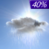
Tonight... A 40 percent chance of showers, mainly before 9pm. Cloudy, then gradually becoming partly cloudy, with a low around 39. Northwest wind 7 to 10 mph. |
|
|
Sunday... Mostly sunny, with a high near 65. Northwest wind 7 to 9 mph. |
|
 |
Sunday Night... Mostly clear, with a low around 38. North northwest wind around 6 mph becoming calm after midnight. |
|
|
Monday... Sunny, with a high near 69. Light and variable wind becoming south southeast 5 to 10 mph in the morning. |
|
 |
Monday Night... Partly cloudy, with a low around 43. |
|
|
Tuesday... Showers. High near 61. Chance of precipitation is 90%. |
|
 |
Tuesday Night... A chance of showers and thunderstorms. Mostly cloudy, with a low around 45. |
|
|
Wednesday... A chance of showers after 1pm. Partly sunny, with a high near 67. |
|
 |
Wednesday Night... A chance of showers. Mostly cloudy, with a low around 44. |
|
|
Thursday... A chance of showers. Partly sunny, with a high near 62. |
|
|
Thursday Night... A chance of showers. Mostly cloudy, with a low around 40. |
|
|
Friday... Partly sunny, with a high near 58. |
|
Current Radar Image
Sun Almanac for Ridgetop, Wisconsin
Sunrise: 05:34 AM
Sunset: 8:05 PM
Civil Sunrise:05:01 AM
Civil Sunset: 8:39 PM
Nautical Sunrise: 04:19 AM
Nautical Sunset: 9:21 PM
Astro Sunrise: 03:30 AM
Astro Sunset: 10:09 PM
Wisconsin's Current Temperatures
 Wisconsin's Satellite Image
 Wisconsin's Current Wind Direction
| National Summary |
of upper and lower values of current conditions amongst 7018 locations
in the contiguous United States |
|
High
Temp |
81° |
Key West NAS, Florida
and 3 other locations
|
|
Low
Temp |
30° |
Thermopolis, Wyoming
and 28 other locations
|
|
Wind
Speed |
28mph |
La Grande, Oregon
|
|
Wind
Gust |
39mph |
Emporia, Kansas
|
|
Wind
Chill |
19° |
Delta, Montana
|
|
High
Pressure |
30.37Hg |
Presque Isle, Maine
|
|
Low
Pressure |
29.55Hg |
Yagabond Aaf, Washington
and 1 other location
|
|
| # Locations Reporting Snow |
2 |
|
| # Locations Reporting Rain |
169 |
|
| # Locations Reporting Thunderstorms / Lightning |
9 |
|
| # Locations Reporting Fog |
42 |
|
| Average Temperature in the Contiguous USA |
56° |
|
Any use of the information on this page is at your own risk. This information should not be relied upon in life-threatening situations, potential financial loss situations or in lieu of any officially disseminated information. Visit the
National Weather Service for official information.


