Platte, Minnesota Weather
No Watches or Warnings for Platte
|
|
|
|
|
|
|
|
 |
 |
 |
 |
 |
 |
|
|
| Low: °F |
High: °F |
High: °F |
High: °F |
High: °F |
High: °F |
High: °F |
High: °F |
| Low: °F |
Low: °F |
Low: °F |
Low: °F |
Low: °F |
Low: °F |
|
| Rain |
Rain |
Rain |
Sunny |
Partly Sunny |
Thunderstorms |
Partly Sunny |
Partly Sunny |
Current Conditions at
LITTLE FALLS - (KLXL)
46°
Cloudy
Heavy Rain
as of 7:55 PM CDST
Rel. Humidity: 100%
Dew Point: 46°F
Visibility: 1 3/4 Miles
Pressure: 29.79 in.
Flight Rule: IFR
Wind Data
8 MPH
130° Southeast
Cloud Level(s): Solid Overcast at 700ft
Current Conditions at
BRAINERD - (KBRD)
Cloudy
Mist
as of 7:53 PM CDST
Rel. Humidity: 87%
Dew Point: 45°F
Visibility: 6 Miles
Pressure: 29.79 in.
Flight Rule: IFR
Wind Data
14 MPH
Gust: 33 MPH
130° Southeast
Cloud Level(s): Solid Overcast at 800ft
Current Conditions at
AITKIN NDB - (KAIT)
46°
Cloudy
as of 7:55 PM CDST
Rel. Humidity: 87%
Dew Point: 43°F
Visibility: 10 Miles
Pressure: 29.81 in.
Flight Rule: MVFR
Cloud Level(s): Solid Overcast at 1000ft
Current Conditions at
PRINCETON - (KPNM)
52°
Cloudy
as of 7:55 PM CDST
Rel. Humidity: 87%
Dew Point: 48°F
Visibility: 10 Miles
Pressure: 29.83 in.
Flight Rule: IFR
Cloud Level(s): Solid Overcast at 700ft
|
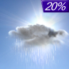
Tonight... Isolated showers before midnight, then areas of drizzle between midnight and 1am. Cloudy, then gradually becoming partly cloudy, with a low around 39. Southeast wind around 10 mph becoming southwest after midnight. Chance of precipitation is 20%. |
|
|
Friday... A 20 percent chance of showers after 4pm. Increasing clouds, with a high near 64. West southwest wind around 15 mph, with gusts as high as 25 mph. |
|
 |
Friday Night... Showers likely, mainly after 1am. Mostly cloudy, with a low around 43. West wind 5 to 10 mph. Chance of precipitation is 60%. New precipitation amounts between a tenth and quarter of an inch possible. |
|
|
Saturday... A 20 percent chance of showers before 1pm. Mostly sunny, with a high near 59. West wind 5 to 10 mph. |
|
 |
Saturday Night... Mostly clear, with a low around 38. Northwest wind 5 to 10 mph. |
|
|
Sunday... Sunny, with a high near 65. South wind 5 to 10 mph. |
|
|
Sunday Night... Mostly clear, with a low around 46. Southeast wind around 10 mph. |
|
|
Monday... A 30 percent chance of showers after 1pm. Partly sunny, with a high near 70. Breezy, with a southeast wind 15 to 20 mph, with gusts as high as 30 mph. |
|
 |
Monday Night... Showers and possibly a thunderstorm. Low around 53. Breezy, with an east southeast wind around 20 mph, with gusts as high as 35 mph. Chance of precipitation is 80%. |
|
|
Tuesday... A chance of showers and thunderstorms. Partly sunny, with a high near 69. Breezy, with a south southwest wind 15 to 20 mph, with gusts as high as 30 mph. Chance of precipitation is 50%. |
|
 |
Tuesday Night... A 20 percent chance of showers and thunderstorms. Mostly cloudy, with a low around 46. South southwest wind 10 to 15 mph. |
|
|
Wednesday... A 40 percent chance of showers. Partly sunny, with a high near 62. West southwest wind 10 to 15 mph. |
|
 |
Wednesday Night... A 30 percent chance of showers. Mostly cloudy, with a low around 44. North wind 10 to 15 mph. |
|
|
Thursday... A 30 percent chance of showers. Partly sunny, with a high near 56. North wind around 15 mph. |
|
Current Radar Image
Sun Almanac for Platte, Minnesota
Sunrise: 06:00 AM
Sunset: 8:26 PM
Civil Sunrise:05:27 AM
Civil Sunset: 9:00 PM
Nautical Sunrise: 04:45 AM
Nautical Sunset: 9:42 PM
Astro Sunrise: 03:57 AM
Astro Sunset: 10:29 PM
Minnesota's Current Temperatures
 Minnesota's Satellite Image
 Minnesota's Current Wind Direction
| National Summary |
of upper and lower values of current conditions amongst 6167 locations
in the contiguous United States |
|
High
Temp |
99° |
Del Rio, Texas
|
|
Low
Temp |
32° |
Salida Mountain, Colorado
|
|
Wind
Speed |
44mph |
Salida Mountain, Colorado
|
|
Wind
Gust |
55mph |
Salida Mountain, Colorado
|
|
Wind
Chill |
15° |
Salida Mountain, Colorado
|
|
Heat
Index |
101° |
Laredo AFB, Texas
|
|
High
Pressure |
30.22Hg |
Salida Mountain, Colorado
|
|
Low
Pressure |
29.60Hg |
Laughlin AFB, Texas
|
|
| # Locations Reporting Snow |
1 |
|
| # Locations Reporting Rain |
93 |
|
| # Locations Reporting Thunderstorms / Lightning |
16 |
|
| # Locations Reporting Fog |
1 |
|
| Average Temperature in the Contiguous USA |
68° |
|
Any use of the information on this page is at your own risk. This information should not be relied upon in life-threatening situations, potential financial loss situations or in lieu of any officially disseminated information. Visit the
National Weather Service for official information.


