Pickelville, Utah Weather
No Watches or Warnings for Pickelville
Issued: 2:45 am MDT Apr 29, 2024 Latitude: 41.9124345 Longitude: -111.3882616 View on Google Maps
|
|
|
|
|
|
|
|
|
|
 |
 |
 |
 |
 |
 |
|
 |
| Low: °F |
High: °F |
High: °F |
High: °F |
High: °F |
High: °F |
High: °F |
High: °F |
| Low: °F |
Low: °F |
Low: °F |
Low: °F |
Low: °F |
Low: °F |
|
| Cloudy |
Thunderstorms |
Sunny |
Snow |
Snow |
Rain & Snow |
Sunny |
Rain |
Current Conditions at
LOGAN - (KLGU)
48°
Partly Cloudy
as of 1:51 AM MDST
Rel. Humidity: 66%
Dew Point: 37°F
Visibility: 10 Miles
Pressure: 29.97 in.
Flight Rule: VFR
Cloud Level(s): Scattered at 7000ft, Scattered at 9500ft
Current Conditions at
EVANSTON - (KEVW)
36°
Clear
as of 1:53 AM MDST
Rel. Humidity: 64%
Dew Point: 25°F
Visibility: 10 Miles
Pressure: 30.04 in.
Flight Rule: VFR
Cloud Level(s): Clear
Current Conditions at
OGDEN - (KOGD)
Clear
as of 1:53 AM MDST
Rel. Humidity: 57%
Dew Point: 34°F
Visibility: 10 Miles
Pressure: 29.96 in.
Flight Rule: VFR
Cloud Level(s): Clear
|
Overnight... Partly cloudy, with a steady temperature around 36. Southwest wind around 6 mph. |
|
|
Monday... A chance of showers between noon and 3pm, then a chance of showers and thunderstorms after 3pm. Mostly sunny, with a high near 56. Breezy, with a southwest wind 6 to 11 mph increasing to 17 to 22 mph in the afternoon. Winds could gust as high as 37 mph. Chance of precipitation is 40%. |
|
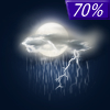 |
Monday Night... Showers likely and possibly a thunderstorm before 9pm, then a chance of showers between 9pm and midnight. Mostly cloudy, then gradually becoming mostly clear, with a low around 25. Breezy, with a west wind 19 to 24 mph decreasing to 11 to 16 mph after midnight. Winds could gust as high as 39 mph. Chance of precipitation is 70%. |
|
|
Tuesday... Sunny, with a high near 47. West southwest wind 9 to 18 mph. |
|
|
Tuesday Night... Partly cloudy, with a low around 29. West northwest wind 15 to 20 mph decreasing to 7 to 12 mph after midnight. Winds could gust as high as 30 mph. |
|
|
Wednesday... A 40 percent chance of snow showers, mainly after noon. Mostly sunny, with a high near 42. New snow accumulation of less than a half inch possible. |
|
|
Wednesday Night... Partly cloudy, with a low around 24. |
|
|
Thursday... A slight chance of snow showers. Mostly sunny, with a high near 47. |
|
|
Thursday Night... Partly cloudy, with a low around 31. |
|
|
Friday... A slight chance of snow showers before 9am, then a slight chance of rain and snow showers between 9am and noon, then a slight chance of rain showers after noon. Mostly sunny, with a high near 53. |
|
 |
Friday Night... Mostly clear, with a low around 33. |
|
|
Saturday... Sunny, with a high near 61. |
|
|
Saturday Night... Partly cloudy, with a low around 40. |
|
|
Sunday... A slight chance of showers. Mostly sunny, with a high near 61. |
|
Current Radar Image
Sun Almanac for Pickelville, Utah
Sunrise: 06:23 AM
Sunset: 8:22 PM
Civil Sunrise:05:53 AM
Civil Sunset: 8:53 PM
Nautical Sunrise: 05:16 AM
Nautical Sunset: 9:30 PM
Astro Sunrise: 04:36 AM
Astro Sunset: 10:10 PM
Utah's Current Temperatures
 Utah's Satellite Image
 Utah's Current Wind Direction
| National Summary |
of upper and lower values of current conditions amongst 7027 locations
in the contiguous United States |
|
High
Temp |
81° |
Zapata Cnty A/P, Texas
and 2 other locations
|
|
Low
Temp |
19° |
Berthoud Pass, Colorado
|
|
Wind
Speed |
33mph |
Duluth Sky Harbor, Minnesota
|
|
Wind
Gust |
46mph |
Duluth Intl, Minnesota
|
|
Wind
Chill |
0° |
Berthoud Pass, Colorado
|
|
High
Pressure |
30.25Hg |
Crescent City, California
|
|
Low
Pressure |
29.63Hg |
Windom, Minnesota
|
|
| # Locations Reporting Snow |
12 |
|
| # Locations Reporting Rain |
128 |
|
| # Locations Reporting Thunderstorms / Lightning |
11 |
|
| # Locations Reporting Fog |
54 |
|
| Average Temperature in the Contiguous USA |
55° |
|
Any use of the information on this page is at your own risk. This information should not be relied upon in life-threatening situations, potential financial loss situations or in lieu of any officially disseminated information. Visit the
National Weather Service for official information.


