Perronville, Michigan Weather
Issued: 2:57 am CDT May 4, 2024 Latitude: 45.7985751 Longitude: -87.3531884 View on Google Maps
|
|
|
|
|
|
|
|
|
|
 |
 |
 |
 |
 |
 |
|
|
| Low: °F |
High: °F |
High: °F |
High: °F |
High: °F |
High: °F |
High: °F |
High: °F |
| Low: °F |
Low: °F |
Low: °F |
Low: °F |
Low: °F |
Low: °F |
|
| Mostly Clear |
Rain |
Mostly Sunny |
Sunny |
Rain |
Partly Sunny |
Partly Sunny |
Partly Sunny |
Current Conditions at
ESCANABA - (KESC)
39°
Mostly Clear
as of 3:56 AM EDST
Rel. Humidity: 100%
Dew Point: 39°F
Visibility: 10 Miles
Pressure: 30.05 in.
Flight Rule: VFR
Cloud Level(s): Few at 11000ft
Current Conditions at
IRON MOUNTAIN - (KIMT)
43°
Mostly Clear
as of 2:54 AM CDST
Rel. Humidity: 70%
Dew Point: 34°F
Visibility: 10 Miles
Pressure: 30.02 in.
Flight Rule: VFR
Cloud Level(s): Few at 11000ft
Current Conditions at
GWINN - (KSAW)
45°
Clear
as of 4:18 AM EDST
Rel. Humidity: 87%
Dew Point: 41°F
Visibility: 10 Miles
Pressure: 30.04 in.
Flight Rule: VFR
Cloud Level(s): Clear
Current Conditions at
MENOMINEE - (KMNM)
46°
Clear
as of 2:57 AM CDST
Rel. Humidity: 93%
Dew Point: 45°F
Visibility: 10 Miles
Pressure: 30.06 in.
Flight Rule: VFR
Cloud Level(s): Clear
|
Overnight... Mostly clear, with a low around 39. Calm wind. |
|
|
Saturday... A 20 percent chance of showers after 3pm. Increasing clouds, with a high near 67. Light southeast wind increasing to 5 to 10 mph in the morning. |
|
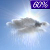 |
Saturday Night... Showers likely, mainly before 8pm. Cloudy, then gradually becoming partly cloudy, with a low around 41. South wind 5 to 10 mph becoming northwest in the evening. Winds could gust as high as 20 mph. Chance of precipitation is 60%. New precipitation amounts between a tenth and quarter of an inch possible. |
|
|
Sunday... Mostly sunny, with a high near 65. Northwest wind 5 to 10 mph. |
|
|
Sunday Night... Mostly clear, with a low around 38. East wind around 5 mph becoming calm in the evening. |
|
|
Monday... Sunny, with a high near 65. |
|
 |
Monday Night... Partly cloudy, with a low around 43. |
|
|
Tuesday... Showers. Mostly cloudy, with a high near 61. |
|
 |
Tuesday Night... Showers likely and possibly a thunderstorm before 1am, then a chance of showers. Mostly cloudy, with a low around 45. |
|
|
Wednesday... A chance of showers after 1pm. Partly sunny, with a high near 66. |
|
 |
Wednesday Night... A chance of showers. Mostly cloudy, with a low around 44. |
|
|
Thursday... A chance of showers. Partly sunny, with a high near 63. |
|
|
Thursday Night... A chance of showers. Mostly cloudy, with a low around 42. |
|
|
Friday... Partly sunny, with a high near 59. |
|
Current Radar Image
Sun Almanac for Perronville, Michigan
Sunrise: 05:31 AM
Sunset: 8:01 PM
Civil Sunrise:04:58 AM
Civil Sunset: 8:35 PM
Nautical Sunrise: 04:16 AM
Nautical Sunset: 9:17 PM
Astro Sunrise: 03:28 AM
Astro Sunset: 10:05 PM
Michigan's Current Temperatures
 Michigan's Satellite Image
 Michigan's Current Wind Direction
| National Summary |
of upper and lower values of current conditions amongst 6933 locations
in the contiguous United States |
|
High
Temp |
82° |
Corpus Christi NAS, Texas
|
|
Low
Temp |
30° |
Wheatland, Wyoming
and 26 other locations
|
|
Wind
Speed |
32mph |
Tekamah, Nebraska
|
|
Wind
Gust |
46mph |
Tekamah, Nebraska
|
|
Wind
Chill |
21° |
November, Montana
and 2 other locations
|
|
High
Pressure |
30.80Hg |
Ottawa, Ohio
|
|
Low
Pressure |
29.58Hg |
Yagabond Aaf, Washington
|
|
| # Locations Reporting Snow |
1 |
|
| # Locations Reporting Rain |
176 |
|
| # Locations Reporting Thunderstorms / Lightning |
11 |
|
| # Locations Reporting Fog |
36 |
|
| Average Temperature in the Contiguous USA |
57° |
|
Any use of the information on this page is at your own risk. This information should not be relied upon in life-threatening situations, potential financial loss situations or in lieu of any officially disseminated information. Visit the
National Weather Service for official information.


