No Watches or Warnings for Oxlip
Issued: 9:30 am CDT May 1, 2024 Latitude: 45.5002421 Longitude: -93.3888429 View on Google Maps
|
|
|
|
|
|
|
|
|
|
 |
 |
 |
 |
|
|
 |
 |
| High: °F |
Low: °F |
High: °F |
High: °F |
High: °F |
High: °F |
High: °F |
High: °F |
| Low: °F |
Low: °F |
Low: °F |
Low: °F |
Low: °F |
|
| Partly Sunny |
Rain |
Rain |
Sunny |
Partly Sunny |
Sunny |
Rain |
Thunderstorms |
Current Conditions at
CAMBRIDGE MUNICIPAL - (KCBG)
52°
Cloudy
as of 9:15 AM CDST
Rel. Humidity: 71%
Dew Point: 43°F
Visibility: 10 Miles
Pressure: 29.84 in.
Flight Rule: MVFR
Wind Data
12 MPH
Gust: 20 MPH
240° Southwest
Cloud Level(s): Solid Overcast at 2700ft
Current Conditions at
PRINCETON - (KPNM)
52°
Cloudy
as of 9:15 AM CDST
Rel. Humidity: 71%
Dew Point: 43°F
Visibility: 10 Miles
Pressure: 29.86 in.
Flight Rule: MVFR
Wind Data
17 MPH
Gust: 24 MPH
260° West
Cloud Level(s): Solid Overcast at 2700ft
Current Conditions at
RUSH CITY - (KROS)
52°
Cloudy
as of 9:15 AM CDST
Rel. Humidity: 71%
Dew Point: 43°F
Visibility: 10 Miles
Pressure: 29.82 in.
Flight Rule: MVFR
Wind Data
10 MPH
Gust: 21 MPH
260° West
Cloud Level(s): Solid Overcast at 2400ft
Current Conditions at
ANOKA COUNTY ARPT - (KANE)
52°
Cloudy
as of 8:50 AM CDST
Rel. Humidity: 71%
Dew Point: 43°F
Visibility: 10 Miles
Pressure: 29.86 in.
Flight Rule: MVFR
Wind Data
12 MPH
Gust: 21 MPH
260° West
Cloud Level(s): Solid Overcast at 2200ft
|
Today... Partly sunny, with a high near 63. West wind around 15 mph, with gusts as high as 25 mph. |
|
|
Tonight... A 30 percent chance of showers, mainly after 5am. Mostly cloudy, with a low around 46. Northwest wind around 5 mph becoming calm. |
|
|
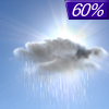
Thursday... Showers. High near 53. East wind 10 to 15 mph. Chance of precipitation is 90%. New precipitation amounts between a quarter and half of an inch possible. |
|
 |
Thursday Night... Showers likely, mainly before 1am. Cloudy, then gradually becoming partly cloudy, with a low around 43. East wind 5 to 10 mph becoming west after midnight. Chance of precipitation is 60%. New precipitation amounts of less than a tenth of an inch possible. |
|
|
Friday... Sunny, with a high near 66. West southwest wind 10 to 15 mph, with gusts as high as 25 mph. |
|
 |
Friday Night... A 20 percent chance of showers after 1am. Mostly cloudy, with a low around 45. West southwest wind 10 to 15 mph. |
|
|
Saturday... A 40 percent chance of showers. Partly sunny, with a high near 61. West wind 10 to 15 mph. |
|
 |
Saturday Night... Mostly clear, with a low around 40. West wind 5 to 10 mph. |
|
|
Sunday... Sunny, with a high near 69. South southwest wind 5 to 10 mph. |
|
 |
Sunday Night... A 20 percent chance of showers. Mostly clear, with a low around 49. Southeast wind 10 to 15 mph. |
|
|
Monday... A 40 percent chance of showers. Mostly sunny, with a high near 73. Breezy, with a south southeast wind 15 to 20 mph, with gusts as high as 30 mph. |
|
 |
Monday Night... Showers likely and possibly a thunderstorm. Mostly cloudy, with a low around 55. Breezy, with a southeast wind around 20 mph, with gusts as high as 30 mph. Chance of precipitation is 70%. |
|
|
Tuesday... A 50 percent chance of showers and thunderstorms. Partly sunny, with a high near 69. Breezy, with a south wind around 20 mph, with gusts as high as 30 mph. |
|
Current Radar Image
Sun Almanac for Oxlip, Minnesota
Sunrise: 06:00 AM
Sunset: 8:21 PM
Civil Sunrise:05:27 AM
Civil Sunset: 8:54 PM
Nautical Sunrise: 04:47 AM
Nautical Sunset: 9:35 PM
Astro Sunrise: 04:01 AM
Astro Sunset: 10:21 PM
Minnesota's Current Temperatures
 Minnesota's Satellite Image
 Minnesota's Current Wind Direction
| National Summary |
of upper and lower values of current conditions amongst 7153 locations
in the contiguous United States |
|
High
Temp |
86° |
Boca Raton, Florida
|
|
Low
Temp |
30° |
Jackson, Wyoming
and 9 other locations
|
|
Wind
Speed |
28mph |
Berthoud Pass, Colorado
|
|
Wind
Gust |
43mph |
Berthoud Pass, Colorado
|
|
Wind
Chill |
17° |
Pagosa Springs, Colorado
|
|
Heat
Index |
90° |
Boca Raton, Florida
|
|
High
Pressure |
30.73Hg |
Ottawa, Ohio
|
|
Low
Pressure |
29.63Hg |
Munising, Michigan
|
|
| # Locations Reporting Snow |
3 |
|
| # Locations Reporting Rain |
28 |
|
| # Locations Reporting Thunderstorms / Lightning |
7 |
|
| # Locations Reporting Fog |
13 |
|
| Average Temperature in the Contiguous USA |
61° |
|
Any use of the information on this page is at your own risk. This information should not be relied upon in life-threatening situations, potential financial loss situations or in lieu of any officially disseminated information. Visit the
National Weather Service for official information.


