No Watches or Warnings for Osseo
Issued: 12:09 pm CDT May 1, 2024 Latitude: 45.1194091 Longitude: -93.4024532 View on Google Maps
|
|
|
|
|
|
|
|
|
|
 |
 |
 |
 |
|
|
 |
 |
| High: °F |
Low: °F |
High: °F |
High: °F |
High: °F |
High: °F |
High: °F |
High: °F |
| Low: °F |
Low: °F |
Low: °F |
Low: °F |
Low: °F |
|
| Partly Sunny |
Rain |
Rain |
Sunny |
Partly Sunny |
Sunny |
Rain |
Thunderstorms |
Current Conditions at
MINNEAPOLIS CRYSTAL - (KMIC)
57°
Partly Cloudy
as of 11:53 AM CDST
Rel. Humidity: 58%
Dew Point: 43°F
Visibility: 10 Miles
Pressure: 29.92 in.
Flight Rule: VFR
Wind Data
18 MPH
Gust: 36 MPH
280° West
Cloud Level(s): Scattered at 3300ft
Current Conditions at
ANOKA COUNTY ARPT - (KANE)
57°
Partly Cloudy
as of 11:55 AM CDST
Rel. Humidity: 58%
Dew Point: 43°F
Visibility: 10 Miles
Pressure: 29.91 in.
Flight Rule: VFR
Wind Data
21 MPH
Gust: 32 MPH
270° West
Cloud Level(s): Scattered at 3000ft
Current Conditions at
MINNEAPOLIS INTL - (KMSP)
57°
Partly Cloudy
as of 11:53 AM CDST
Rel. Humidity: 54%
Dew Point: 41°F
Visibility: 10 Miles
Pressure: 29.94 in.
Flight Rule: VFR
Wind Data
21 MPH
Gust: 36 MPH
270° West
Cloud Level(s): Few at 3000ft, Scattered at 25000ft
Current Conditions at
ST PAUL - (KSTP)
57°
Mostly Cloudy
as of 11:53 AM CDST
Rel. Humidity: 58%
Dew Point: 43°F
Visibility: 10 Miles
Pressure: 29.93 in.
Flight Rule: VFR
Cloud Level(s): Broken at 3400ft
|
This Afternoon... Partly sunny, with a high near 64. Breezy, with a west northwest wind 15 to 20 mph, with gusts as high as 30 mph. |
|
|
Tonight... A 30 percent chance of showers after 4am. Mostly cloudy, with a low around 48. North northwest wind around 5 mph becoming calm. |
|
|
Thursday... Showers, mainly before 4pm. High near 55. East wind 10 to 15 mph. Chance of precipitation is 90%. New precipitation amounts between a half and three quarters of an inch possible. |
|
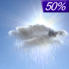 |
Thursday Night... A 50 percent chance of showers, mainly before 1am. Cloudy, then gradually becoming partly cloudy, with a low around 45. East wind 5 to 10 mph becoming west after midnight. New precipitation amounts of less than a tenth of an inch possible. |
|
|
Friday... Sunny, with a high near 67. Breezy, with a west southwest wind 10 to 20 mph, with gusts as high as 30 mph. |
|
 |
Friday Night... A 20 percent chance of showers after 1am. Mostly cloudy, with a low around 47. West southwest wind 10 to 15 mph. |
|
|
Saturday... A 30 percent chance of showers. Partly sunny, with a high near 62. West wind 10 to 15 mph. |
|
 |
Saturday Night... Mostly clear, with a low around 43. West wind 5 to 10 mph. |
|
|
Sunday... Sunny, with a high near 70. South southwest wind 5 to 10 mph. |
|
 |
Sunday Night... A 20 percent chance of showers. Mostly clear, with a low around 52. South southeast wind 10 to 15 mph. |
|
|
Monday... A 40 percent chance of showers. Mostly sunny, with a high near 74. Breezy, with a south southeast wind 15 to 20 mph, with gusts as high as 30 mph. |
|
 |
Monday Night... Showers likely and possibly a thunderstorm. Mostly cloudy, with a low around 57. Breezy, with a southeast wind around 20 mph, with gusts as high as 30 mph. Chance of precipitation is 70%. |
|
|
Tuesday... A 50 percent chance of showers and thunderstorms. Partly sunny, with a high near 72. Breezy, with a south wind around 20 mph, with gusts as high as 30 mph. |
|
Current Radar Image
Sun Almanac for Osseo, Minnesota
Sunrise: 06:01 AM
Sunset: 8:20 PM
Civil Sunrise:05:29 AM
Civil Sunset: 8:53 PM
Nautical Sunrise: 04:48 AM
Nautical Sunset: 9:33 PM
Astro Sunrise: 04:03 AM
Astro Sunset: 10:18 PM
Minnesota's Current Temperatures
 Minnesota's Satellite Image
 Minnesota's Current Wind Direction
| National Summary |
of upper and lower values of current conditions amongst 7136 locations
in the contiguous United States |
|
High
Temp |
91° |
Plant City Municipal A/P, Florida
|
|
Low
Temp |
30° |
Walton Peak, Colorado
|
|
Wind
Speed |
93mph |
Morristown, New Jersey
|
|
Wind
Gust |
47mph |
Kemmerer, Wyoming
|
|
Wind
Chill |
18° |
Berthoud Pass, Colorado
|
|
Heat
Index |
111° |
Kennett, Missouri
|
|
High
Pressure |
30.68Hg |
Ottawa, Ohio
|
|
Low
Pressure |
29.66Hg |
Newberry, Michigan
|
|
| # Locations Reporting Snow |
5 |
|
| # Locations Reporting Rain |
22 |
|
| # Locations Reporting Thunderstorms / Lightning |
8 |
|
| # Locations Reporting Fog |
1 |
|
| Average Temperature in the Contiguous USA |
68° |
|
Any use of the information on this page is at your own risk. This information should not be relied upon in life-threatening situations, potential financial loss situations or in lieu of any officially disseminated information. Visit the
National Weather Service for official information.


