Ortonville, Minnesota Weather
No Watches or Warnings for Ortonville
Issued: 1:46 pm CDT May 1, 2024 Latitude: 45.3046871 Longitude: -96.4447788 View on Google Maps
|
|
|
|
|
|
|
|
|
|
 |
 |
 |
 |
 |
 |
 |
 |
| High: °F |
Low: °F |
High: °F |
High: °F |
High: °F |
High: °F |
High: °F |
High: °F |
| Low: °F |
Low: °F |
Low: °F |
Low: °F |
Low: °F |
|
| Mostly Cloudy |
Rain |
Rain |
Mostly Sunny |
Rain |
Sunny |
Thunderstorms |
Partly Sunny |
Current Conditions at
ORTONVILLE - (KVVV)
63°
Clear
as of 2:15 PM CDST
Rel. Humidity: 39%
Dew Point: 37°F
Visibility: 10 Miles
Pressure: 29.94 in.
Flight Rule: VFR
Wind Data
8 MPH
320° Northwest
Cloud Level(s): Clear
Current Conditions at
APPLETON - (KAQP)
64°
Clear
as of 2:13 PM CDST
Rel. Humidity: 34%
Dew Point: 36°F
Visibility: 10 Miles
Pressure: 29.94 in.
Flight Rule: VFR
Wind Data
12 MPH
Gust: 18 MPH
280° West
Cloud Level(s): Clear
Current Conditions at
MADISON - (KDXX)
64°
Clear
as of 2:15 PM CDST
Rel. Humidity: 36%
Dew Point: 37°F
Visibility: 10 Miles
Pressure: 29.96 in.
Flight Rule: VFR
Wind Data
12 MPH
Gust: 18 MPH
310° Northwest
Cloud Level(s): Clear
Current Conditions at
WHEATON NDB - (KETH)
61°
Clear
as of 2:13 PM CDST
Rel. Humidity: 41%
Dew Point: 37°F
Visibility: 10 Miles
Pressure: 29.94 in.
Flight Rule: VFR
Wind Data
6 MPH
320° Northwest
Cloud Level(s): Clear
|
This Afternoon... Mostly cloudy, with a high near 65. West northwest wind 9 to 13 mph. |
|
|
Tonight... Showers likely, mainly after 4am. Cloudy, with a low around 47. South southwest wind 6 to 9 mph becoming east in the evening. Chance of precipitation is 60%. New precipitation amounts of less than a tenth of an inch possible. |
|
|
Thursday... Showers likely before 3pm, then a slight chance of showers after 4pm. Cloudy, with a high near 55. East southeast wind 9 to 13 mph. Chance of precipitation is 60%. New precipitation amounts of less than a tenth of an inch possible. |
|
 |
Thursday Night... A slight chance of showers before 10pm. Partly cloudy, with a low around 40. West southwest wind 5 to 8 mph. Chance of precipitation is 20%. |
|
|
Friday... Mostly sunny, with a high near 63. West wind 10 to 18 mph, with gusts as high as 26 mph. |
|
 |
Friday Night... A chance of showers, mainly after 1am. Mostly cloudy, with a low around 43. West wind 9 to 13 mph. Chance of precipitation is 30%. |
|
|
Saturday... A slight chance of showers before 1pm. Mostly sunny, with a high near 61. West northwest wind 10 to 15 mph, with gusts as high as 23 mph. Chance of precipitation is 20%. |
|
 |
Saturday Night... Mostly clear, with a low around 41. Northwest wind 7 to 11 mph becoming south after midnight. |
|
|
Sunday... Sunny, with a high near 70. South southeast wind 8 to 15 mph, with gusts as high as 23 mph. |
|
 |
Sunday Night... A chance of showers, mainly after 1am. Partly cloudy, with a low around 54. Chance of precipitation is 30%. |
|
|
Monday... A chance of showers and thunderstorms. Partly sunny, with a high near 75. Breezy. Chance of precipitation is 50%. |
|
 |
Monday Night... Showers and thunderstorms likely. Mostly cloudy, with a low around 54. Breezy. Chance of precipitation is 60%. |
|
|
Tuesday... A chance of showers. Partly sunny, with a high near 69. Breezy. Chance of precipitation is 40%. |
|
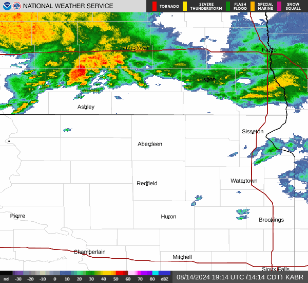
Current Radar Image
Sun Almanac for Ortonville, Minnesota
Sunrise: 06:13 AM
Sunset: 8:33 PM
Civil Sunrise:05:40 AM
Civil Sunset: 9:05 PM
Nautical Sunrise: 05:00 AM
Nautical Sunset: 9:46 PM
Astro Sunrise: 04:14 AM
Astro Sunset: 10:32 PM
Minnesota's Current Temperatures
 Minnesota's Satellite Image
 Minnesota's Current Wind Direction
| National Summary |
of upper and lower values of current conditions amongst 7060 locations
in the contiguous United States |
|
High
Temp |
93° |
Plant City Municipal A/P, Florida
and 1 other location
|
|
Low
Temp |
30° |
Jackson, Wyoming
and 1 other location
|
|
Wind
Speed |
33mph |
El Reno, Oklahoma
|
|
Wind
Gust |
48mph |
Imperial, Nebraska
|
|
Wind
Chill |
22° |
Afton, Wyoming
|
|
Heat
Index |
111° |
Clarksdale/Fletcher, Mississippi
|
|
High
Pressure |
30.26Hg |
Newport, Oregon
|
|
Low
Pressure |
29.68Hg |
Buckley Angb Arpt, Colorado
|
|
| # Locations Reporting Snow |
6 |
|
| # Locations Reporting Rain |
36 |
|
| # Locations Reporting Thunderstorms / Lightning |
6 |
|
| Average Temperature in the Contiguous USA |
71° |
|
Any use of the information on this page is at your own risk. This information should not be relied upon in life-threatening situations, potential financial loss situations or in lieu of any officially disseminated information. Visit the
National Weather Service for official information.