Orrock, Minnesota Weather
No Watches or Warnings for Orrock
|
|
|
|
|
|
|
|
 |
 |
 |
 |
|
 |
 |
 |
| Low: °F |
High: °F |
High: °F |
High: °F |
High: °F |
High: °F |
High: °F |
High: °F |
| Low: °F |
Low: °F |
Low: °F |
Low: °F |
Low: °F |
Low: °F |
|
| Rain |
Rain |
Sunny |
Partly Sunny |
Sunny |
Rain |
Thunderstorms |
Thunderstorms |
Current Conditions at
PRINCETON - (KPNM)
63°
Clear
as of 4:55 PM CDST
Rel. Humidity: 42%
Dew Point: 39°F
Visibility: 10 Miles
Pressure: 29.95 in.
Flight Rule: VFR
Cloud Level(s): Clear
Current Conditions at
ST CLOUD - (KSTC)
61°
Clear
as of 4:53 PM CDST
Rel. Humidity: 44%
Dew Point: 39°F
Visibility: 10 Miles
Pressure: 29.94 in.
Flight Rule: VFR
Cloud Level(s): Clear
Current Conditions at
MAPLE LAKE - (KMGG)
61°
Clear
as of 5:15 PM CDST
Rel. Humidity: 44%
Dew Point: 39°F
Visibility: 10 Miles
Pressure: 29.95 in.
Flight Rule: VFR
Wind Data
6 MPH
310° Northwest
Cloud Level(s): Clear
Current Conditions at
BUFFALO - (KCFE)
61°
Clear
as of 4:55 PM CDST
Rel. Humidity: 48%
Dew Point: 41°F
Visibility: 10 Miles
Pressure: 29.93 in.
Flight Rule: VFR
Wind Data
12 MPH
320° Northwest
Cloud Level(s): Clear
|
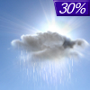
Tonight... A 30 percent chance of showers, mainly after 4am. Mostly cloudy, with a low around 47. Northwest wind 5 to 10 mph becoming light and variable. |
|
|
Thursday... Showers, mainly between 7am and 4pm. High near 53. East wind 10 to 15 mph. Chance of precipitation is 90%. New precipitation amounts between a quarter and half of an inch possible. |
|
 |
Thursday Night... A 30 percent chance of showers before 1am. Cloudy, then gradually becoming partly cloudy, with a low around 43. East northeast wind 5 to 10 mph becoming west after midnight. |
|
|
Friday... Sunny, with a high near 67. West southwest wind 5 to 15 mph. |
|
|
Friday Night... A 30 percent chance of showers after 1am. Mostly cloudy, with a low around 46. Southwest wind 5 to 10 mph becoming northwest after midnight. |
|
|
Saturday... A 30 percent chance of showers, mainly before 1pm. Partly sunny, with a high near 64. West northwest wind 5 to 15 mph. |
|
 |
Saturday Night... Mostly clear, with a low around 41. Northwest wind 5 to 10 mph. |
|
|
Sunday... Sunny, with a high near 70. North wind 5 to 10 mph becoming south in the afternoon. |
|
 |
Sunday Night... A 20 percent chance of showers after 1am. Mostly clear, with a low around 50. Southeast wind around 10 mph. |
|
|
Monday... A 30 percent chance of showers, mainly after 1pm. Mostly sunny, with a high near 75. Breezy, with a southeast wind 15 to 20 mph, with gusts as high as 30 mph. |
|
 |
Monday Night... Showers likely and possibly a thunderstorm. Mostly cloudy, with a low around 57. Breezy, with a southeast wind around 20 mph, with gusts as high as 30 mph. Chance of precipitation is 70%. |
|
|
Tuesday... A 50 percent chance of showers and thunderstorms. Partly sunny, with a high near 70. Breezy, with a south wind around 20 mph, with gusts as high as 30 mph. |
|
 |
Tuesday Night... A 30 percent chance of showers. Partly cloudy, with a low around 48. South southwest wind 10 to 15 mph, with gusts as high as 25 mph. |
|
|
Wednesday... A 30 percent chance of showers and thunderstorms. Partly sunny, with a high near 66. West southwest wind 10 to 15 mph becoming north northwest in the afternoon. |
|
Current Radar Image
Sun Almanac for Orrock, Minnesota
Sunrise: 06:02 AM
Sunset: 8:22 PM
Civil Sunrise:05:29 AM
Civil Sunset: 8:55 PM
Nautical Sunrise: 04:48 AM
Nautical Sunset: 9:36 PM
Astro Sunrise: 04:02 AM
Astro Sunset: 10:22 PM
Minnesota's Current Temperatures
 Minnesota's Satellite Image
 Minnesota's Current Wind Direction
| National Summary |
of upper and lower values of current conditions amongst 6889 locations
in the contiguous United States |
|
High
Temp |
97° |
Palm Springs, California
|
|
Low
Temp |
30° |
Sunlight, Colorado
and 1 other location
|
|
Wind
Speed |
31mph |
Las Vegas, New Mexico
|
|
Wind
Gust |
59mph |
Clayton, New Mexico
|
|
Wind
Chill |
19° |
Pinedale, Wyoming
|
|
Heat
Index |
121° |
Clarksdale/Fletcher, Mississippi
|
|
High
Pressure |
30.23Hg |
Crescent City, California
|
|
Low
Pressure |
29.59Hg |
La Junta, Colorado
|
|
| # Locations Reporting Snow |
4 |
|
| # Locations Reporting Rain |
51 |
|
| # Locations Reporting Thunderstorms / Lightning |
11 |
|
| # Locations Reporting Fog |
1 |
|
| Average Temperature in the Contiguous USA |
72° |
|
Any use of the information on this page is at your own risk. This information should not be relied upon in life-threatening situations, potential financial loss situations or in lieu of any officially disseminated information. Visit the
National Weather Service for official information.


