Orangetree, Florida Weather
Issued: 9:02 pm EDT May 5, 2024 Latitude: 26.2928621 Longitude: -81.5884153 View on Google Maps
|
|
|
|
|
|
|
|
|
|
 |
 |
 |
 |
|
|
 |
 |
| Low: °F |
High: °F |
High: °F |
High: °F |
High: °F |
High: °F |
High: °F |
High: °F |
| Low: °F |
Low: °F |
Low: °F |
Low: °F |
Low: °F |
Low: °F |
|
| Cloudy |
Thunderstorms |
Thunderstorms |
Sunny |
Sunny |
Sunny |
Thunderstorms |
Thunderstorms |
Current Conditions at
NAPLES - (KAPF)
75°
Clear
as of 12:53 AM EDST
Rel. Humidity: 88%
Dew Point: 72°F
Visibility: 10 Miles
Pressure: 30.04 in.
Flight Rule: VFR
Cloud Level(s): Clear
Current Conditions at
FT MYERS SW APT - (KRSW)
73°
Partly Cloudy
as of 12:53 AM EDST
Rel. Humidity: 94%
Dew Point: 72°F
Visibility: 10 Miles
Pressure: 30.05 in.
Flight Rule: VFR
Cloud Level(s): Scattered at 12000ft
Current Conditions at
FT MYERS PAGE FLD - (KFMY)
73°
Cloudy
as of 12:53 AM EDST
Rel. Humidity: 94%
Dew Point: 72°F
Visibility: 10 Miles
Pressure: 30.05 in.
Flight Rule: VFR
Cloud Level(s): Solid Overcast at 11000ft
Current Conditions at
FORT LAUDERDALE EXEC - (KFXE)
79°
Clear
as of 12:53 AM EDST
Rel. Humidity: 69%
Dew Point: 68°F
Visibility: 10 Miles
Pressure: 30.05 in.
Flight Rule: VFR
Cloud Level(s): Clear
|
Overnight... Partly cloudy, with a low around 68. East wind around 6 mph. |
|
|
Monday... A slight chance of showers between 3pm and 5pm, then a slight chance of showers and thunderstorms after 5pm. Sunny, with a high near 91. East wind 6 to 9 mph. Chance of precipitation is 20%. |
|
 |
Monday Night... A 10 percent chance of showers and thunderstorms before 8pm. Partly cloudy, with a low around 70. Southwest wind around 6 mph becoming east in the evening. |
|
|
Tuesday... A 20 percent chance of showers and thunderstorms after 2pm. Mostly sunny, with a high near 92. East wind 5 to 8 mph becoming south in the afternoon. |
|
|
Tuesday Night... Partly cloudy, with a low around 71. Southwest wind around 6 mph becoming light and variable. |
|
|
Wednesday... Sunny, with a high near 94. Southeast wind 6 to 10 mph. |
|
 |
Wednesday Night... Mostly clear, with a low around 69. Southwest wind 8 to 10 mph becoming southeast after midnight. |
|
|
Thursday... Sunny, with a high near 94. Southeast wind 8 to 11 mph becoming southwest in the afternoon. |
|
|
Thursday Night... Mostly clear, with a low around 70. South wind 7 to 10 mph. |
|
|
Friday... Sunny, with a high near 93. |
|
|
Friday Night... Mostly clear, with a low around 73. |
|
|
Saturday... A 30 percent chance of showers and thunderstorms. Sunny, with a high near 90. |
|
 |
Saturday Night... A 30 percent chance of showers and thunderstorms. Mostly clear, with a low around 68. |
|
|
Sunday... A 30 percent chance of showers and thunderstorms. Mostly sunny, with a high near 89. |
|
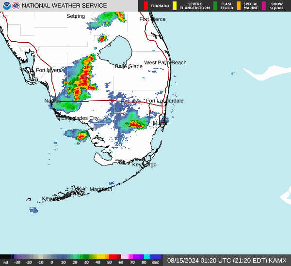
Current Radar Image
Sun Almanac for Orangetree, Florida
Sunrise: 06:45 AM
Sunset: 8:01 PM
Civil Sunrise:06:20 AM
Civil Sunset: 8:26 PM
Nautical Sunrise: 05:51 AM
Nautical Sunset: 8:55 PM
Astro Sunrise: 05:20 AM
Astro Sunset: 9:25 PM
Florida's Current Temperatures
 Florida's Satellite Image
 Florida's Current Wind Direction
| National Summary |
of upper and lower values of current conditions amongst 7001 locations
in the contiguous United States |
|
High
Temp |
84° |
Key West NAS, Florida
|
|
Low
Temp |
30° |
Evanston, Wyoming
and 7 other locations
|
|
Wind
Speed |
41mph |
Farmington, New Mexico
|
|
Wind
Gust |
63mph |
Farmington, New Mexico
|
|
Wind
Chill |
15° |
Berthoud Pass, Colorado
|
|
High
Pressure |
30.17Hg |
San Carlos, California
and 1 other location
|
|
Low
Pressure |
29.36Hg |
Malta, Montana
|
|
| # Locations Reporting Snow |
10 |
|
| # Locations Reporting Rain |
122 |
|
| # Locations Reporting Thunderstorms / Lightning |
1 |
|
| # Locations Reporting Fog |
39 |
|
| Average Temperature in the Contiguous USA |
59° |
|
Any use of the information on this page is at your own risk. This information should not be relied upon in life-threatening situations, potential financial loss situations or in lieu of any officially disseminated information. Visit the
National Weather Service for official information.