Nanatlugunyi, Tennessee Weather
Current Conditions at
BRISTOL - (KTRI)
66°
Mostly Cloudy
as of 7:53 PM EDST
Rel. Humidity: 88%
Dew Point: 63°F
Visibility: 10 Miles
Pressure: 30.07 in.
Flight Rule: VFR
Cloud Level(s): Broken at 6000ft, Broken at 8000ft
Current Conditions at
ABINGDON - (KVJI)
66°
Partly Cloudy
as of 8:15 PM EDST
Rel. Humidity: 72%
Dew Point: 57°F
Visibility: 10 Miles
Pressure: 30.09 in.
Flight Rule: VFR
Cloud Level(s): Scattered at 5000ft, Scattered at 9000ft
Current Conditions at
BOONE - (KTNB)
63°
Mostly Cloudy
Light Rain
as of 8:15 PM EDST
Rel. Humidity: 88%
Dew Point: 59°F
Visibility: 10 Miles
Pressure: 30.17 in.
Flight Rule: MVFR
Cloud Level(s): Scattered at 1800ft, Broken at 2600ft, Broken at 3700ft
Current Conditions at
WISE/LONESOME PINE - (KLNP)
64°
Clear
as of 8:15 PM EDST
Rel. Humidity: 77%
Dew Point: 57°F
Visibility: 10 Miles
Pressure: 30.09 in.
Flight Rule: VFR
Wind Data
12 MPH
180° South
Cloud Level(s): Clear
Moon Almanac for Nanatlugunyi, Tennessee
Moon Phase: Waning Gibbous
Moon Illumination: 92%
Moon Age: 17.5 Days
Moon is currently below the horizon
Distance from Moon to Earth: 250,733 miles
Upcoming Lunar Events for
Nanatlugunyi: |
| Next Event | Event Time | Illum |
|
|
|
| Moonrise: | 10:50 pm Sat | 91.3% |
| High Moon: | 03:49 am Sun | 90.1% |
| Moonset: | 08:42 am Sun | 88.9% |
 | New Moon: Wed Mar 18 |
 | First Quarter: Wed Mar 25 |
 | Full Moon: Wed Apr 1 |
 | Last Quarter: Fri Apr 10 |
| New Moon: Fri Apr 17 |
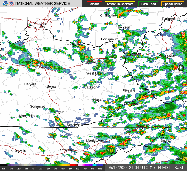
Current Radar Image
| Tennessee State Summary |
of upper and lower values of current conditions amongst 14 locations
in Tennessee |
|
|
|
Low
Temp |
59° |
Dyersburg
and 1 other location
|
|
Wind
Speed |
13mph |
Knoxville
|
|
Wind
Gust |
18mph |
Millington-Memphis Airport
|
|
High
Pressure |
30.09Hg |
Dyersburg
|
|
Low
Pressure |
30.04Hg |
Chattanooga
and 2 other locations
|
|
| Average temperature in Tennessee |
67° |
|
| # Locations Reporting Rain |
4 |
|
# Locations Reporting MVFR
(Marginal Visual Flight Rules) |
2 |
|
# Locations Reporting VFR
(Visual Flight Rules) |
12 |
|
Tennessee's Current Temperatures
 Tennessee's Satellite Image
 Tennessee's Current Wind Direction
| National Summary |
of upper and lower values of current conditions amongst 6849 locations
in the contiguous United States |
|
High
Temp |
91° |
Corona Municipal A/P, California
|
|
Low
Temp |
23° |
Berthoud Pass, Colorado
|
|
Wind
Speed |
31mph |
Maurice, Iowa
|
|
Wind
Gust |
46mph |
Whitefield, New Hampshire
and 1 other location
|
|
Wind
Chill |
13° |
Grand Marais, Minnesota
|
|
Heat
Index |
92° |
Mcallen, Texas
|
|
High
Pressure |
30.55Hg |
Salida Mountain, Colorado
|
|
Low
Pressure |
29.63Hg |
Newberry, Michigan
|
|
| # Locations Reporting Snow |
38 |
|
| # Locations Reporting Rain |
103 |
|
| # Locations Reporting Thunderstorms / Lightning |
6 |
|
| # Locations Reporting Fog |
3 |
|
| Average Temperature in the Contiguous USA |
60° |
|
Any use of the information on this page is at your own risk. This information should not be relied upon in life-threatening situations, potential financial loss situations or in lieu of any officially disseminated information. Visit the
National Weather Service for official information.