Moore, Washington Weather
No Watches or Warnings for Moore
Issued: 5:17 am PDT May 3, 2024 Latitude: 48.2351369 Longitude: -120.6159304 View on Google Maps
|
|
|
|
|
|
|
|
|
|
 |
 |
 |
 |
 |
 |
 |
 |
| High: °F |
Low: °F |
High: °F |
High: °F |
High: °F |
High: °F |
High: °F |
High: °F |
| Low: °F |
Low: °F |
Low: °F |
Low: °F |
Low: °F |
|
| Increasing Clouds |
Rain |
Rain |
Rain |
Partly Sunny |
Rain |
Mostly Sunny |
Sunny |
Current Conditions at
OMAK - (KOMK)
45°
Clear
as of 6:53 AM PDST
Rel. Humidity: 70%
Dew Point: 36°F
Visibility: 10 Miles
Pressure: 30.05 in.
Flight Rule: VFR
Cloud Level(s): Clear
Current Conditions at
WENATCHEE - (KEAT)
45°
Clear
as of 6:55 AM PDST
Rel. Humidity: 61%
Dew Point: 32°F
Visibility: 10 Miles
Pressure: 30.02 in.
Flight Rule: VFR
Cloud Level(s): Clear
Current Conditions at
ARLINGTON MUNICIPAL - (KAWO)
41°
Clear
as of 6:56 AM PDST
Rel. Humidity: 93%
Dew Point: 39°F
Visibility: 10 Miles
Pressure: 30.01 in.
Flight Rule: VFR
Cloud Level(s): Clear
Current Conditions at
STAMPEDE PASS - (KSMP)
37°
Clear
as of 6:56 AM PDST
Rel. Humidity: 74%
Dew Point: 30°F
Visibility: 10 Miles
Pressure: 29.98 in.
Flight Rule: VFR
Cloud Level(s): Clear
|
Today... Increasing clouds, with a high near 64. Light southeast wind increasing to 6 to 11 mph in the morning. |
|
|
Tonight... A 20 percent chance of showers after 11pm. Mostly cloudy, with a low around 49. South wind 8 to 11 mph. |
|
|
Saturday... A 50 percent chance of showers. Mostly cloudy, with a high near 59. Southeast wind 8 to 10 mph. New precipitation amounts of less than a tenth of an inch possible. |
|
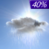 |
Saturday Night... A 40 percent chance of showers, mainly before 11pm. Cloudy, then gradually becoming partly cloudy, with a low around 48. Southeast wind 6 to 9 mph becoming northwest after midnight. New precipitation amounts of less than a tenth of an inch possible. |
|
|
Sunday... A 40 percent chance of rain. Partly sunny, with a high near 54. West wind 6 to 9 mph. |
|
 |
Sunday Night... A 40 percent chance of rain. Mostly cloudy, with a low around 43. |
|
|
Monday... A 50 percent chance of showers. Partly sunny, with a high near 54. |
|
 |
Monday Night... A 30 percent chance of showers, mainly before 11pm. Partly cloudy, with a low around 40. |
|
|
Tuesday... A 30 percent chance of showers, mainly after 11am. Mostly sunny, with a high near 53. |
|
 |
Tuesday Night... Partly cloudy, with a low around 39. |
|
|
Wednesday... Mostly sunny, with a high near 58. |
|
 |
Wednesday Night... Mostly clear, with a low around 42. |
|
|
Thursday... Sunny, with a high near 68. |
|
Current Radar Image
Sun Almanac for Moore, Washington
Sunrise: 05:39 AM
Sunset: 8:20 PM
Civil Sunrise:05:03 AM
Civil Sunset: 8:55 PM
Nautical Sunrise: 04:18 AM
Nautical Sunset: 9:40 PM
Astro Sunrise: 03:25 AM
Astro Sunset: 10:33 PM
Washington's Current Temperatures
 Washington's Satellite Image
 Washington's Current Wind Direction
| National Summary |
of upper and lower values of current conditions amongst 7246 locations
in the contiguous United States |
|
High
Temp |
86° |
Key West NAS, Florida
|
|
Low
Temp |
30° |
Pinedale, Wyoming
and 15 other locations
|
|
Wind
Speed |
33mph |
Berthoud Pass, Colorado
|
|
Wind
Gust |
55mph |
Berthoud Pass, Colorado
|
|
Wind
Chill |
17° |
Charlie, Montana
|
|
Heat
Index |
92° |
Key WestNAS, Florida
|
|
High
Pressure |
30.27Hg |
Presque Isle, Maine
|
|
Low
Pressure |
29.63Hg |
Flag Island, Minnesota
|
|
| # Locations Reporting Snow |
16 |
|
| # Locations Reporting Rain |
112 |
|
| # Locations Reporting Thunderstorms / Lightning |
5 |
|
| # Locations Reporting Fog |
10 |
|
| Average Temperature in the Contiguous USA |
61° |
|
Any use of the information on this page is at your own risk. This information should not be relied upon in life-threatening situations, potential financial loss situations or in lieu of any officially disseminated information. Visit the
National Weather Service for official information.


