Lordland, Florida Weather
Issued: 2:14 pm EDT Apr 29, 2024 Latitude: 28.7719383 Longitude: -81.2603428 View on Google Maps
|
|
|
|
|
|
|
|
|
|
 |
 |
 |
 |
|
|
|
|
| High: °F |
Low: °F |
High: °F |
High: °F |
High: °F |
High: °F |
High: °F |
High: °F |
| Low: °F |
Low: °F |
Low: °F |
Low: °F |
Low: °F |
|
| Sunny |
Mostly Clear |
Thunderstorms |
Thunderstorms |
Sunny |
Sunny |
Thunderstorms |
Thunderstorms |
Current Conditions at
SANFORD - (KSFB)
82°
Mostly Cloudy
as of 1:53 PM EDST
Rel. Humidity: 42%
Dew Point: 57°F
Visibility: 10 Miles
Pressure: 30.09 in.
Flight Rule: VFR
Wind Data
9 MPH
Gust: 21 MPH
120° Southeast
Cloud Level(s): Broken at 5500ft
Current Conditions at
ORLANDO HERN APRT - (KORL)
84°
Mostly Cloudy
as of 1:53 PM EDST
Rel. Humidity: 39%
Dew Point: 57°F
Visibility: 10 Miles
Pressure: 30.08 in.
Flight Rule: VFR
Cloud Level(s): Broken at 6000ft
Current Conditions at
ORLANDO INTL - (KMCO)
84°
Partly Cloudy
as of 1:53 PM EDST
Rel. Humidity: 35%
Dew Point: 54°F
Visibility: 10 Miles
Pressure: 30.08 in.
Flight Rule: VFR
Wind Data
8 MPH
Gust: 18 MPH
200° South
Cloud Level(s): Scattered at 6000ft
Current Conditions at
DAYTONA BEACH - (KDAB)
81°
Partly Cloudy
as of 1:53 PM EDST
Rel. Humidity: 54%
Dew Point: 63°F
Visibility: 10 Miles
Pressure: 30.11 in.
Flight Rule: VFR
Wind Data
12 MPH
Gust: 22 MPH
100° East
Cloud Level(s): Scattered at 4500ft
|
This Afternoon... Sunny, with a high near 85. East southeast wind 10 to 15 mph. |
|
|
Tonight... Mostly clear, with a low around 66. East southeast wind 5 to 15 mph, with gusts as high as 20 mph. |
|
|
Tuesday... A slight chance of showers between 11am and 5pm, then a chance of showers and thunderstorms after 5pm. Mostly sunny, with a high near 86. South southeast wind 5 to 10 mph. Chance of precipitation is 30%. |
|
 |
Tuesday Night... A 30 percent chance of showers and thunderstorms before 8pm. Mostly cloudy, then gradually becoming mostly clear, with a low around 68. South wind 5 to 10 mph. |
|
|
Wednesday... A 20 percent chance of showers and thunderstorms after 2pm. Sunny, with a high near 89. South southwest wind around 5 mph becoming east in the afternoon. |
|
 |
Wednesday Night... A 10 percent chance of showers and thunderstorms before 8pm. Mostly clear, with a low around 68. South southeast wind 5 to 10 mph. |
|
|
Thursday... Sunny, with a high near 90. Light southeast wind becoming east 5 to 10 mph in the afternoon. |
|
|
Thursday Night... Mostly clear, with a low around 68. East southeast wind 5 to 10 mph. |
|
|
Friday... Sunny, with a high near 88. East southeast wind 5 to 15 mph. |
|
|
Friday Night... Mostly clear, with a low around 67. East southeast wind 5 to 10 mph. |
|
|
Saturday... A 20 percent chance of showers and thunderstorms. Sunny, with a high near 88. East wind 5 to 15 mph, with gusts as high as 20 mph. |
|
|
Saturday Night... A 10 percent chance of showers and thunderstorms. Mostly clear, with a low around 67. East southeast wind 5 to 15 mph, with gusts as high as 20 mph. |
|
|
Sunday... A 20 percent chance of showers and thunderstorms. Sunny, with a high near 87. East southeast wind 5 to 15 mph. |
|
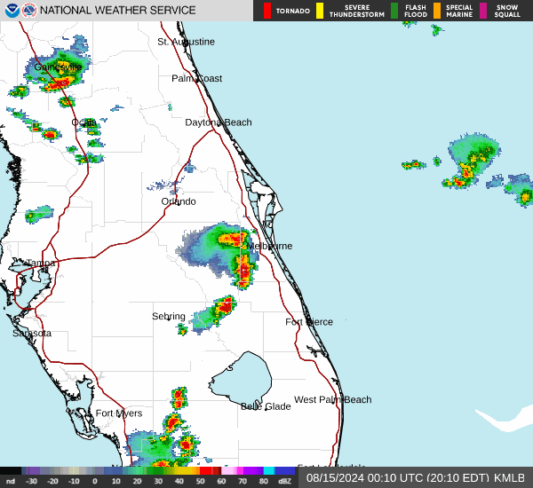
Current Radar Image
Sun Almanac for Lordland, Florida
Sunrise: 06:45 AM
Sunset: 8:00 PM
Civil Sunrise:06:20 AM
Civil Sunset: 8:25 PM
Nautical Sunrise: 05:50 AM
Nautical Sunset: 8:54 PM
Astro Sunrise: 05:20 AM
Astro Sunset: 9:25 PM
Florida's Current Temperatures
 Florida's Satellite Image
 Florida's Current Wind Direction
| National Summary |
of upper and lower values of current conditions amongst 7005 locations
in the contiguous United States |
|
High
Temp |
91° |
Baltimore Inner Harbor, Maryland
and 2 other locations
|
|
Low
Temp |
23° |
Berthoud Pass, Colorado
|
|
Wind
Speed |
30mph |
Ennis Big Sky, Montana
|
|
Wind
Gust |
40mph |
Ennis Big Sky, Montana
|
|
Wind
Chill |
7° |
Berthoud Pass, Colorado
|
|
Heat
Index |
100° |
Brownsville, Texas
|
|
High
Pressure |
30.30Hg |
Salida Mountain, Colorado
and 1 other location
|
|
Low
Pressure |
29.67Hg |
New Richmond, Wisconsin
and 4 other locations
|
|
| # Locations Reporting Snow |
5 |
|
| # Locations Reporting Rain |
78 |
|
| # Locations Reporting Thunderstorms / Lightning |
1 |
|
| # Locations Reporting Fog |
6 |
|
| Average Temperature in the Contiguous USA |
68° |
|
Any use of the information on this page is at your own risk. This information should not be relied upon in life-threatening situations, potential financial loss situations or in lieu of any officially disseminated information. Visit the
National Weather Service for official information.