Wenatchee, Washington Weather
Issued: 3:12 am PST Dec 17, 2025 Latitude: 47.4234599 Longitude: -120.3103494 View on Google Maps
|
|
|
|
|
|
|
|
|
|
 |
 |
|
|
 |
 |
|
 |
| Low: °F |
High: °F |
High: °F |
High: °F |
High: °F |
High: °F |
High: °F |
High: °F |
| Low: °F |
Low: °F |
Low: °F |
Low: °F |
Low: °F |
Low: °F |
|
| Rain & Snow |
Rain & Snow |
Rain & Snow |
Rain & Snow |
Rain & Snow |
Rain & Snow |
Rain & Snow |
Rain & Snow |
Current Conditions at
WENATCHEE - (KEAT)
Mostly Clear
as of 3:55 AM PST
Rel. Humidity: 49%
Dew Point: 30°F
Visibility: 10 Miles
Pressure: 29.22 in.
Flight Rule: VFR
Wind Data
37 MPH
Gust: 63 MPH
250° West
Cloud Level(s): Few at 6000ft
Current Conditions at
ELLENSBURG - (KELN)
Mostly Clear
as of 3:53 AM PST
Rel. Humidity: 80%
Dew Point: 34°F
Visibility: 10 Miles
Pressure: 29.34 in.
Flight Rule: VFR
Wind Data
29 MPH
Gust: 39 MPH
290° West
Cloud Level(s): Few at 11000ft
Current Conditions at
EPHRATA - (KEPH)
Mostly Cloudy
as of 3:53 AM PST
Rel. Humidity: 87%
Dew Point: 45°F
Visibility: 10 Miles
Pressure: 29.24 in.
Flight Rule: VFR
Wind Data
20 MPH
Gust: 29 MPH
230° Southwest
Cloud Level(s): Scattered at 5000ft, Broken at 6000ft, Broken at 7500ft
Current Conditions at
STAMPEDE PASS - (KSMP)
30°
Partly Cloudy
Light Snow Mist
as of 4:01 AM PST
Rel. Humidity: 92%
Dew Point: 28°F
Visibility: 3/4 Miles
Pressure: 29.36 in.
Flight Rule: MVFR
|
Overnight... A 50 percent chance of rain. Snow level 2300 feet. Mostly cloudy, with a steady temperature around 38. Windy, with a west wind 26 to 28 mph, with gusts as high as 45 mph. New precipitation amounts of less than a tenth of an inch possible. |
|
|
Wednesday... A 30 percent chance of rain. Snow level 1600 feet rising to 2200 feet in the afternoon. Partly sunny, with a high near 42. Windy, with a west wind 20 to 25 mph, with gusts as high as 41 mph. New precipitation amounts of less than a tenth of an inch possible. |
|
|
Wednesday Night... A 30 percent chance of rain. Snow level 2300 feet lowering to 1700 feet. Increasing clouds, with a low around 33. West wind 5 to 7 mph becoming light and variable after midnight. New precipitation amounts of less than a tenth of an inch possible. |
|
|
Thursday... A 50 percent chance of rain. Snow level 1900 feet. Cloudy, with a high near 39. Southeast wind 6 to 8 mph. New precipitation amounts between a quarter and half of an inch possible. |
|
|
Thursday Night... A 50 percent chance of rain. Snow level 3800 feet lowering to 2200 feet after midnight . Mostly cloudy, with a low around 27. West wind 7 to 9 mph, with gusts as high as 21 mph. New precipitation amounts between a tenth and quarter of an inch possible. |
|
|
Friday... A 30 percent chance of rain. Snow level 1200 feet rising to 1900 feet in the afternoon. Partly sunny, with a high near 38. |
|
|
Friday Night... A chance of rain and snow. Snow level 1300 feet. Mostly cloudy, with a low around 28. Chance of precipitation is 40%. Little or no snow accumulation expected. |
|
|
Saturday... A chance of rain and snow before 10am, then a chance of rain. Snow level 1200 feet rising to 2000 feet in the afternoon. Partly sunny, with a high near 36. Chance of precipitation is 40%. |
|
|
Saturday Night... A slight chance of rain before 10pm, then a slight chance of rain after 4am. Snow level 1500 feet. Partly cloudy, with a low around 27. Chance of precipitation is 20%. |
|
|
Sunday... A chance of rain and snow before 1pm, then rain likely. Snow level 1300 feet rising to 1800 feet in the afternoon. Partly sunny, with a high near 34. Chance of precipitation is 60%. |
|
 |
Sunday Night... Rain and snow likely. Snow level 2200 feet. Mostly cloudy, with a low around 28. Chance of precipitation is 70%. |
|
|
Monday... A chance of rain and snow. Snow level 2100 feet. Partly sunny, with a high near 36. Chance of precipitation is 40%. |
|
|
Monday Night... A chance of rain and snow. Snow level 1500 feet. Partly cloudy, with a low around 26. Chance of precipitation is 30%. |
|
|
Tuesday... A slight chance of rain and snow. Snow level 1400 feet. Partly sunny, with a high near 35. Chance of precipitation is 20%. |
|
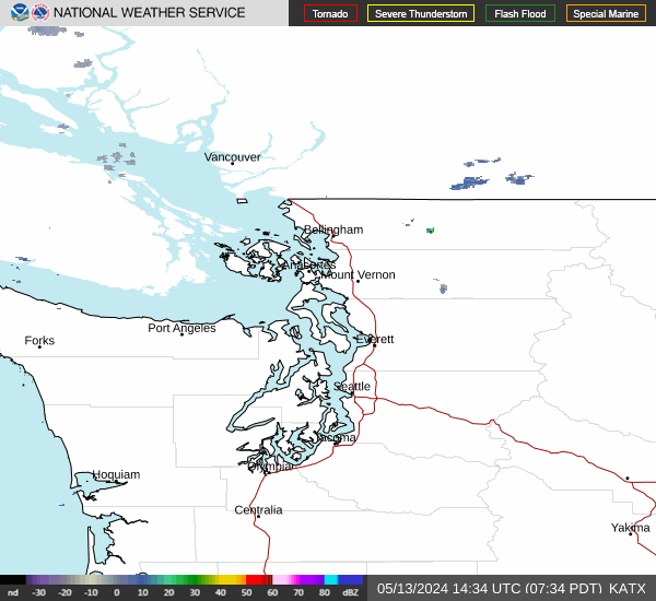
Current Radar Image
Sun Almanac for Wenatchee, Washington
Sunrise: 07:44 AM
Sunset: 4:11 PM
Civil Sunrise:07:08 AM
Civil Sunset: 4:47 PM
Nautical Sunrise: 06:29 AM
Nautical Sunset: 5:26 PM
Astro Sunrise: 05:51 AM
Astro Sunset: 6:04 PM
Washington's Current Temperatures
 Washington's Satellite Image
 Washington's Current Wind Direction
| National Summary |
of upper and lower values of current conditions amongst 6941 locations
in the contiguous United States |
|
High
Temp |
77° |
Keathley C 875, Louisiana
|
|
Low
Temp |
1° |
International Falls, Minnesota
and 1 other location
|
|
Wind
Speed |
48mph |
Pendleton, Oregon
|
|
Wind
Gust |
73mph |
Pendleton, Oregon
|
|
Wind
Chill |
-4° |
Robertson Field, North Dakota
|
|
High
Pressure |
30.34Hg |
Salida Mountain, Colorado
and 1 other location
|
|
Low
Pressure |
29.08Hg |
Omak, Washington
|
|
| # Locations Reporting Snow |
2 |
|
| # Locations Reporting Rain |
75 |
|
| # Locations Reporting Fog |
39 |
|
| Average Temperature in the Contiguous USA |
39° |
|
Any use of the information on this page is at your own risk. This information should not be relied upon in life-threatening situations, potential financial loss situations or in lieu of any officially disseminated information. Visit the
National Weather Service for official information.