Smithfield, North Carolina Weather
Issued: 3:10 pm EDT May 4, 2024 Latitude: 35.5084935 Longitude: -78.3394455 View on Google Maps
|
|
|
|
|
|
|
|
|
|
|
 |
 |
|
 |
 |
 |
 |
 |
 |
| High: °F |
Low: °F |
High: °F |
High: °F |
High: °F |
High: °F |
High: °F |
High: °F |
High: °F |
| Low: °F |
Low: °F |
Low: °F |
Low: °F |
Low: °F |
Low: °F |
|
| Thunderstorms |
Thunderstorms |
Thunderstorms |
Thunderstorms |
Thunderstorms |
Sunny |
Thunderstorms |
Thunderstorms |
Mostly Sunny |
Current Conditions at
SMITHFIELD - (KJNX)
84°
Mostly Cloudy
as of 4:30 PM EDST
Rel. Humidity: 48%
Dew Point: 63°F
Visibility: 10 Miles
Pressure: 30.05 in.
Flight Rule: VFR
Cloud Level(s): Broken at 5000ft
Current Conditions at
GOLDSBORO-WAYNE - (KGWW)
81°
Cloudy
as of 4:30 PM EDST
Rel. Humidity: 61%
Dew Point: 66°F
Visibility: 10 Miles
Pressure: 30.06 in.
Flight Rule: VFR
Cloud Level(s): Scattered at 4600ft, Broken at 5000ft, Solid Overcast at 8000ft
Current Conditions at
SEY JOHNSON AFB - (KGSB)
84°
Mostly Cloudy
as of 3:55 PM EDST
Rel. Humidity: 45%
Dew Point: 61°F
Visibility: 10 Miles
Pressure: 30.04 in.
Flight Rule: VFR
Wind Data
12 MPH
Gust: 20 MPH
180° South
Cloud Level(s): Broken at 5000ft
Current Conditions at
ERWIN-HARNETT COUNTY - (KHRJ)
79°
Cloudy
as of 4:30 PM EDST
Rel. Humidity: 65%
Dew Point: 66°F
Visibility: 10 Miles
Pressure: 30.08 in.
Flight Rule: VFR
Wind Data
10 MPH
180° South
Cloud Level(s): Scattered at 3400ft, Broken at 4600ft, Solid Overcast at 10000ft
|
This Afternoon... A chance of showers and thunderstorms. Mostly cloudy, with a high near 82. South wind around 7 mph. Chance of precipitation is 50%. New rainfall amounts between a tenth and quarter of an inch, except higher amounts possible in thunderstorms. |
|
|
Tonight... Showers and thunderstorms likely before 2am, then a slight chance of showers and thunderstorms after 3am. Mostly cloudy, with a low around 66. South wind around 6 mph. Chance of precipitation is 60%. New rainfall amounts between a tenth and quarter of an inch, except higher amounts possible in thunderstorms. |
|
|
Sunday... A chance of showers, with thunderstorms also possible after 11am. Mostly cloudy, with a high near 79. South wind 5 to 10 mph. Chance of precipitation is 50%. New rainfall amounts between a tenth and quarter of an inch, except higher amounts possible in thunderstorms. |
|
 |
Sunday Night... A chance of showers and thunderstorms before 11pm, then a slight chance of showers. Mostly cloudy, with a low around 65. South wind around 7 mph. Chance of precipitation is 30%. New precipitation amounts of less than a tenth of an inch, except higher amounts possible in thunderstorms. |
|
|
Monday... A chance of showers before 11am, then a chance of showers and thunderstorms between 11am and 2pm, then showers likely and possibly a thunderstorm after 2pm. Mostly cloudy, with a high near 83. Southwest wind 7 to 10 mph. Chance of precipitation is 60%. New rainfall amounts between a tenth and quarter of an inch, except higher amounts possible in thunderstorms. |
|
|
Monday Night... Showers likely and possibly a thunderstorm before 8pm, then a chance of showers and thunderstorms, mainly between 8pm and 2am. Mostly cloudy, with a low around 66. Chance of precipitation is 60%. New rainfall amounts between a tenth and quarter of an inch, except higher amounts possible in thunderstorms. |
|
|
Tuesday... A chance of showers and thunderstorms after noon. Partly sunny, with a high near 87. Chance of precipitation is 40%. |
|
 |
Tuesday Night... Mostly clear, with a low around 68. |
|
|
Wednesday... Sunny, with a high near 93. |
|
 |
Wednesday Night... Partly cloudy, with a low around 71. |
|
|
Thursday... A chance of showers and thunderstorms. Mostly sunny, with a high near 93. Breezy. Chance of precipitation is 40%. |
|
 |
Thursday Night... A chance of showers and thunderstorms. Mostly cloudy, with a low around 68. Chance of precipitation is 40%. |
|
|
Friday... Showers likely and possibly a thunderstorm. Partly sunny, with a high near 86. Chance of precipitation is 60%. |
|
 |
Friday Night... Showers and thunderstorms likely. Partly cloudy, with a low around 59. Chance of precipitation is 60%. |
|
|
Saturday... Mostly sunny, with a high near 78. |
|
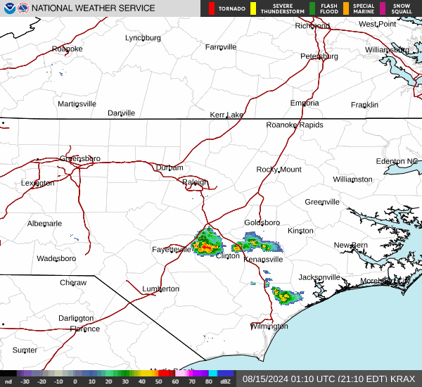
Current Radar Image
Sun Almanac for Smithfield, North Carolina
Sunrise: 06:18 AM
Sunset: 8:02 PM
Civil Sunrise:05:50 AM
Civil Sunset: 8:30 PM
Nautical Sunrise: 05:17 AM
Nautical Sunset: 9:03 PM
Astro Sunrise: 04:42 AM
Astro Sunset: 9:39 PM
North Carolina's Current Temperatures
 North Carolina's Satellite Image
 North Carolina's Current Wind Direction
| National Summary |
of upper and lower values of current conditions amongst 7007 locations
in the contiguous United States |
|
High
Temp |
93° |
Gila Bend (Aaf), Arizona
and 1 other location
|
|
Low
Temp |
32° |
Oakland, Michigan
|
|
Wind
Speed |
36mph |
Reno, Nevada
and 1 other location
|
|
Wind
Gust |
52mph |
Reno, Nevada
|
|
Wind
Chill |
24° |
South Lake Tahoe, California
and 1 other location
|
|
Heat
Index |
109° |
Ft Rucker/Hanche, Alabama
|
|
High
Pressure |
30.41Hg |
Wiscasset, Maine
|
|
Low
Pressure |
29.44Hg |
Hermiston, Oregon
|
|
| # Locations Reporting Snow |
5 |
|
| # Locations Reporting Rain |
193 |
|
| # Locations Reporting Thunderstorms / Lightning |
24 |
|
| # Locations Reporting Fog |
6 |
|
| Average Temperature in the Contiguous USA |
68° |
|
Any use of the information on this page is at your own risk. This information should not be relied upon in life-threatening situations, potential financial loss situations or in lieu of any officially disseminated information. Visit the
National Weather Service for official information.