Shelton, Washington Weather
No Watches or Warnings for Shelton
Issued: 1:25 pm PST Jan 12, 2026 Latitude: 47.2150945 Longitude: -123.1007066 View on Google Maps
|
|
|
|
|
|
|
|
|
|
|
 |
 |
 |
|
 |
 |
|
|
|
| High: °F |
Low: °F |
High: °F |
High: °F |
High: °F |
High: °F |
High: °F |
High: °F |
High: °F |
| Low: °F |
Low: °F |
Low: °F |
Low: °F |
Low: °F |
Low: °F |
|
| Rain |
Rain |
Patchy Fog |
Morning Fog |
Partly Sunny |
Sunny |
Sunny |
Sunny |
Partly Sunny |
Current Conditions at
SHELTON - (KSHN)
54°
Cloudy
Mist
as of 3:01 PM PST
Rel. Humidity: 93%
Dew Point: 52°F
Visibility: 3 Miles
Pressure: 30.29 in.
Flight Rule: MVFR
Wind Data
8 MPH
220° Southwest
Cloud Level(s): Few at 600ft, Broken at 3500ft, Solid Overcast at 4600ft
Current Conditions at
OLYMPIA - (KOLM)
54°
Cloudy
Light Rain
as of 2:54 PM PST
Rel. Humidity: 76%
Dew Point: 46°F
Visibility: 10 Miles
Pressure: 30.32 in.
Flight Rule: MVFR
Cloud Level(s): Solid Overcast at 2200ft
Current Conditions at
BREMERTON - (KPWT)
Cloudy
as of 2:56 PM PST
Rel. Humidity: 100%
Dew Point: 50°F
Visibility: 10 Miles
Pressure: 30.30 in.
Flight Rule: LIFR
Wind Data
10 MPH
200° South
Cloud Level(s): Solid Overcast at 300ft
Current Conditions at
TACOMA - (KTIW)
52°
Cloudy
as of 2:53 PM PST
Rel. Humidity: 81%
Dew Point: 46°F
Visibility: 10 Miles
Pressure: 30.32 in.
Flight Rule: MVFR
Wind Data
5 MPH
240° Southwest
Cloud Level(s): Solid Overcast at 2200ft
|
This Afternoon... A 40 percent chance of rain. Mostly cloudy, with a high near 50. Southwest wind around 9 mph. |
|
|
Tonight... A 30 percent chance of rain, mainly before 7pm. Mostly cloudy, with a steady temperature around 48. Southwest wind around 5 mph becoming calm in the evening. |
|
|
Tuesday... Patchy fog before 1pm, then patchy fog after 4pm. Otherwise, mostly cloudy, with a high near 55. Calm wind. |
|
 |
Tuesday Night... Patchy dense fog. Otherwise, mostly cloudy, with a low around 42. Calm wind. |
|
|
Wednesday... Patchy fog before 10am. Otherwise, mostly cloudy, with a high near 50. Calm wind. |
|
 |
Wednesday Night... Mostly cloudy, with a low around 41. |
|
|
Thursday... Partly sunny, with a high near 50. |
|
 |
Thursday Night... Mostly clear, with a low around 37. |
|
|
Friday... Sunny, with a high near 52. |
|
|
Friday Night... Mostly clear, with a low around 35. |
|
|
Saturday... Sunny, with a high near 51. |
|
|
Saturday Night... Mostly clear, with a low around 34. |
|
|
Sunday... Sunny, with a high near 50. |
|
|
Sunday Night... Patchy fog. Otherwise, partly cloudy, with a low around 34. |
|
|
M.L.King Day... Partly sunny, with a high near 49. |
|
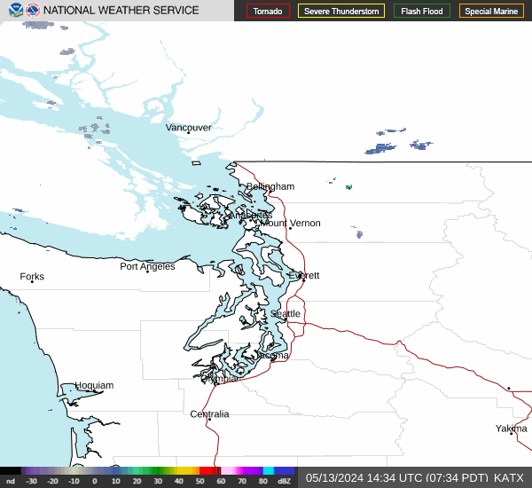
Current Radar Image
Sun Almanac for Shelton, Washington
Sunrise: 07:56 AM
Sunset: 4:46 PM
Civil Sunrise:07:21 AM
Civil Sunset: 5:20 PM
Nautical Sunrise: 06:43 AM
Nautical Sunset: 5:59 PM
Astro Sunrise: 06:06 AM
Astro Sunset: 6:35 PM
Washington's Current Temperatures
 Washington's Satellite Image
 Washington's Current Wind Direction
| National Summary |
of upper and lower values of current conditions amongst 7017 locations
in the contiguous United States |
|
High
Temp |
79° |
Santa Ana, California
|
|
Low
Temp |
12° |
Frenchville, Maine
|
|
Wind
Speed |
37mph |
Lewistown, Montana
|
|
Wind
Gust |
52mph |
Lewistown, Montana
|
|
Wind
Chill |
6° |
Berthoud Pass, Colorado
|
|
High
Pressure |
30.61Hg |
Salida Mountain, Colorado
|
|
Low
Pressure |
29.64Hg |
Rolla Municipal A/P, North Dakota
|
|
| # Locations Reporting Snow |
6 |
|
| # Locations Reporting Rain |
11 |
|
| # Locations Reporting Fog |
1 |
|
| Average Temperature in the Contiguous USA |
46° |
|
Any use of the information on this page is at your own risk. This information should not be relied upon in life-threatening situations, potential financial loss situations or in lieu of any officially disseminated information. Visit the
National Weather Service for official information.