Salisbury, North Carolina Weather
No Watches or Warnings for Salisbury
Issued: 3:37 am EDT May 3, 2024 Latitude: 35.6709727 Longitude: -80.4742261 View on Google Maps
|
|
|
|
|
|
|
|
|
|
 |
 |
 |
 |
 |
 |
 |
|
| High: °F |
Low: °F |
High: °F |
High: °F |
High: °F |
High: °F |
High: °F |
High: °F |
| Low: °F |
Low: °F |
Low: °F |
Low: °F |
Low: °F |
|
| Partly Sunny |
Thunderstorms |
Thunderstorms |
Thunderstorms |
Thunderstorms |
Thunderstorms |
Mostly Sunny |
Thunderstorms |
Current Conditions at
SALISBURY - (KRUQ)
59°
Clear
as of 5:05 AM EDST
Rel. Humidity: 93%
Dew Point: 57°F
Visibility: 10 Miles
Pressure: 30.00 in.
Flight Rule: VFR
Cloud Level(s): Clear
Current Conditions at
LEXINGTON - (KEXX)
61°
Clear
as of 5:05 AM EDST
Rel. Humidity: 100%
Dew Point: 61°F
Visibility: 10 Miles
Pressure: 30.00 in.
Flight Rule: VFR
Cloud Level(s): Clear
Current Conditions at
CONCORD RGNL AP - (KJQF)
66°
Clear
as of 5:10 AM EDST
Rel. Humidity: 88%
Dew Point: 63°F
Visibility: 10 Miles
Pressure: 30.03 in.
Flight Rule: VFR
Cloud Level(s): Clear
Current Conditions at
ASHEBORO - (KHBI)
66°
Clear
as of 5:05 AM EDST
Rel. Humidity: 88%
Dew Point: 63°F
Visibility: 10 Miles
Pressure: 30.02 in.
Flight Rule: VFR
Cloud Level(s): Clear
|
Today... Partly sunny, with a high near 86. Calm wind becoming south southwest 5 to 7 mph in the morning. |
|
|
Tonight... A chance of showers and thunderstorms. Mostly cloudy, with a low around 64. Light south southeast wind. Chance of precipitation is 30%. New precipitation amounts of less than a tenth of an inch, except higher amounts possible in thunderstorms. |
|
|
Saturday... A chance of showers and thunderstorms, then showers likely and possibly a thunderstorm after noon. Patchy fog between 7am and 8am. Otherwise, mostly cloudy, with a high near 76. East southeast wind 5 to 8 mph. Chance of precipitation is 70%. New rainfall amounts between a quarter and half of an inch possible. |
|
 |
Saturday Night... Showers and possibly a thunderstorm. Low around 64. South southeast wind 6 to 8 mph. Chance of precipitation is 80%. New rainfall amounts between a quarter and half of an inch possible. |
|
|
Sunday... Showers and thunderstorms likely, then showers and possibly a thunderstorm after 2pm. High near 79. South southwest wind 7 to 9 mph. Chance of precipitation is 80%. |
|
 |
Sunday Night... Showers and thunderstorms likely before 5am, then a slight chance of showers. Mostly cloudy, with a low around 64. Chance of precipitation is 60%. |
|
|
Monday... A chance of showers before 2pm, then a chance of showers and thunderstorms between 2pm and 5pm, then showers likely and possibly a thunderstorm after 5pm. Mostly cloudy, with a high near 81. Chance of precipitation is 60%. |
|
|
Monday Night... A 30 percent chance of showers and thunderstorms before 11pm. Mostly cloudy, with a low around 63. |
|
|
Tuesday... A 30 percent chance of showers and thunderstorms after 4pm. Partly sunny, with a high near 85. |
|
 |
Tuesday Night... Partly cloudy, with a low around 65. |
|
|
Wednesday... Mostly sunny, with a high near 89. |
|
|
Wednesday Night... Partly cloudy, with a low around 67. |
|
|
Thursday... A 30 percent chance of showers and thunderstorms. Partly sunny, with a high near 88. |
|
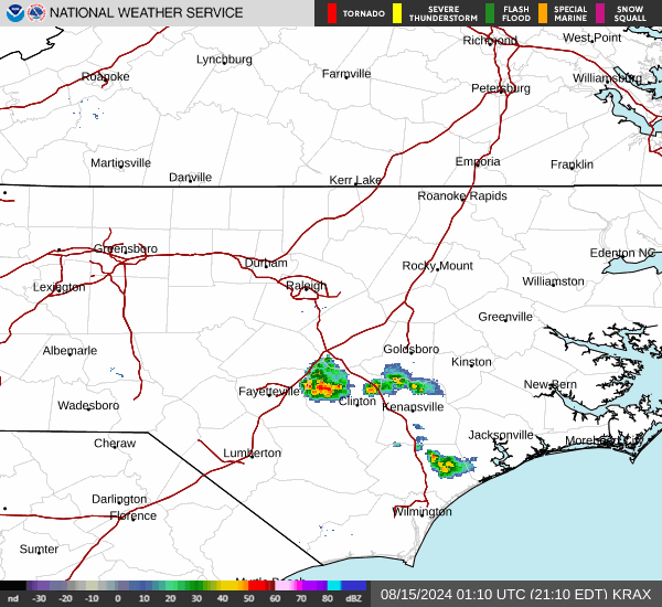
Current Radar Image
Sun Almanac for Salisbury, North Carolina
Sunrise: 06:27 AM
Sunset: 8:10 PM
Civil Sunrise:05:59 AM
Civil Sunset: 8:38 PM
Nautical Sunrise: 05:26 AM
Nautical Sunset: 9:11 PM
Astro Sunrise: 04:51 AM
Astro Sunset: 9:46 PM
North Carolina's Current Temperatures
 North Carolina's Satellite Image
 North Carolina's Current Wind Direction
| National Summary |
of upper and lower values of current conditions amongst 6887 locations
in the contiguous United States |
|
High
Temp |
81° |
Key West NAS, Florida
and 6 other locations
|
|
Low
Temp |
30° |
Pinedale, Wyoming
and 23 other locations
|
|
Wind
Speed |
29mph |
Laramie, Wyoming
and 1 other location
|
|
Wind
Gust |
37mph |
Laramie, Wyoming
|
|
Wind
Chill |
17° |
Foxtrot, Montana
and 1 other location
|
|
High
Pressure |
30.22Hg |
Salida Mountain, Colorado
|
|
Low
Pressure |
29.56Hg |
Warroad, Minnesota
and 1 other location
|
|
| # Locations Reporting Snow |
12 |
|
| # Locations Reporting Rain |
128 |
|
| # Locations Reporting Thunderstorms / Lightning |
7 |
|
| # Locations Reporting Fog |
63 |
|
| Average Temperature in the Contiguous USA |
56° |
|
Any use of the information on this page is at your own risk. This information should not be relied upon in life-threatening situations, potential financial loss situations or in lieu of any officially disseminated information. Visit the
National Weather Service for official information.