Rochester, New Hampshire Weather
Issued: 1:01 am EST Dec 7, 2025 Latitude: 43.3045261 Longitude: -70.9756186 View on Google Maps
|
|
|
|
|
|
|
|
|
|
 |
 |
 |
 |
 |
 |
|
|
| High: °F |
Low: °F |
High: °F |
High: °F |
High: °F |
High: °F |
High: °F |
High: °F |
| Low: °F |
Low: °F |
Low: °F |
Low: °F |
Low: °F |
|
| Increasing Clouds |
Snow |
Sunny |
Mostly Sunny |
Rain & Snow |
Partly Sunny |
Snow |
Mostly Sunny |
Current Conditions at
PORTSMOUTH - (KPSM)
27°
Mostly Cloudy
as of 3:55 AM EST
Rel. Humidity: 86%
Dew Point: 23°F
Visibility: 10 Miles
Pressure: 29.96 in.
Flight Rule: VFR
Cloud Level(s): Few at 4000ft, Broken at 21000ft
Current Conditions at
CONCORD - (KCON)
18°
Clear
as of 3:51 AM EST
Rel. Humidity: 92%
Dew Point: 16°F
Visibility: 10 Miles
Pressure: 29.97 in.
Flight Rule: VFR
Cloud Level(s): Clear
Current Conditions at
LACONIA - (KLCI)
21°
Clear
as of 3:56 AM EST
Rel. Humidity: 92%
Dew Point: 19°F
Visibility: 10 Miles
Pressure: 29.95 in.
Flight Rule: VFR
Cloud Level(s): Clear
|
Today... Increasing clouds, with a high near 34. West wind around 5 mph becoming calm in the morning. |
|
|
Tonight... A 30 percent chance of snow, mainly before 11pm. Cloudy, then gradually becoming partly cloudy, with a low around 14. Light and variable wind becoming northwest 5 to 10 mph after midnight. Winds could gust as high as 20 mph. |
|
|
Monday... Sunny, with a high near 22. Northwest wind 10 to 15 mph, with gusts as high as 25 mph. |
|
 |
Monday Night... Mostly clear, with a low around 3. West wind around 5 mph. |
|
|
Tuesday... Mostly sunny, with a high near 28. West wind around 5 mph becoming south in the afternoon. |
|
|
Tuesday Night... A chance of snow between 9pm and 1am. Mostly cloudy, with a low around 19. Chance of precipitation is 30%. |
|
|
Wednesday... A chance of rain and snow between 11am and 2pm, then rain likely. Mostly cloudy, with a high near 38. Chance of precipitation is 60%. |
|
 |
Wednesday Night... Rain likely, mainly before 7pm. Mostly cloudy, with a low around 27. Chance of precipitation is 60%. |
|
|
Thursday... Partly sunny, with a high near 37. |
|
 |
Thursday Night... Mostly cloudy, with a low around 19. |
|
|
Friday... A 30 percent chance of snow showers. Partly sunny, with a high near 32. |
|
|
Friday Night... A 30 percent chance of snow showers. Mostly cloudy, with a low around 16. |
|
|
Saturday... Mostly sunny, with a high near 27. |
|
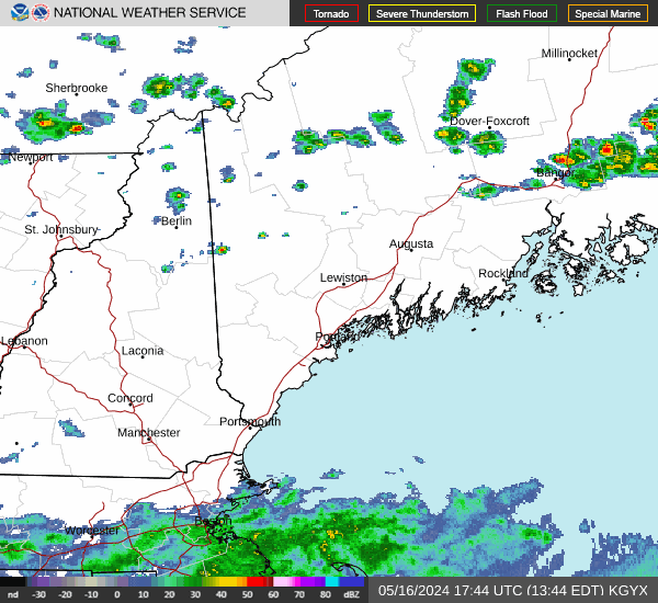
Current Radar Image
Sun Almanac for Rochester, New Hampshire
Sunrise: 07:03 AM
Sunset: 4:08 PM
Civil Sunrise:06:31 AM
Civil Sunset: 4:40 PM
Nautical Sunrise: 05:55 AM
Nautical Sunset: 5:16 PM
Astro Sunrise: 05:20 AM
Astro Sunset: 5:51 PM
New Hampshire's Current Temperatures
 New Hampshire's Satellite Image
 New Hampshire's Current Wind Direction
| National Summary |
of upper and lower values of current conditions amongst 7082 locations
in the contiguous United States |
|
High
Temp |
79° |
Key West Intl, Florida
and 1 other location
|
|
Low
Temp |
-18° |
Bismarck, North Dakota
|
|
Wind
Speed |
28mph |
Cutbank, Montana
|
|
Wind
Gust |
40mph |
Cutbank, Montana
|
|
Wind
Chill |
-27° |
Duluth Intl, Minnesota
and 2 other locations
|
|
High
Pressure |
30.32Hg |
Hutson Field, North Dakota
and 1 other location
|
|
Low
Pressure |
29.77Hg |
Cleburne, Texas
|
|
| # Locations Reporting Snow |
108 |
|
| # Locations Reporting Rain |
47 |
|
| # Locations Reporting Thunderstorms / Lightning |
1 |
|
| # Locations Reporting Fog |
167 |
|
| Average Temperature in the Contiguous USA |
34° |
|
Any use of the information on this page is at your own risk. This information should not be relied upon in life-threatening situations, potential financial loss situations or in lieu of any officially disseminated information. Visit the
National Weather Service for official information.