No Watches or Warnings for Naples
Issued: 11:21 pm EDT Aug 10, 2025 Latitude: 26.1420358 Longitude: -81.7948103 View on Google Maps
|
|
|
|
|
|
|
|
|
|
 |
 |
 |
 |
|
 |
|
 |
| Low: °F |
High: °F |
High: °F |
High: °F |
High: °F |
High: °F |
High: °F |
High: °F |
| Low: °F |
Low: °F |
Low: °F |
Low: °F |
Low: °F |
Low: °F |
|
| Thunderstorms |
Thunderstorms |
Thunderstorms |
Thunderstorms |
Thunderstorms |
Thunderstorms |
Thunderstorms |
Thunderstorms |
Current Conditions at
NAPLES - (KAPF)
79°
Mostly Clear
as of 10:53 PM EDST
Rel. Humidity: 78%
Dew Point: 72°F
Visibility: 10 Miles
Pressure: 30.04 in.
Flight Rule: VFR
Wind Data
7 MPH
130° Southeast
Cloud Level(s): Few at 2500ft
Current Conditions at
FT MYERS SW APT - (KRSW)
79°
Mostly Clear
as of 10:53 PM EDST
Rel. Humidity: 94%
Dew Point: 77°F
Visibility: 10 Miles
Pressure: 30.04 in.
Flight Rule: VFR
Wind Data
8 MPH
150° Southeast
Cloud Level(s): Few at 2900ft
Current Conditions at
HOMESTEAD AFB - (KHST)
81°
Clear
as of 10:55 PM EDST
Rel. Humidity: 83%
Dew Point: 75°F
Visibility: 10 Miles
Pressure: 30.06 in.
Flight Rule: VFR
Cloud Level(s): Clear
|
Tonight... A 40 percent chance of showers and thunderstorms, mainly before 1am. Partly cloudy, with a low around 75. Southeast wind around 6 mph. |
|
|
Monday... A chance of showers and thunderstorms before noon, then showers likely and possibly a thunderstorm between noon and 2pm, then showers and thunderstorms likely after 2pm. Increasing clouds, with a high near 91. Heat index values as high as 103. South wind 7 to 11 mph. Chance of precipitation is 70%. New rainfall amounts between a tenth and quarter of an inch, except higher amounts possible in thunderstorms. |
|
 |
Monday Night... Showers and thunderstorms likely, mainly before 8pm. Mostly clear, with a low around 76. Southeast wind around 6 mph becoming east after midnight. Chance of precipitation is 60%. New rainfall amounts of less than a tenth of an inch, except higher amounts possible in thunderstorms. |
|
|
Tuesday... Showers and thunderstorms, mainly after 2pm. High near 92. Heat index values as high as 103. East wind 7 to 9 mph becoming south in the afternoon. Chance of precipitation is 80%. |
|
 |
Tuesday Night... Showers and thunderstorms, mainly before 8pm. Low around 77. Light east wind. Chance of precipitation is 80%. |
|
|
Wednesday... Showers and thunderstorms likely, mainly after 2pm. Mostly sunny, with a high near 92. East wind 5 to 7 mph becoming southwest in the afternoon. Chance of precipitation is 60%. |
|
 |
Wednesday Night... Showers and thunderstorms likely, mainly before 8pm. Mostly cloudy, with a low around 78. Light and variable wind. Chance of precipitation is 60%. |
|
|
Thursday... Showers and thunderstorms likely, mainly after 2pm. Mostly sunny, with a high near 92. Light and variable wind becoming southwest around 6 mph in the morning. Chance of precipitation is 60%. |
|
 |
Thursday Night... Showers and thunderstorms likely, mainly before 8pm. Partly cloudy, with a low around 78. Light and variable wind. Chance of precipitation is 60%. |
|
|
Friday... A 50 percent chance of showers and thunderstorms, mainly after 2pm. Sunny, with a high near 93. |
|
 |
Friday Night... A 30 percent chance of showers and thunderstorms. Partly cloudy, with a low around 78. |
|
|
Saturday... Showers and thunderstorms likely. Mostly sunny, with a high near 92. Chance of precipitation is 60%. |
|
|
Saturday Night... Showers and thunderstorms likely. Partly cloudy, with a low around 77. Chance of precipitation is 60%. |
|
|
Sunday... Showers and thunderstorms likely. Sunny, with a high near 92. Chance of precipitation is 60%. |
|
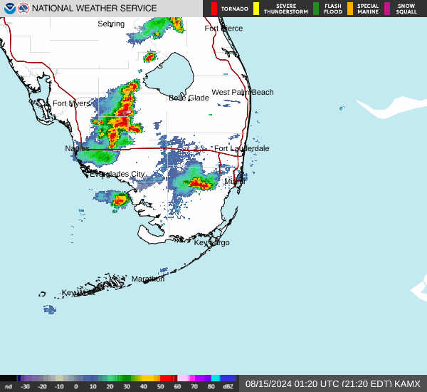
Current Radar Image
Sun Almanac for Naples, Florida
Sunrise: 06:58 AM
Sunset: 8:07 PM
Civil Sunrise:06:33 AM
Civil Sunset: 8:32 PM
Nautical Sunrise: 06:04 AM
Nautical Sunset: 9:01 PM
Astro Sunrise: 05:35 AM
Astro Sunset: 9:30 PM
Florida's Current Temperatures
 Florida's Satellite Image
 Florida's Current Wind Direction
| National Summary |
of upper and lower values of current conditions amongst 6884 locations
in the contiguous United States |
|
High
Temp |
109° |
Needles, California
|
|
Low
Temp |
41° |
Berthoud Pass, Colorado
|
|
Wind
Speed |
29mph |
Amarillo, Texas
|
|
Wind
Gust |
52mph |
Amarillo, Texas
|
|
Wind
Chill |
33° |
Berthoud Pass, Colorado
|
|
Heat
Index |
111° |
Needles, California
|
|
High
Pressure |
30.69Hg |
Salida Mountain, Colorado
|
|
Low
Pressure |
29.71Hg |
Thermal, California
|
|
| # Locations Reporting Rain |
52 |
|
| # Locations Reporting Thunderstorms / Lightning |
28 |
|
| Average Temperature in the Contiguous USA |
75° |
|
Any use of the information on this page is at your own risk. This information should not be relied upon in life-threatening situations, potential financial loss situations or in lieu of any officially disseminated information. Visit the
National Weather Service for official information.