Keene, New Hampshire Weather
Issued: 8:28 pm EST Jan 25, 2026 Latitude: 42.933692 Longitude: -72.2781409 View on Google Maps
|
|
|
|
|
|
|
|
|
|
 |
 |
 |
 |
 |
|
|
 |
| Low: °F |
High: °F |
High: °F |
High: °F |
High: °F |
High: °F |
High: °F |
High: °F |
| Low: °F |
Low: °F |
Low: °F |
Low: °F |
Low: °F |
Low: °F |
|
| Snow |
Snow |
Increasing Clouds |
Mostly Sunny |
Partly Sunny |
Mostly Sunny |
Mostly Sunny |
Sunny |
Current Conditions at
KEENE - (KEEN)
Cloudy
Light Snow Mist
as of 10:56 PM EST
Rel. Humidity: 84%
Dew Point: 7°F
Visibility: 1 3/4 Miles
Pressure: 29.98 in.
Flight Rule: IFR
Wind Data
17 MPH
020° North
Cloud Level(s): Solid Overcast at 1200ft
Current Conditions at
JAFFREY - (KAFN)
7°
Clear
Light Snow
as of 10:52 PM EST
Rel. Humidity: 77%
Dew Point: 1°F
Visibility: 3/4 Miles
Pressure: 29.91 in.
Flight Rule: MVFR
Current Conditions at
ORANGE - (KORE)
10°
Cloudy
Light Snow Mist
as of 10:52 PM EST
Rel. Humidity: 84%
Dew Point: 7°F
Visibility: 1 1/4 Miles
Pressure: 29.95 in.
Flight Rule: IFR
Cloud Level(s): Solid Overcast at 1100ft
Current Conditions at
SPRINGFIELD - (KVSF)
3°
Cloudy
Light Snow Mist
as of 10:54 PM EST
Rel. Humidity: 84%
Dew Point: -0°F
Visibility: 3/4 Miles
Pressure: 30.04 in.
Flight Rule: MVFR
|
Tonight... Snow. The snow could be heavy at times. Low around 9. North wind around 5 mph. Chance of precipitation is 100%. Total nighttime snow accumulation of 5 to 9 inches possible. |
|
|
Monday... Snow. High near 24. North wind around 5 mph becoming calm. Chance of precipitation is 80%. New snow accumulation of 1 to 2 inches possible. |
|
 |
Monday Night... A 40 percent chance of snow, mainly before 9pm. Cloudy during the early evening, then gradual clearing, with a low around 4. Wind chill values as low as -4. Northwest wind around 5 mph. |
|
|
Tuesday... Increasing clouds, with a high near 20. Wind chill values as low as -2. Calm wind becoming west around 5 mph. |
|
 |
Tuesday Night... Partly cloudy, with a low around -2. Calm wind. |
|
|
Wednesday... Mostly sunny, with a high near 20. |
|
 |
Wednesday Night... Mostly cloudy, with a low around 0. |
|
|
Thursday... Partly sunny, with a high near 19. |
|
|
Thursday Night... Partly cloudy, with a low around -5. |
|
|
Friday... Mostly sunny, with a high near 16. |
|
|
Friday Night... Partly cloudy, with a low around -1. |
|
|
Saturday... Mostly sunny, with a high near 22. |
|
 |
Saturday Night... Mostly clear, with a low around 1. |
|
|
Sunday... Sunny, with a high near 27. |
|
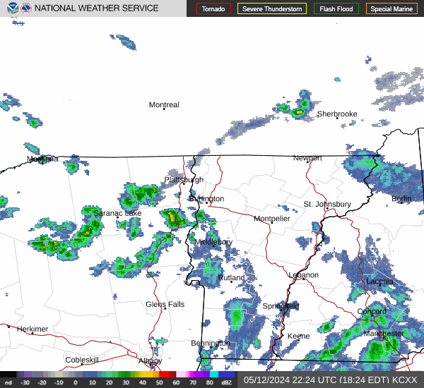
Current Radar Image
Sun Almanac for Keene, New Hampshire
Sunrise: 07:10 AM
Sunset: 4:52 PM
Civil Sunrise:06:40 AM
Civil Sunset: 5:23 PM
Nautical Sunrise: 06:05 AM
Nautical Sunset: 5:57 PM
Astro Sunrise: 05:32 AM
Astro Sunset: 6:31 PM
New Hampshire's Current Temperatures
 New Hampshire's Satellite Image
 New Hampshire's Current Wind Direction
| National Summary |
of upper and lower values of current conditions amongst 6761 locations
in the contiguous United States |
|
High
Temp |
75° |
Homestead AFB, Florida
and 9 other locations
|
|
Low
Temp |
-24° |
Park Rapids, Minnesota
and 2 other locations
|
|
Wind
Speed |
43mph |
Big Timber, Montana
|
|
Wind
Gust |
53mph |
Big Timber, Montana
|
|
Wind
Chill |
-51° |
Berthoud Pass, Colorado
|
|
High
Pressure |
30.48Hg |
Kickapoo Downtown A/P, Texas
and 2 other locations
|
|
Low
Pressure |
29.60Hg |
Johnstown, Pennsylvania
and 1 other location
|
|
| # Locations Reporting Snow |
234 |
|
| # Locations Reporting Rain |
70 |
|
| # Locations Reporting Fog |
18 |
|
| Average Temperature in the Contiguous USA |
20° |
|
Any use of the information on this page is at your own risk. This information should not be relied upon in life-threatening situations, potential financial loss situations or in lieu of any officially disseminated information. Visit the
National Weather Service for official information.