Fort Wayne, Indiana Weather
No Watches or Warnings for Fort Wayne
Issued: 12:17 am EST Jan 3, 2026 Latitude: 41.1306041 Longitude: -85.1288597 View on Google Maps
|
|
|
|
|
|
|
|
|
|
 |
 |
 |
 |
 |
|
 |
|
| Low: °F |
High: °F |
High: °F |
High: °F |
High: °F |
High: °F |
High: °F |
High: °F |
| Low: °F |
Low: °F |
Low: °F |
Low: °F |
Low: °F |
Low: °F |
|
| Mostly Cloudy |
Mostly Cloudy |
Partly Sunny |
Mostly Sunny |
Rain |
Partly Sunny |
Rain |
Rain |
Current Conditions at
FORT WAYNE - (KFWA)
18°
Cloudy
as of 12:54 AM EST
Rel. Humidity: 85%
Dew Point: 14°F
Visibility: 10 Miles
Pressure: 29.99 in.
Flight Rule: VFR
Cloud Level(s): Broken at 18000ft, Solid Overcast at 25000ft
Current Conditions at
WARSAW - (KASW)
19°
Clear
as of 12:55 AM EST
Rel. Humidity: 79%
Dew Point: 14°F
Visibility: 10 Miles
Pressure: 30.00 in.
Flight Rule: VFR
Cloud Level(s): Clear
Current Conditions at
DEFIANCE - (KDFI)
19°
Clear
as of 12:53 AM EST
Rel. Humidity: 73%
Dew Point: 12°F
Visibility: 10 Miles
Pressure: 29.99 in.
Flight Rule: VFR
Wind Data
3 MPH
240° Southwest
Cloud Level(s): Clear
Current Conditions at
GOSHEN - (KGSH)
18°
Clear
as of 12:53 AM EST
Rel. Humidity: 78%
Dew Point: 12°F
Visibility: 10 Miles
Pressure: 29.98 in.
Flight Rule: VFR
Cloud Level(s): Clear
|
Overnight... Mostly cloudy, with a low around 16. Calm wind. |
|
|
Saturday... Mostly cloudy, with a high near 30. Calm wind becoming northwest around 5 mph in the afternoon. |
|
|
Saturday Night... Mostly cloudy, with a low around 17. West wind around 5 mph. |
|
|
Sunday... Partly sunny, with a high near 30. Calm wind becoming west around 5 mph. |
|
|
Sunday Night... Mostly cloudy, with a low around 21. Calm wind becoming south around 5 mph after midnight. |
|
|
Monday... Mostly sunny, with a high near 38. |
|
|
Monday Night... Mostly cloudy, with a low around 30. |
|
|
Tuesday... A 20 percent chance of rain. Mostly cloudy, with a high near 45. |
|
|
Tuesday Night... Mostly cloudy, with a low around 32. |
|
|
Wednesday... Partly sunny, with a high near 45. |
|
|
Wednesday Night... Mostly cloudy, with a low around 34. |
|
|
Thursday... A 40 percent chance of rain. Mostly cloudy, with a high near 52. |
|
 |
Thursday Night... Rain likely. Mostly cloudy, with a low around 42. |
|
|
Friday... A chance of rain. Mostly cloudy, with a high near 54. |
|
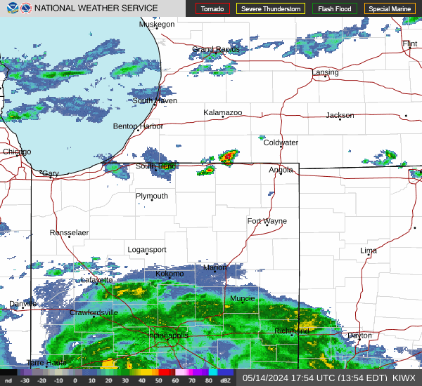
Current Radar Image
Sun Almanac for Fort Wayne, Indiana
Sunrise: 08:06 AM
Sunset: 5:24 PM
Civil Sunrise:07:35 AM
Civil Sunset: 5:55 PM
Nautical Sunrise: 07:01 AM
Nautical Sunset: 6:30 PM
Astro Sunrise: 06:27 AM
Astro Sunset: 7:03 PM
Indiana's Current Temperatures
 Indiana's Satellite Image
 Indiana's Current Wind Direction
| National Summary |
of upper and lower values of current conditions amongst 6900 locations
in the contiguous United States |
|
High
Temp |
75° |
Viosca Knoll768, Alabama
and 3 other locations
|
|
Low
Temp |
-4° |
Presque Isle, Maine
and 1 other location
|
|
Wind
Speed |
32mph |
Green Canyon 338, Louisiana
|
|
Wind
Gust |
43mph |
Montague/Ssk, California
|
|
Wind
Chill |
-16° |
Greenville, Maine
|
|
High
Pressure |
30.34Hg |
Salida Mountain, Colorado
|
|
Low
Pressure |
29.38Hg |
Frenchville, Maine
|
|
| # Locations Reporting Snow |
41 |
|
| # Locations Reporting Rain |
107 |
|
| # Locations Reporting Fog |
20 |
|
| Average Temperature in the Contiguous USA |
37° |
|
Any use of the information on this page is at your own risk. This information should not be relied upon in life-threatening situations, potential financial loss situations or in lieu of any officially disseminated information. Visit the
National Weather Service for official information.