Charleston, South Carolina Weather
No Watches or Warnings for Charleston
Issued: 8:35 pm EDT Jul 3, 2025 Latitude: 32.7765656 Longitude: -79.9309216 View on Google Maps
|
|
|
|
|
|
|
|
|
|
 |
 |
 |
 |
|
 |
 |
 |
| Low: °F |
High: °F |
High: °F |
High: °F |
High: °F |
High: °F |
High: °F |
High: °F |
| Low: °F |
Low: °F |
Low: °F |
Low: °F |
Low: °F |
Low: °F |
|
| Cloudy |
Thunderstorms |
Thunderstorms |
Thunderstorms |
Thunderstorms |
Thunderstorms |
Thunderstorms |
Thunderstorms |
Current Conditions at
CHARLESTON - (KCHS)
79°
Mostly Clear
as of 9:56 PM EDST
Rel. Humidity: 88%
Dew Point: 75°F
Visibility: 10 Miles
Pressure: 29.97 in.
Flight Rule: VFR
Cloud Level(s): Few at 2500ft, Few at 20000ft
Current Conditions at
BEAUFORT MCAS - (KNBC)
81°
Clear
as of 9:56 PM EDST
Rel. Humidity: 83%
Dew Point: 75°F
Visibility: 10 Miles
Pressure: 29.97 in.
Flight Rule: VFR
Cloud Level(s): Clear
Current Conditions at
HILTON HEAD - (KHXD)
79°
Partly Cloudy
as of 10:35 PM EDST
Rel. Humidity: 88%
Dew Point: 75°F
Visibility: 10 Miles
Pressure: 29.98 in.
Flight Rule: VFR
Cloud Level(s): Scattered at 1700ft, Scattered at 2200ft
Current Conditions at
ORANGEBURG - (KOGB)
79°
Clear
as of 9:53 PM EDST
Rel. Humidity: 88%
Dew Point: 75°F
Visibility: 10 Miles
Pressure: 29.98 in.
Flight Rule: VFR
Cloud Level(s): Clear
|
Tonight... Partly cloudy, with a low around 76. Calm wind. |
|
|
Independence Day... A 30 percent chance of showers and thunderstorms, mainly after 4pm. Mostly sunny, with a high near 87. East wind 6 to 15 mph, with gusts as high as 22 mph. |
|
 |
Friday Night... A slight chance of showers and thunderstorms before 7pm, then a chance of showers and thunderstorms after 8pm. Mostly cloudy, with a low around 76. East wind 10 to 13 mph, with gusts as high as 20 mph. Chance of precipitation is 50%. New rainfall amounts of less than a tenth of an inch, except higher amounts possible in thunderstorms. |
|
|
Saturday... Showers likely and possibly a thunderstorm before 2pm, then showers and thunderstorms likely between 2pm and 5pm, then showers likely and possibly a thunderstorm after 5pm. Mostly cloudy, with a high near 84. East wind 15 to 18 mph, with gusts as high as 26 mph. Chance of precipitation is 70%. New rainfall amounts between a quarter and half of an inch possible. |
|
 |
Saturday Night... Showers likely and possibly a thunderstorm before 2am, then a chance of showers and thunderstorms after 2am. Mostly cloudy, with a low around 75. East wind 10 to 14 mph, with gusts as high as 22 mph. Chance of precipitation is 60%. New rainfall amounts between a quarter and half of an inch possible. |
|
|
Sunday... A chance of showers and thunderstorms before 8am, then showers likely and possibly a thunderstorm between 8am and 2pm, then a chance of showers and thunderstorms after 2pm. Mostly cloudy, with a high near 86. Chance of precipitation is 60%. New rainfall amounts between a tenth and quarter of an inch, except higher amounts possible in thunderstorms. |
|
 |
Sunday Night... A 30 percent chance of showers and thunderstorms, mainly before 2am. Mostly cloudy, with a low around 77. |
|
|
Monday... A 30 percent chance of showers and thunderstorms, mainly after 8am. Mostly sunny, with a high near 89. |
|
 |
Monday Night... A 30 percent chance of showers and thunderstorms, mainly before 8pm. Partly cloudy, with a low around 78. |
|
|
Tuesday... A 30 percent chance of showers and thunderstorms, mainly after 2pm. Sunny, with a high near 91. |
|
|
Tuesday Night... A 30 percent chance of showers and thunderstorms. Partly cloudy, with a low around 79. |
|
|
Wednesday... A 40 percent chance of showers and thunderstorms. Mostly sunny, with a high near 91. |
|
 |
Wednesday Night... A 40 percent chance of showers and thunderstorms. Mostly cloudy, with a low around 79. |
|
|
Thursday... A 50 percent chance of showers and thunderstorms. Partly sunny, with a high near 91. |
|
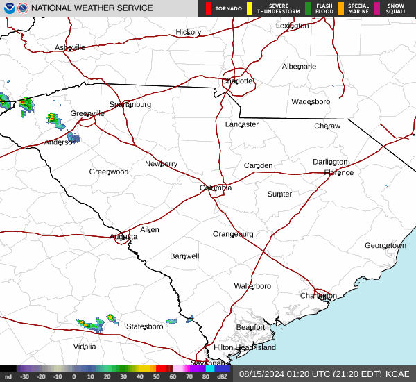
Current Radar Image
Sun Almanac for Charleston, South Carolina
Sunrise: 06:17 AM
Sunset: 8:32 PM
Civil Sunrise:05:48 AM
Civil Sunset: 9:00 PM
Nautical Sunrise: 05:13 AM
Nautical Sunset: 9:35 PM
Astro Sunrise: 04:36 AM
Astro Sunset: 10:13 PM
South Carolina's Current Temperatures
 South Carolina's Satellite Image
 South Carolina's Current Wind Direction
| National Summary |
of upper and lower values of current conditions amongst 6892 locations
in the contiguous United States |
|
High
Temp |
102° |
Gila Bend (Aaf), Arizona
and 3 other locations
|
|
Low
Temp |
43° |
Pagosa Springs, Colorado
|
|
Wind
Speed |
29mph |
Ellensburg, Washington
and 1 other location
|
|
Wind
Gust |
41mph |
Limon, Colorado
|
|
Wind
Chill |
37° |
Salida Mountain, Colorado
|
|
High
Pressure |
30.60Hg |
Salida Mountain, Colorado
|
|
Low
Pressure |
29.62Hg |
Minot AFB, North Dakota
|
|
| # Locations Reporting Rain |
59 |
|
| # Locations Reporting Thunderstorms / Lightning |
8 |
|
| # Locations Reporting Fog |
3 |
|
| Average Temperature in the Contiguous USA |
76° |
|
Any use of the information on this page is at your own risk. This information should not be relied upon in life-threatening situations, potential financial loss situations or in lieu of any officially disseminated information. Visit the
National Weather Service for official information.