Burlington, North Carolina Weather
No Watches or Warnings for Burlington
Issued: 3:15 pm EDT Apr 29, 2024 Latitude: 36.0956918 Longitude: -79.4377991 View on Google Maps
|
|
|
|
|
|
|
|
|
|
 |
 |
 |
 |
 |
 |
 |
|
| Low: °F |
High: °F |
High: °F |
High: °F |
High: °F |
High: °F |
High: °F |
High: °F |
| Low: °F |
Low: °F |
Low: °F |
Low: °F |
Low: °F |
Low: °F |
|
| Mostly Clear |
Partly Sunny |
Thunderstorms |
Morning Fog |
Mostly Sunny |
Rain |
Thunderstorms |
Partly Sunny |
Current Conditions at
BURLINGTON - (KBUY)
81°
Clear
as of 4:54 PM EDST
Rel. Humidity: 36%
Dew Point: 52°F
Visibility: 7 Miles
Pressure: 30.05 in.
Flight Rule: VFR
Cloud Level(s): Clear
Current Conditions at
ROXBORO - (KTDF)
79°
Clear
as of 4:45 PM EDST
Rel. Humidity: 39%
Dew Point: 52°F
Visibility: 10 Miles
Pressure: 30.07 in.
Flight Rule: VFR
Cloud Level(s): Clear
Current Conditions at
RALEIGH-DURHAM - (KRDU)
84°
Mostly Clear
as of 4:51 PM EDST
Rel. Humidity: 35%
Dew Point: 54°F
Visibility: 10 Miles
Pressure: 30.06 in.
Flight Rule: VFR
Wind Data
15 MPH
230° Southwest
Cloud Level(s): Few at 1000ft
|
Tonight... Mostly clear, with a low around 59. South wind 6 to 8 mph. |
|
|
Tuesday... Partly sunny, with a high near 82. Southwest wind 8 to 11 mph, with gusts as high as 20 mph. |
|
 |
Tuesday Night... A chance of showers and thunderstorms before 2am, then a slight chance of showers. Mostly cloudy, with a low around 60. Southwest wind around 7 mph. Chance of precipitation is 30%. New rainfall amounts of less than a tenth of an inch, except higher amounts possible in thunderstorms. |
|
|
Wednesday... A slight chance of showers, then a chance of showers and thunderstorms after 11am. Partly sunny, with a high near 81. Southwest wind around 7 mph becoming northwest in the afternoon. Chance of precipitation is 30%. New rainfall amounts of less than a tenth of an inch, except higher amounts possible in thunderstorms. |
|
 |
Wednesday Night... A chance of showers and thunderstorms before 8pm. Patchy fog after 5am. Otherwise, partly cloudy, with a low around 58. North wind 3 to 5 mph. Chance of precipitation is 30%. New precipitation amounts of less than a tenth of an inch, except higher amounts possible in thunderstorms. |
|
|
Thursday... Patchy fog before 7am. Otherwise, mostly sunny, with a high near 85. |
|
|
Thursday Night... Mostly clear, with a low around 57. |
|
|
Friday... Mostly sunny, with a high near 84. |
|
 |
Friday Night... Mostly cloudy, with a low around 61. |
|
|
Saturday... A chance of showers after 2pm. Mostly cloudy, with a high near 81. Chance of precipitation is 40%. |
|
 |
Saturday Night... A chance of showers. Mostly cloudy, with a low around 60. Chance of precipitation is 30%. |
|
|
Sunday... A chance of showers and thunderstorms. Mostly cloudy, with a high near 80. Chance of precipitation is 40%. |
|
|
Sunday Night... A chance of showers and thunderstorms. Mostly cloudy, with a low around 60. Chance of precipitation is 30%. |
|
|
Monday... A chance of showers. Partly sunny, with a high near 82. Chance of precipitation is 30%. |
|
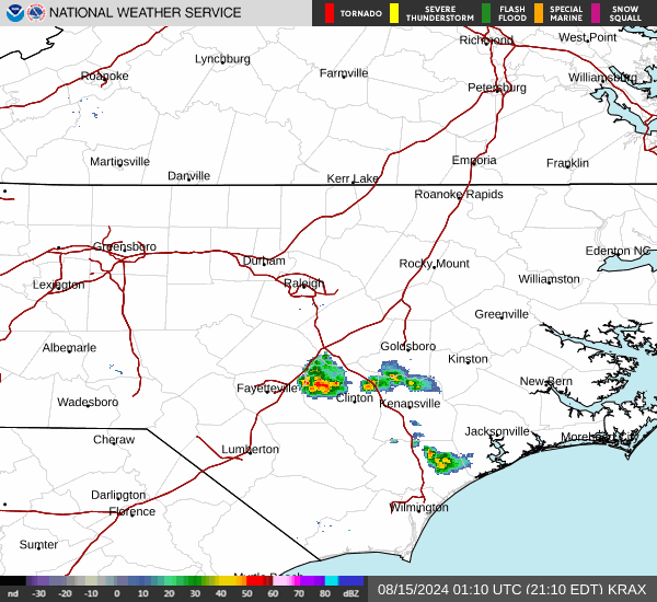
Current Radar Image
Sun Almanac for Burlington, North Carolina
Sunrise: 06:26 AM
Sunset: 8:04 PM
Civil Sunrise:05:59 AM
Civil Sunset: 8:31 PM
Nautical Sunrise: 05:26 AM
Nautical Sunset: 9:04 PM
Astro Sunrise: 04:51 AM
Astro Sunset: 9:39 PM
North Carolina's Current Temperatures
 North Carolina's Satellite Image
 North Carolina's Current Wind Direction
| National Summary |
of upper and lower values of current conditions amongst 5184 locations
in the contiguous United States |
|
High
Temp |
97° |
Zapata Cnty A/P, Texas
and 1 other location
|
|
Low
Temp |
23° |
Berthoud Pass, Colorado
|
|
Wind
Speed |
39mph |
Green Canyon 338, Louisiana
|
|
Wind
Gust |
54mph |
Green Canyon 338, Louisiana
|
|
Wind
Chill |
6° |
Berthoud Pass, Colorado
|
|
Heat
Index |
100° |
Edinburg Intl Arpt, Texas
|
|
High
Pressure |
30.27Hg |
Pagosa Springs, Colorado
|
|
Low
Pressure |
29.64Hg |
Roundup, Montana
and 1 other location
|
|
| # Locations Reporting Snow |
3 |
|
| # Locations Reporting Rain |
47 |
|
| # Locations Reporting Thunderstorms / Lightning |
2 |
|
| # Locations Reporting Fog |
1 |
|
| Average Temperature in the Contiguous USA |
69° |
|
Any use of the information on this page is at your own risk. This information should not be relied upon in life-threatening situations, potential financial loss situations or in lieu of any officially disseminated information. Visit the
National Weather Service for official information.