Burlington, Vermont Weather
|
|
|
|
|
|
|
|
 |
 |
 |
 |
|
|
 |
|
| Low: °F |
High: °F |
High: °F |
High: °F |
High: °F |
High: °F |
High: °F |
High: °F |
| Low: °F |
Low: °F |
Low: °F |
Low: °F |
Low: °F |
Low: °F |
|
| Cloudy |
Mostly Sunny |
Partly Sunny |
Mostly Cloudy |
Mostly Cloudy |
Mostly Cloudy |
Rain & Snow |
Partly Sunny |
Current Conditions at
BURLINGTON - (KBTV)
10°
Clear
as of 9:54 PM EST
Rel. Humidity: 46%
Dew Point: -6°F
Visibility: 10 Miles
Pressure: 29.75 in.
Flight Rule: VFR
Cloud Level(s): Clear
Current Conditions at
PLATTSBURGH AFB - (KPBG)
7°
Clear
as of 9:53 PM EST
Rel. Humidity: 50%
Dew Point: -8°F
Visibility: 10 Miles
Pressure: 29.75 in.
Flight Rule: VFR
Cloud Level(s): Clear
Current Conditions at
MORRISVILLE - (KMVL)
-6°
Clear
as of 9:54 PM EST
Rel. Humidity: 76%
Dew Point: -11°F
Visibility: 10 Miles
Pressure: 29.72 in.
Flight Rule: VFR
Cloud Level(s): Clear
|
Tonight... Partly cloudy, with a low around -2. Southwest wind 5 to 7 mph. |
|
|
Friday... Mostly sunny, with a high near 18. Wind chill values as low as -6. South wind 6 to 8 mph becoming west in the afternoon. |
|
 |
Friday Night... Mostly cloudy, with a low around 5. Wind chill values as low as -3. Northwest wind around 7 mph. |
|
|
Saturday... Partly sunny, with a high near 13. Wind chill values as low as -5. Northwest wind 6 to 9 mph. |
|
|
Saturday Night... Mostly cloudy, with a low around 4. Northeast wind around 6 mph becoming calm in the evening. |
|
|
Sunday... Mostly cloudy, with a high near 16. Light and variable wind becoming north 5 to 7 mph in the morning. |
|
|
Sunday Night... Mostly cloudy, with a low around -1. Northwest wind 6 to 8 mph. |
|
|
Monday... Mostly cloudy, with a high near 16. North wind around 5 mph becoming south in the afternoon. |
|
 |
Monday Night... A 40 percent chance of snow before 1am. Mostly cloudy, with a low around 10. South wind around 6 mph. |
|
|
Tuesday... Mostly cloudy, with a high near 30. South wind around 7 mph. |
|
 |
Tuesday Night... A 50 percent chance of snow. Cloudy, with a low around 24. South wind 7 to 11 mph. |
|
|
Wednesday... A chance of rain and snow. Mostly cloudy, with a high near 38. South wind 8 to 11 mph. Chance of precipitation is 50%. |
|
 |
Wednesday Night... A chance of rain and snow. Mostly cloudy, with a low around 26. Southwest wind 6 to 8 mph becoming west after midnight. Chance of precipitation is 30%. |
|
|
Thursday... Partly sunny, with a high near 35. West wind 7 to 9 mph becoming south in the afternoon. |
|
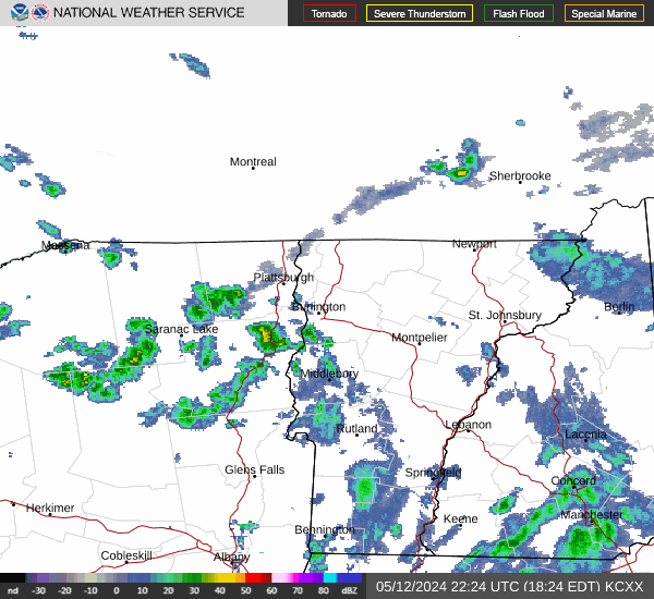
Current Radar Image
Sun Almanac for Burlington, Vermont
Sunrise: 07:29 AM
Sunset: 4:24 PM
Civil Sunrise:06:56 AM
Civil Sunset: 4:57 PM
Nautical Sunrise: 06:19 AM
Nautical Sunset: 5:34 PM
Astro Sunrise: 05:44 AM
Astro Sunset: 6:09 PM
Vermont's Current Temperatures
 Vermont's Satellite Image
 Vermont's Current Wind Direction
| National Summary |
of upper and lower values of current conditions amongst 6953 locations
in the contiguous United States |
|
High
Temp |
70° |
Miss Canyan 807, Louisiana
and 3 other locations
|
|
Low
Temp |
-11° |
Saranac Lake, New York
|
|
Wind
Speed |
43mph |
Salida Mountain, Colorado
|
|
Wind
Gust |
48mph |
Salida Mountain, Colorado
|
|
Wind
Chill |
-23° |
Flag Island, Minnesota
|
|
High
Pressure |
30.24Hg |
Pagosa Springs, Colorado
|
|
Low
Pressure |
29.38Hg |
Frenchville, Maine
|
|
| # Locations Reporting Snow |
126 |
|
| # Locations Reporting Rain |
55 |
|
| # Locations Reporting Fog |
16 |
|
| Average Temperature in the Contiguous USA |
36° |
|
Any use of the information on this page is at your own risk. This information should not be relied upon in life-threatening situations, potential financial loss situations or in lieu of any officially disseminated information. Visit the
National Weather Service for official information.