Birchwood, Alaska Weather
Issued: 4:16 pm AKST Jan 27, 2026 Latitude: 61.4052778 Longitude: -149.4688889 View on Google Maps
|
|
|
|
|
|
|
|
|
|
|
 |
 |
 |
 |
|
 |
|
 |
|
| High: °F |
Low: °F |
High: °F |
High: °F |
High: °F |
High: °F |
High: °F |
High: °F |
High: °F |
| Low: °F |
Low: °F |
Low: °F |
Low: °F |
Low: °F |
Low: °F |
|
| Snow |
Snow |
Freezing Rain & Snow |
Partly Sunny |
Partly Sunny |
Mostly Cloudy |
Mostly Cloudy |
Snow |
Snow |
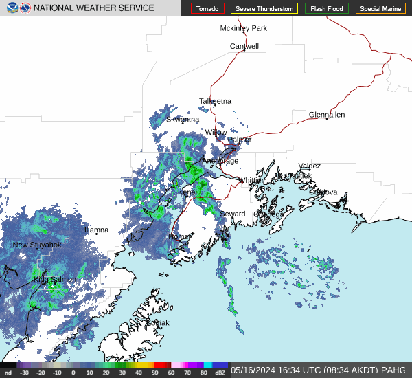
Current Conditions at
BIRCHWOOD - (PABV)
14°
Cloudy
Light Snow
as of 4:56 PM AST
Rel. Humidity: 92%
Dew Point: 12°F
Visibility: 9 Miles
Pressure: 29.15 in.
Flight Rule: VFR
Wind Data
3 MPH
220° Southwest
Cloud Level(s): Scattered at 3200ft, Broken at 4000ft, Solid Overcast at 8500ft
Current Conditions at
WASILLA - (PAWS)
14°
Cloudy
as of 4:56 PM AST
Rel. Humidity: 85%
Dew Point: 10°F
Visibility: 9 Miles
Pressure: 29.12 in.
Flight Rule: MVFR
Cloud Level(s): Solid Overcast at 1900ft
Current Conditions at
ELMENDORF AFB - (PAED)
16°
Cloudy
Light Snow Mist
as of 5:10 PM AST
Rel. Humidity: 85%
Dew Point: 12°F
Visibility: 5 Miles
Pressure: 29.10 in.
Flight Rule: IFR
Cloud Level(s): Broken at 600ft, Solid Overcast at 1500ft
Current Conditions at
MERRILL FIELD ARPT - (PAMR)
16°
Cloudy
Light Snow Mist
as of 4:53 PM AST
Rel. Humidity: 85%
Dew Point: 12°F
Visibility: 2 Miles
Pressure: 29.12 in.
Flight Rule: IFR
Cloud Level(s): Solid Overcast at 2000ft
|
This Afternoon... Snow. High near 19. Northwest wind around 5 mph. Chance of precipitation is 90%. Total daytime snow accumulation of 1 to 2 inches possible. |
|
|
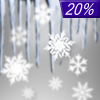
Tonight... Snow, mainly before 9pm. Low around 18. West wind around 5 mph becoming calm. Chance of precipitation is 80%. New snow accumulation of less than a half inch possible. |
|
|
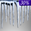
Wednesday... A slight chance of snow and freezing rain between 9am and noon. Partly sunny, with a high near 27. Calm wind becoming northeast around 5 mph. Chance of precipitation is 20%. |
|
 |
Wednesday Night... A chance of freezing rain between 9pm and 3am. Mostly cloudy, with a low around 26. Northeast wind 5 to 10 mph becoming light and variable in the evening. Chance of precipitation is 30%. |
|
|
Thursday... Partly sunny, with a high near 31. Calm wind becoming northeast around 5 mph. |
|
 |
Thursday Night... Mostly cloudy, with a low around 24. East wind 5 to 10 mph. |
|
|
Friday... Partly sunny, with a high near 28. |
|
|
Friday Night... A chance of snow between 9pm and 3am. Mostly cloudy, with a low around 22. |
|
|
Saturday... Mostly cloudy, with a high near 30. |
|
|
Saturday Night... Mostly cloudy, with a low around 15. |
|
|
Sunday... Mostly cloudy, with a high near 28. |
|
|
Sunday Night... Mostly cloudy, with a low around 16. |
|
|
Monday... A chance of snow. Mostly cloudy, with a high near 29. |
|
|
Monday Night... A chance of snow. Mostly cloudy, with a low around 20. |
|
|
Tuesday... A chance of snow. Mostly cloudy, with a high near 32. |
|
Alaska's Current Temperatures
 Alaska's Satellite Image
 Alaska's Current Wind Direction
| National Summary |
of upper and lower values of current conditions amongst 6920 locations
in the contiguous United States |
|
High
Temp |
68° |
El Monte, California
|
|
Low
Temp |
-13° |
Kings, Wisconsin
|
|
Wind
Speed |
35mph |
Jefferson/Ashe County, North Carolina
|
|
Wind
Gust |
63mph |
Jefferson/Ashe County, North Carolina
|
|
Wind
Chill |
-23° |
Flag Island, Minnesota
|
|
High
Pressure |
30.48Hg |
Vidalia/Concordi, Louisiana
and 2 other locations
|
|
Low
Pressure |
29.70Hg |
Greenville, Maine
|
|
| # Locations Reporting Snow |
71 |
|
| # Locations Reporting Rain |
17 |
|
| # Locations Reporting Fog |
3 |
|
| Average Temperature in the Contiguous USA |
25° |
|
Any use of the information on this page is at your own risk. This information should not be relied upon in life-threatening situations, potential financial loss situations or in lieu of any officially disseminated information. Visit the
National Weather Service for official information.