Billings, Montana Weather
No Watches or Warnings for Billings
Issued: 5:30 pm MST Dec 25, 2025 Latitude: 45.7832856 Longitude: -108.5006904 View on Google Maps
|
|
|
|
|
|
|
|
|
|
 |
 |
 |
 |
|
 |
 |
|
| Low: °F |
High: °F |
High: °F |
High: °F |
High: °F |
High: °F |
High: °F |
High: °F |
| Low: °F |
Low: °F |
Low: °F |
Low: °F |
Low: °F |
Low: °F |
|
| Cloudy |
Mostly Sunny |
Rain & Snow |
Sunny |
Mostly Sunny |
Partly Sunny |
Mostly Cloudy |
Mostly Cloudy |
Current Conditions at
BILLINGS - (KBIL)
Partly Cloudy
as of 5:53 PM MST
Rel. Humidity: 39%
Dew Point: 27°F
Visibility: 10 Miles
Pressure: 29.72 in.
Flight Rule: VFR
Wind Data
12 MPH
240° Southwest
Cloud Level(s): Few at 12000ft, Scattered at 25000ft
Current Conditions at
SOUTH BIG HORN - (KGEY)
48°
Clear
as of 5:53 PM MST
Rel. Humidity: 49%
Dew Point: 30°F
Visibility: 10 Miles
Pressure: 29.80 in.
Flight Rule: VFR
Cloud Level(s): Clear
Current Conditions at
CODY - (KCOD)
46°
Cloudy
as of 5:56 PM MST
Rel. Humidity: 49%
Dew Point: 28°F
Visibility: 10 Miles
Pressure: 29.86 in.
Flight Rule: VFR
Cloud Level(s): Solid Overcast at 7000ft
Current Conditions at
LIVINGSTON - (KLVM)
52°
Clear
as of 5:53 PM MST
Rel. Humidity: 34%
Dew Point: 25°F
Visibility: 10 Miles
Pressure: 29.72 in.
Flight Rule: VFR
Wind Data
35 MPH
Gust: 48 MPH
210° Southwest
Cloud Level(s): Clear
|
Tonight... Partly cloudy, with a low around 37. Southwest wind 7 to 9 mph. |
|
|
Friday... Mostly sunny, with a high near 58. South southwest wind 9 to 16 mph. |
|
|
Friday Night... Partly cloudy, with a low around 32. Southwest wind 10 to 13 mph. |
|
|
Saturday... A slight chance of rain and snow before 8am, then snow likely. Mostly cloudy, with a temperature rising to near 41 by 11am, then falling to around 24 during the remainder of the day. West southwest wind 11 to 15 mph becoming north northwest in the afternoon. Chance of precipitation is 60%. New snow accumulation of less than a half inch possible. |
|
 |
Saturday Night... A 20 percent chance of snow before 11pm. Mostly cloudy, with a low around 8. North northeast wind 6 to 11 mph. |
|
|
Sunday... Sunny, with a high near 28. West southwest wind around 6 mph. |
|
|
Sunday Night... Partly cloudy, with a low around 17. West southwest wind 6 to 9 mph. |
|
|
Monday... Mostly sunny, with a high near 42. West southwest wind 10 to 13 mph. |
|
 |
Monday Night... Mostly cloudy, with a low around 28. West southwest wind around 10 mph. |
|
|
Tuesday... Partly sunny, with a high near 48. West southwest wind around 10 mph. |
|
|
Tuesday Night... Mostly cloudy, with a low around 29. West southwest wind around 9 mph. |
|
|
Wednesday... Mostly cloudy, with a high near 45. West southwest wind around 9 mph. |
|
|
Wednesday Night... Mostly cloudy, with a low around 22. West southwest wind around 7 mph. |
|
|
New Year's Day... Mostly cloudy, with a high near 40. Southwest wind around 6 mph. |
|
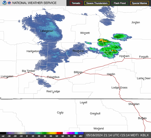
Current Radar Image
Sun Almanac for Billings, Montana
Sunrise: 07:54 AM
Sunset: 4:35 PM
Civil Sunrise:07:20 AM
Civil Sunset: 5:09 PM
Nautical Sunrise: 06:42 AM
Nautical Sunset: 5:47 PM
Astro Sunrise: 06:05 AM
Astro Sunset: 6:23 PM
Montana's Current Temperatures
 Montana's Satellite Image
 Montana's Current Wind Direction
| National Summary |
of upper and lower values of current conditions amongst 6958 locations
in the contiguous United States |
|
High
Temp |
79° |
Mcallen, Texas
|
|
Low
Temp |
7° |
Potsdam, New York
and 1 other location
|
|
Wind
Speed |
39mph |
Manchester, New Hampshire
|
|
Wind
Gust |
51mph |
Manchester, New Hampshire
|
|
Wind
Chill |
-11° |
Greenville, Maine
|
|
High
Pressure |
30.39Hg |
Salida Mountain, Colorado
and 1 other location
|
|
Low
Pressure |
29.40Hg |
Charlie, Montana
|
|
| # Locations Reporting Snow |
14 |
|
| # Locations Reporting Rain |
53 |
|
| # Locations Reporting Thunderstorms / Lightning |
1 |
|
| # Locations Reporting Fog |
83 |
|
| Average Temperature in the Contiguous USA |
49° |
|
Any use of the information on this page is at your own risk. This information should not be relied upon in life-threatening situations, potential financial loss situations or in lieu of any officially disseminated information. Visit the
National Weather Service for official information.