Bellingham, Washington Weather
No Watches or Warnings for Bellingham
Issued: 3:40 pm PDT Apr 27, 2025 Latitude: 48.7595529 Longitude: -122.4882249 View on Google Maps
|
|
|
|
|
|
|
|
|
|
 |
 |
 |
 |
 |
 |
|
 |
| Low: °F |
High: °F |
High: °F |
High: °F |
High: °F |
High: °F |
High: °F |
High: °F |
| Low: °F |
Low: °F |
Low: °F |
Low: °F |
Low: °F |
Low: °F |
|
| Cloudy |
Rain |
Rain |
Mostly Sunny |
Sunny |
Partly Sunny |
Partly Sunny |
Rain |
Current Conditions at
BELLINGHAM - (KBLI)
57°
Clear
as of 4:53 PM PDST
Rel. Humidity: 62%
Dew Point: 45°F
Visibility: 10 Miles
Pressure: 30.06 in.
Flight Rule: VFR
Wind Data
8 MPH
Gust: 20 MPH
180° South
Cloud Level(s): Clear
Current Conditions at
ORCAS ISLAND ARPT - (KORS)
59°
Clear
as of 5:15 PM PDST
Rel. Humidity: 62%
Dew Point: 46°F
Visibility: 10 Miles
Pressure: 30.07 in.
Flight Rule: VFR
Wind Data
10 MPH
170° South
Cloud Level(s): Clear
Current Conditions at
SKAGIT RGNL ARPT - (KBVS)
59°
Clear
as of 4:55 PM PDST
Rel. Humidity: 58%
Dew Point: 45°F
Visibility: 10 Miles
Pressure: 30.08 in.
Flight Rule: VFR
Cloud Level(s): Clear
Current Conditions at
FRIDAY HARBOR - (KFHR)
64°
Clear
as of 4:53 PM PDST
Rel. Humidity: 48%
Dew Point: 45°F
Visibility: 10 Miles
Pressure: 30.09 in.
Flight Rule: VFR
Wind Data
9 MPH
140° Southeast
Cloud Level(s): Clear
|
Tonight... Partly cloudy, with a low around 47. South wind 3 to 7 mph. |
|
|
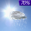
Monday... Rain likely, mainly after 2pm. Mostly cloudy, with a high near 57. South wind 7 to 11 mph, with gusts as high as 21 mph. Chance of precipitation is 70%. New precipitation amounts of less than a tenth of an inch possible. |
|
 |
Monday Night... Rain. Low around 49. South wind 5 to 7 mph. Chance of precipitation is 100%. New precipitation amounts between a tenth and quarter of an inch possible. |
|
|
Tuesday... Showers likely, mainly before 11am. Cloudy, then gradually becoming mostly sunny, with a high near 62. South wind around 7 mph. Chance of precipitation is 70%. New precipitation amounts of less than a tenth of an inch possible. |
|
|
Tuesday Night... Partly cloudy, with a low around 45. Southwest wind around 6 mph becoming calm in the evening. |
|
|
Wednesday... Mostly sunny, with a high near 64. |
|
 |
Wednesday Night... Mostly clear, with a low around 45. |
|
|
Thursday... Sunny, with a high near 70. |
|
 |
Thursday Night... A slight chance of showers after 11pm. Mostly clear, with a low around 49. |
|
|
Friday... A chance of showers. Partly sunny, with a high near 65. |
|
 |
Friday Night... Showers likely. Mostly cloudy, with a low around 47. |
|
|
Saturday... A chance of showers. Partly sunny, with a high near 58. |
|
|
Saturday Night... A slight chance of showers. Partly cloudy, with a low around 44. |
|
|
Sunday... A slight chance of showers. Mostly sunny, with a high near 61. |
|
Current Radar Image
Sun Almanac for Bellingham, Washington
Sunrise: 05:55 AM
Sunset: 8:20 PM
Civil Sunrise:05:20 AM
Civil Sunset: 8:55 PM
Nautical Sunrise: 04:37 AM
Nautical Sunset: 9:38 PM
Astro Sunrise: 03:46 AM
Astro Sunset: 10:29 PM
Washington's Current Temperatures
 Washington's Satellite Image
 Washington's Current Wind Direction
| National Summary |
of upper and lower values of current conditions amongst 6794 locations
in the contiguous United States |
|
High
Temp |
97° |
Presidio, Texas
|
|
Low
Temp |
32° |
Pagosa Springs, Colorado
and 1 other location
|
|
Wind
Speed |
92mph |
Watford City Municipal, North Dakota
|
|
Wind
Gust |
59mph |
Raton Airport, New Mexico
|
|
Wind
Chill |
19° |
Salida Mountain, Colorado
|
|
High
Pressure |
30.29Hg |
Willoughby, Ohio
and 1 other location
|
|
Low
Pressure |
29.50Hg |
Mike Madis, Colorado
and 1 other location
|
|
| # Locations Reporting Rain |
37 |
|
| # Locations Reporting Thunderstorms / Lightning |
11 |
|
| # Locations Reporting Fog |
1 |
|
| Average Temperature in the Contiguous USA |
66° |
|
Any use of the information on this page is at your own risk. This information should not be relied upon in life-threatening situations, potential financial loss situations or in lieu of any officially disseminated information. Visit the
National Weather Service for official information.


