No Watches or Warnings for Bangor
Issued: 5:27 pm EST Jan 19, 2026 Latitude: 44.8011821 Longitude: -68.7778138 View on Google Maps
|
|
|
|
|
|
|
|
|
|
 |
 |
 |
 |
 |
|
|
|
| Low: °F |
High: °F |
High: °F |
High: °F |
High: °F |
High: °F |
High: °F |
High: °F |
| Low: °F |
Low: °F |
Low: °F |
Low: °F |
Low: °F |
Low: °F |
|
| Clearing |
Sunny |
Snow |
Partly Sunny |
Mostly Sunny |
Sunny |
Mostly Sunny |
Mostly Sunny |
Current Conditions at
BANGOR - (KBGR)
Cloudy
as of 5:57 PM EST
Rel. Humidity: 92%
Dew Point: 25°F
Visibility: 10 Miles
Pressure: 29.76 in.
Flight Rule: VFR
Cloud Level(s): Solid Overcast at 4500ft
Current Conditions at
BAR HARBOR - (KBHB)
27°
Cloudy
Light Snow
as of 6:16 PM EST
Rel. Humidity: 92%
Dew Point: 25°F
Visibility: 9 Miles
Pressure: 29.79 in.
Flight Rule: MVFR
Cloud Level(s): Scattered at 2300ft, Broken at 2900ft, Solid Overcast at 4500ft
Current Conditions at
WATERVILLE - (KWVL)
27°
Cloudy
as of 5:56 PM EST
Rel. Humidity: 92%
Dew Point: 25°F
Visibility: 10 Miles
Pressure: 29.73 in.
Flight Rule: VFR
Cloud Level(s): Few at 4800ft, Solid Overcast at 10000ft
Current Conditions at
MILLINOCKET - (KMLT)
25°
Cloudy
Light Snow
as of 6:27 PM EST
Rel. Humidity: 85%
Dew Point: 21°F
Visibility: 7 Miles
Pressure: 29.73 in.
Flight Rule: MVFR
Cloud Level(s): Broken at 2000ft, Broken at 2900ft, Solid Overcast at 3500ft
|
Tonight... Cloudy during the early evening, then gradual clearing, with a low around 14. Southwest wind 5 to 11 mph, with gusts as high as 22 mph. |
|
|
Tuesday... Sunny, with a high near 22. Wind chill values as low as zero. West wind 13 to 18 mph, with gusts as high as 32 mph. |
|
|
Tuesday Night... Mostly clear, with a low around 6. Wind chill values as low as -2. West wind 5 to 7 mph. |
|
|
Wednesday... A slight chance of snow after 4pm. Increasing clouds, with a high near 26. Wind chill values as low as -3. Southwest wind 5 to 9 mph. Chance of precipitation is 20%. |
|
 |
Wednesday Night... Snow likely, mainly between 11pm and 3am. Mostly cloudy, with a low around 17. South wind around 6 mph. Chance of precipitation is 70%. New snow accumulation of 1 to 3 inches possible. |
|
|
Thursday... Partly sunny, with a high near 36. Southwest wind 7 to 13 mph, with gusts as high as 23 mph. |
|
 |
Thursday Night... Partly cloudy, with a low around 15. West wind around 6 mph. |
|
|
Friday... Mostly sunny, with a high near 24. |
|
|
Friday Night... Partly cloudy, with a low around -3. |
|
|
Saturday... Sunny and cold, with a high near 6. |
|
|
Saturday Night... Mostly clear, with a low around -8. |
|
|
Sunday... Mostly sunny and cold, with a high near 8. |
|
|
Sunday Night... Partly cloudy, with a low around -5. |
|
|
Monday... Mostly sunny, with a high near 13. |
|
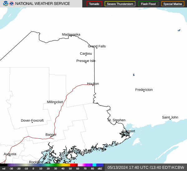
Current Radar Image
Sun Almanac for Bangor, Maine
Sunrise: 07:06 AM
Sunset: 4:25 PM
Civil Sunrise:06:34 AM
Civil Sunset: 4:58 PM
Nautical Sunrise: 05:58 AM
Nautical Sunset: 5:34 PM
Astro Sunrise: 05:23 AM
Astro Sunset: 6:08 PM
Maine's Current Temperatures
 Maine's Satellite Image
 Maine's Current Wind Direction
| National Summary |
of upper and lower values of current conditions amongst 6518 locations
in the contiguous United States |
|
High
Temp |
81° |
Riverside, California
and 2 other locations
|
|
Low
Temp |
-11° |
Grand Marais, Minnesota
|
|
Wind
Speed |
30mph |
Nantucket, Massachusetts
|
|
Wind
Gust |
44mph |
Watertown, New York
|
|
Wind
Chill |
-28° |
Duluth Intl, Minnesota
and 1 other location
|
|
High
Pressure |
30.55Hg |
Richland, Washington
and 1 other location
|
|
Low
Pressure |
29.62Hg |
Greenville, Maine
|
|
| # Locations Reporting Snow |
69 |
|
| # Locations Reporting Rain |
1 |
|
| # Locations Reporting Fog |
8 |
|
| Average Temperature in the Contiguous USA |
33° |
|
Any use of the information on this page is at your own risk. This information should not be relied upon in life-threatening situations, potential financial loss situations or in lieu of any officially disseminated information. Visit the
National Weather Service for official information.