West Leesburg, Mississippi Weather
Current Conditions at
JACKSON INTERNATIONAL - (KJAN)
59°
Mostly Clear
as of 7:54 PM CDST
Rel. Humidity: 54%
Dew Point: 43°F
Visibility: 10 Miles
Pressure: 30.04 in.
Flight Rule: VFR
Wind Data
6 MPH
130° Southeast
Cloud Level(s): Few at 25000ft
Current Conditions at
JACKSON HAWKINS FIELD - (KHKS)
66°
Clear
as of 7:53 PM CDST
Rel. Humidity: 37%
Dew Point: 39°F
Visibility: 10 Miles
Pressure: 30.04 in.
Flight Rule: VFR
Wind Data
3 MPH
140° Southeast
Cloud Level(s): Clear
Current Conditions at
MERIDIAN KEY FIELD - (KMEI)
57°
Clear
as of 7:58 PM CDST
Rel. Humidity: 62%
Dew Point: 45°F
Visibility: 10 Miles
Pressure: 30.05 in.
Flight Rule: VFR
Cloud Level(s): Clear
Current Conditions at
MERIDIAN NAS - (KNMM)
63°
Clear
as of 7:56 PM CDST
Rel. Humidity: 42%
Dew Point: 39°F
Visibility: 10 Miles
Pressure: 30.05 in.
Flight Rule: VFR
Cloud Level(s): Clear
Moon Almanac for West Leesburg, Mississippi
Moon Phase: Waning Crescent
Moon Illumination: 26%
Moon Age: 24.5 Days
Moon is currently below the horizon
Distance from Moon to Earth: 248,047 miles
Upcoming Lunar Events for
West Leesburg: |
| Next Event | Event Time | Illum |
|
|
|
| Moonrise: | 05:38 am Sat | 22.6% |
| High Moon: | 10:41 am Sat | 20.8% |
| Moonset: | 03:49 pm Sat | 19.1% |
 | New Moon: Tue Feb 17 |
 | First Quarter: Tue Feb 24 |
 | Full Moon: Tue Mar 3 |
 | Last Quarter: Wed Mar 11 |
| New Moon: Wed Mar 18 |
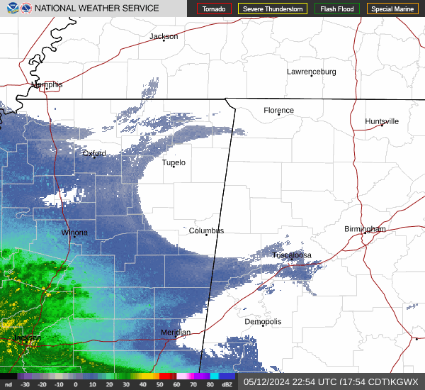
Current Radar Image
| Mississippi State Summary |
of upper and lower values of current conditions amongst 33 locations
in Mississippi |
|
High
Temp |
66° |
Jackson Hawkins Field
|
|
Low
Temp |
55° |
Belmont
and 3 other locations
|
|
Wind
Speed |
8mph |
Columbus Arpt
and 1 other location
|
|
High
Pressure |
30.08Hg |
Pascagoula
|
|
Low
Pressure |
29.99Hg |
Olive Branch Airprt
and 1 other location
|
|
| Average temperature in Mississippi |
59° |
|
# Locations Reporting VFR
(Visual Flight Rules) |
33 |
|
Mississippi's Current Temperatures
 Mississippi's Satellite Image
 Mississippi's Current Wind Direction
| National Summary |
of upper and lower values of current conditions amongst 6674 locations
in the contiguous United States |
|
High
Temp |
93° |
Yuma Mcas, Arizona
and 5 other locations
|
|
Low
Temp |
7° |
Hutson Field, North Dakota
and 1 other location
|
|
Wind
Speed |
43mph |
Berthoud Pass, Colorado
|
|
Wind
Gust |
62mph |
Willow Run Arpt, Michigan
|
|
Wind
Chill |
8° |
Plentywood, Montana
and 1 other location
|
|
High
Pressure |
30.36Hg |
Salida Mountain, Colorado
|
|
Low
Pressure |
29.36Hg |
Charlie, Montana
|
|
| # Locations Reporting Snow |
96 |
|
| # Locations Reporting Rain |
37 |
|
| # Locations Reporting Thunderstorms / Lightning |
3 |
|
| # Locations Reporting Fog |
9 |
|
| Average Temperature in the Contiguous USA |
52° |
|
Any use of the information on this page is at your own risk. This information should not be relied upon in life-threatening situations, potential financial loss situations or in lieu of any officially disseminated information. Visit the
National Weather Service for official information.