Underwood Crossing, Wyoming Weather
Current Conditions at
CONVERSE COUNTY ARPT - (KDGW)
Cloudy
Light Snow Mist
as of 4:20 AM MDST
Rel. Humidity: 100%
Dew Point: 28°F
Visibility: 2 Miles
Pressure: 29.89 in.
Flight Rule: IFR
Wind Data
12 MPH
300° Northwest
Cloud Level(s): Scattered at 500ft, Solid Overcast at 3900ft
Current Conditions at
GILLETTE - (KGCC)
Mostly Clear
as of 3:53 AM MDST
Rel. Humidity: 92%
Dew Point: 23°F
Visibility: 10 Miles
Pressure: 29.92 in.
Flight Rule: VFR
Cloud Level(s): Few at 7500ft
Current Conditions at
CUSTER - (KCUT)
Cloudy
as of 3:53 AM MDST
Rel. Humidity: 73%
Dew Point: 18°F
Visibility: 10 Miles
Pressure: 29.81 in.
Flight Rule: VFR
Wind Data
9 MPH
Gust: 17 MPH
350° North
Cloud Level(s): Solid Overcast at 7000ft
Current Conditions at
CHADRON - (KCDR)
Cloudy
as of 4:42 AM MDST
Rel. Humidity: 80%
Dew Point: 28°F
Visibility: 10 Miles
Pressure: 29.90 in.
Flight Rule: VFR
Wind Data
14 MPH
330° Northwest
Cloud Level(s): Solid Overcast at 3100ft
Moon Almanac for Underwood Crossing, Wyoming
Moon Phase: New Moon
Moon Illumination: 0%
Moon Age: 29.4 Days
Moon is currently below the horizon
Distance from Moon to Earth: 229,446 miles
Upcoming Lunar Events for
Underwood Crossing: |
| Next Event | Event Time | Illum |
|
|
|
| New Moon: | 07:52 am Fri | 0.0% |
| Moonrise: | 07:59 am Fri | 0.0% |
| High Moon: | 03:09 pm Fri | 0.1% |
| Moonset: | 10:36 pm Fri | 0.5% |
 | New Moon: Fri Apr 17 |
 | First Quarter: Thu Apr 23 |
 | Full Moon: Fri May 1 |
 | Last Quarter: Sat May 9 |
| New Moon: Sat May 16 |
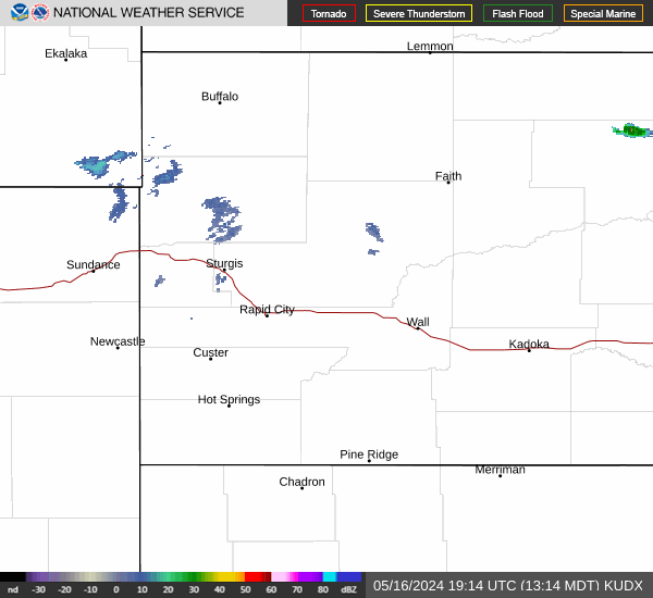
Current Radar Image
| Wyoming State Summary |
of upper and lower values of current conditions amongst 38 locations
in Wyoming |
|
|
|
|
|
|
|
|
|
Wind
Chill |
0° |
Boysen/Thermopol
|
|
High
Pressure |
30.07Hg |
Alpine
|
|
Low
Pressure |
29.79Hg |
Warren AFB
and 1 other location
|
|
| Average temperature in Wyoming |
24° |
|
| # Locations Reporting Snow |
7 |
|
# Locations Reporting IFR
(Instrument Flight Rules) |
4 |
|
# Locations Reporting MVFR
(Marginal Visual Flight Rules) |
1 |
|
# Locations Reporting VFR
(Visual Flight Rules) |
33 |
|
Wyoming's Current Temperatures
 Wyoming's Satellite Image
 Wyoming's Current Wind Direction
| National Summary |
of upper and lower values of current conditions amongst 7062 locations
in the contiguous United States |
|
High
Temp |
79° |
Brownsville, Texas
|
|
Low
Temp |
7° |
West Yellowstone, Montana
|
|
Wind
Speed |
39mph |
Salida Mountain, Colorado
|
|
Wind
Gust |
55mph |
Broken Bow, Nebraska
|
|
Wind
Chill |
1° |
Boysen/Thermopol, Wyoming
|
|
High
Pressure |
30.36Hg |
Vancouver, Washington
and 1 other location
|
|
Low
Pressure |
29.45Hg |
Grand Island, Nebraska
|
|
| # Locations Reporting Snow |
23 |
|
| # Locations Reporting Rain |
35 |
|
| # Locations Reporting Fog |
100 |
|
| Average Temperature in the Contiguous USA |
54° |
|
Any use of the information on this page is at your own risk. This information should not be relied upon in life-threatening situations, potential financial loss situations or in lieu of any officially disseminated information. Visit the
National Weather Service for official information.