Tucson National Estates, Arizona Weather
No Watches or Warnings for Tucson National Estates
Issued: 2:07 pm MST Dec 18, 2025 Latitude: 32.3531295 Longitude: -111.0256544 View on Google Maps
|
|
|
|
|
|
|
|
|
|
 |
 |
|
|
|
 |
 |
 |
| Low: °F |
High: °F |
High: °F |
High: °F |
High: °F |
High: °F |
High: °F |
High: °F |
| Low: °F |
Low: °F |
Low: °F |
Low: °F |
Low: °F |
Low: °F |
|
| Mostly Clear |
Sunny |
Sunny |
Sunny |
Sunny |
Partly Sunny |
Thunderstorms |
Rain |
Current Conditions at
DAVIS-MONTHAN AFB - (KDMA)
54°
Clear
as of 8:55 PM MST
Rel. Humidity: 46%
Dew Point: 34°F
Visibility: 10 Miles
Pressure: 30.09 in.
Flight Rule: VFR
Wind Data
7 MPH
140° Southeast
Cloud Level(s): Clear
Current Conditions at
TUCSON - (KTUS)
55°
Clear
as of 8:53 PM MST
Rel. Humidity: 47%
Dew Point: 36°F
Visibility: 10 Miles
Pressure: 30.10 in.
Flight Rule: VFR
Wind Data
7 MPH
150° Southeast
Cloud Level(s): Clear
Current Conditions at
CASA GRANDE - (KCGZ)
54°
Clear
as of 8:56 PM MST
Rel. Humidity: 54%
Dew Point: 37°F
Visibility: 10 Miles
Pressure: 30.04 in.
Flight Rule: VFR
Wind Data
5 MPH
050° Northeast
Cloud Level(s): Clear
Current Conditions at
FT HUACHUCA - (KFHU)
59°
Clear
as of 8:55 PM MST
Rel. Humidity: 26%
Dew Point: 25°F
Visibility: 10 Miles
Pressure: 30.17 in.
Flight Rule: VFR
Wind Data
9 MPH
220° Southwest
Cloud Level(s): Clear
|
Tonight... Mostly clear, with a low around 50. Calm wind becoming east southeast around 5 mph after midnight. |
|
|
Friday... Sunny, with a high near 83. East southeast wind around 6 mph becoming calm in the morning. |
|
|
Friday Night... Mostly clear, with a low around 50. Calm wind becoming southeast around 6 mph in the evening. |
|
|
Saturday... Sunny, with a high near 80. East southeast wind 5 to 7 mph becoming light and variable in the afternoon. |
|
 |
Saturday Night... Clear, with a low around 50. Calm wind becoming east southeast around 6 mph after midnight. |
|
|
Sunday... Sunny, with a high near 82. |
|
|
Sunday Night... Clear, with a low around 52. |
|
|
Monday... Sunny, with a high near 85. |
|
 |
Monday Night... Partly cloudy, with a low around 54. |
|
|
Tuesday... Partly sunny, with a high near 80. |
|
 |
Tuesday Night... A 10 percent chance of showers. Mostly cloudy, with a low around 53. |
|
|
Wednesday... A 10 percent chance of showers and thunderstorms. Mostly sunny, with a high near 78. |
|
 |
Wednesday Night... A 10 percent chance of showers. Partly cloudy, with a low around 52. |
|
|
Christmas Day... A 20 percent chance of showers. Mostly sunny, with a high near 76. |
|
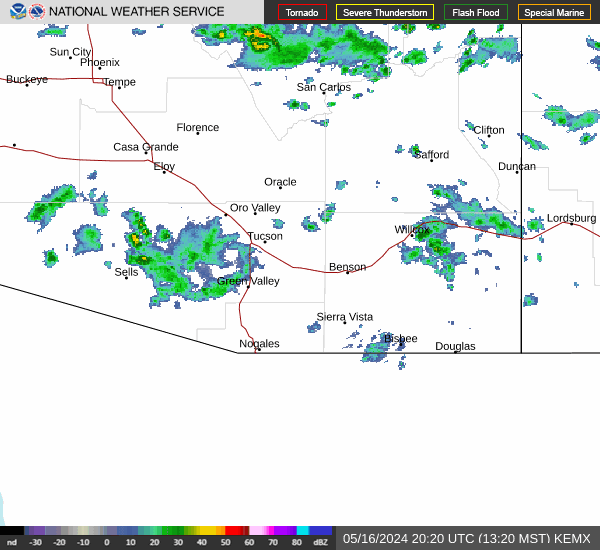
Current Radar Image
Sun Almanac for Tucson National Estates, Arizona
Sunrise: 07:20 AM
Sunset: 5:22 PM
Civil Sunrise:06:53 AM
Civil Sunset: 5:49 PM
Nautical Sunrise: 06:22 AM
Nautical Sunset: 6:20 PM
Astro Sunrise: 05:52 AM
Astro Sunset: 6:50 PM
Arizona's Current Temperatures
 Arizona's Satellite Image
 Arizona's Current Wind Direction
| National Summary |
of upper and lower values of current conditions amongst 7006 locations
in the contiguous United States |
|
High
Temp |
81° |
Miss Canyan 807, Louisiana
|
|
Low
Temp |
-17° |
Robertson Field, North Dakota
|
|
Wind
Speed |
53mph |
Salida Mountain, Colorado
|
|
Wind
Gust |
62mph |
Knoxville, Tennessee
|
|
Wind
Chill |
-35° |
Fergus Falls, Minnesota
|
|
High
Pressure |
30.30Hg |
Big Bear City, California
|
|
Low
Pressure |
29.07Hg |
Newberry, Michigan
|
|
| # Locations Reporting Snow |
84 |
|
| # Locations Reporting Rain |
285 |
|
| # Locations Reporting Thunderstorms / Lightning |
3 |
|
| # Locations Reporting Fog |
13 |
|
| Average Temperature in the Contiguous USA |
42° |
|
Any use of the information on this page is at your own risk. This information should not be relied upon in life-threatening situations, potential financial loss situations or in lieu of any officially disseminated information. Visit the
National Weather Service for official information.