Tucker Crossroads, Alabama Weather
No Watches or Warnings for Tucker Crossroads
Issued: 5:06 am CST Dec 17, 2025 Latitude: 34.1350964 Longitude: -85.5719055 View on Google Maps
|
|
|
|
|
|
|
|
|
|
 |
 |
 |
 |
|
 |
|
|
| High: °F |
Low: °F |
High: °F |
High: °F |
High: °F |
High: °F |
High: °F |
High: °F |
| Low: °F |
Low: °F |
Low: °F |
Low: °F |
Low: °F |
|
| Mostly Cloudy |
Rain |
Thunderstorms |
Sunny |
Sunny |
Partly Sunny |
Partly Sunny |
Partly Sunny |
Current Conditions at
ISBELL FIELD ARPT - (K4A9)
27°
Clear
as of 4:55 AM CST
Rel. Humidity: 86%
Dew Point: 23°F
Visibility: 10 Miles
Pressure: 30.20 in.
Flight Rule: VFR
Cloud Level(s): Clear
Current Conditions at
ROME - (KRMG)
30°
Clear
as of 5:53 AM EST
Rel. Humidity: 68%
Dew Point: 21°F
Visibility: 10 Miles
Pressure: 30.22 in.
Flight Rule: VFR
Cloud Level(s): Clear
Current Conditions at
GADSDEN - (KGAD)
23°
Clear
Mist
as of 4:56 AM CST
Rel. Humidity: 100%
Dew Point: 23°F
Visibility: 6 Miles
Pressure: 30.22 in.
Flight Rule: VFR
Cloud Level(s): Clear
Current Conditions at
ANNISTON - (KANB)
30°
Clear
as of 4:53 AM CST
Rel. Humidity: 80%
Dew Point: 25°F
Visibility: 10 Miles
Pressure: 30.21 in.
Flight Rule: VFR
Cloud Level(s): Clear
|
Today... Mostly cloudy, with a high near 58. Calm wind. |
|
|
Tonight... A 20 percent chance of showers after 3am. Mostly cloudy, with a low around 44. Calm wind becoming east around 5 mph after midnight. |
|
|
Thursday... Rain before 1pm, then showers between 1pm and 3pm, then showers and possibly a thunderstorm after 3pm. High near 62. East wind 5 to 15 mph becoming south in the afternoon. Chance of precipitation is 90%. New rainfall amounts between a tenth and quarter of an inch, except higher amounts possible in thunderstorms. |
|
 |
Thursday Night... Showers and possibly a thunderstorm before midnight, then a slight chance of showers between midnight and 3am, then a slight chance of rain after 3am. Low around 39. South wind 10 to 15 mph becoming west after midnight. Chance of precipitation is 90%. |
|
|
Friday... Sunny, with a high near 50. Northwest wind 5 to 10 mph. |
|
 |
Friday Night... Mostly clear, with a low around 31. |
|
|
Saturday... Sunny, with a high near 61. |
|
 |
Saturday Night... A 20 percent chance of showers after midnight. Partly cloudy, with a low around 44. |
|
|
Sunday... A 30 percent chance of showers. Partly sunny, with a high near 62. |
|
 |
Sunday Night... A 30 percent chance of showers, mainly after midnight. Mostly cloudy, with a low around 46. |
|
|
Monday... A 20 percent chance of showers. Partly sunny, with a high near 62. |
|
|
Monday Night... A 20 percent chance of showers. Mostly cloudy, with a low around 47. |
|
|
Tuesday... Partly sunny, with a high near 61. |
|
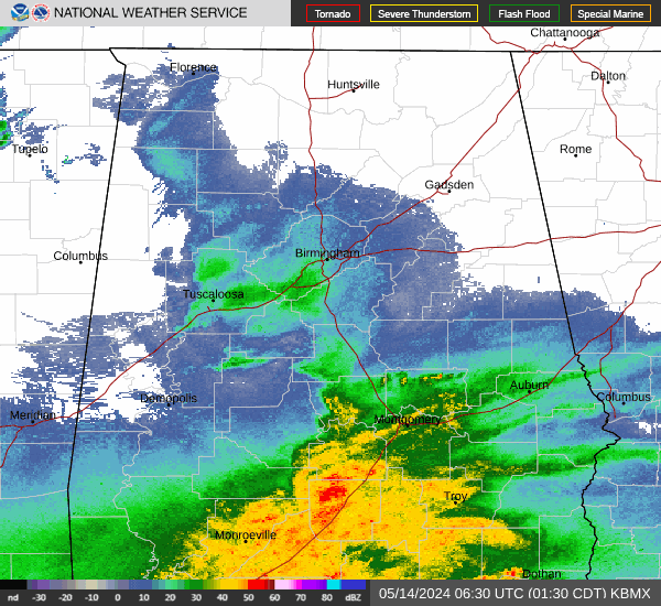
Current Radar Image
Sun Almanac for Tucker Crossroads, Alabama
Sunrise: 06:42 AM
Sunset: 4:35 PM
Civil Sunrise:06:14 AM
Civil Sunset: 5:03 PM
Nautical Sunrise: 05:43 AM
Nautical Sunset: 5:34 PM
Astro Sunrise: 05:13 AM
Astro Sunset: 6:05 PM
Alabama's Current Temperatures
 Alabama's Satellite Image
 Alabama's Current Wind Direction
| National Summary |
of upper and lower values of current conditions amongst 6428 locations
in the contiguous United States |
|
High
Temp |
75° |
Keathley C 875, Louisiana
|
|
Low
Temp |
1° |
Gunnison, Colorado
|
|
Wind
Speed |
43mph |
Livingston, Montana
|
|
Wind
Gust |
59mph |
Livingston, Montana
|
|
Wind
Chill |
-9° |
Robertson Field, North Dakota
|
|
High
Pressure |
30.38Hg |
Salida Mountain, Colorado
|
|
Low
Pressure |
29.17Hg |
Ephrata, Washington
|
|
| # Locations Reporting Rain |
92 |
|
| # Locations Reporting Fog |
37 |
|
| Average Temperature in the Contiguous USA |
38° |
|
Any use of the information on this page is at your own risk. This information should not be relied upon in life-threatening situations, potential financial loss situations or in lieu of any officially disseminated information. Visit the
National Weather Service for official information.