| your sport, your way | ||||
 |  |  |  |  |
|

| Tonight | Thursday | Friday | Saturday | Sunday | Monday | Tuesday | Wednesday |
 |
 |
 |
 |
 |
 |
|
 |
| Low: 38°F | High: 52°F | High: 41°F | High: 23°F | High: 31°F | High: 28°F | High: 27°F | High: 32°F |
| Low: 33°F | Low: 19°F | Low: 20°F | Low: 23°F | Low: 14°F | Low: 17°F | ||
| Mostly Cloudy | Sunny | Rain & Snow | Snow | Freezing Rain & Snow | Snow | Sunny | Partly Sunny |


|
Tonight... Mostly cloudy, with a low around 38. Southwest wind around 8 mph. |
|
Thursday... Sunny, with a high near 52. West wind 7 to 11 mph. |
 |
Thursday Night... Partly cloudy, with a low around 33. Southwest wind around 6 mph becoming north after midnight. |
|
Friday... A slight chance of rain after 1pm, mixing with snow after 4pm. Mostly cloudy, with a high near 41. Northeast wind 6 to 9 mph. Chance of precipitation is 20%. |
|
Friday Night... Mostly cloudy, with a low around 19. Blustery, with a north wind 10 to 20 mph, with gusts as high as 28 mph. |
|
Saturday... A chance of snow after 1pm. Mostly cloudy, with a high near 23. Chance of precipitation is 50%. |
 |
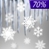
Saturday Night... Snow. Low around 20. Chance of precipitation is 100%. |
|
Sunday... Snow and freezing rain. High near 31. Chance of precipitation is 100%. |
 |
Sunday Night... Snow and freezing rain likely before 1am, then a chance of snow. Mostly cloudy, with a low around 23. Chance of precipitation is 70%. |
|
Monday... A chance of snow before 1pm. Partly sunny, with a high near 28. Chance of precipitation is 30%. |
 |
Monday Night... Mostly clear, with a low around 14. |
|
Tuesday... Sunny, with a high near 27. |
|
Tuesday Night... Mostly clear, with a low around 17. |
|
Wednesday... Partly sunny, with a high near 32. |