Taylors, Virginia Weather
Issued: 3:59 pm EST Jan 21, 2026 Latitude: 38.0543006 Longitude: -77.0880292 View on Google Maps
|
|
|
|
|
|
|
|
|
|
 |
 |
 |
 |
 |
 |
|
 |
| Low: °F |
High: °F |
High: °F |
High: °F |
High: °F |
High: °F |
High: °F |
High: °F |
| Low: °F |
Low: °F |
Low: °F |
Low: °F |
Low: °F |
Low: °F |
|
| Cloudy |
Sunny |
Rain & Snow |
Snow & Sleet |
Freezing Rain & Snow |
Mostly Sunny |
Sunny |
Partly Sunny |
Current Conditions at
SHANNON ARPT - (KEZF)
Clear
as of 8:55 PM EST
Rel. Humidity: 37%
Dew Point: 14°F
Visibility: 10 Miles
Pressure: 30.19 in.
Flight Rule: VFR
Wind Data
13 MPH
Gust: 17 MPH
180° South
Cloud Level(s): Clear
Current Conditions at
RICHMOND/HANOVER - (KOFP)
39°
Clear
as of 8:54 PM EST
Rel. Humidity: 38%
Dew Point: 16°F
Visibility: 10 Miles
Pressure: 30.25 in.
Flight Rule: VFR
Cloud Level(s): Clear
Current Conditions at
STAFFORD - (KRMN)
37°
Clear
as of 8:55 PM EST
Rel. Humidity: 29%
Dew Point: 9°F
Visibility: 10 Miles
Pressure: 30.19 in.
Flight Rule: VFR
Cloud Level(s): Clear
Current Conditions at
QUANTICO MCAS - (KNYG)
Clear
as of 8:56 PM EST
Rel. Humidity: 60%
Dew Point: 25°F
Visibility: 10 Miles
Pressure: 30.21 in.
Flight Rule: VFR
Wind Data
14 MPH
170° South
Cloud Level(s): Clear
|
Tonight... Partly cloudy, with a low around 36. Southwest wind around 7 mph. |
|
|
Thursday... Sunny, with a high near 54. West wind 6 to 9 mph, with gusts as high as 18 mph. |
|
|
Thursday Night... Partly cloudy, with a low around 27. Calm wind. |
|
|
Friday... A slight chance of snow before 1pm, then a slight chance of rain and snow. Mostly cloudy, with a high near 45. Calm wind becoming northwest around 6 mph in the afternoon. Chance of precipitation is 20%. |
|
 |
Friday Night... Mostly cloudy, with a low around 14. North wind 6 to 11 mph, with gusts as high as 20 mph. |
|
|
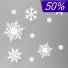
Saturday... A slight chance of snow and sleet before 1pm, then a chance of snow. Cloudy, with a high near 21. Chance of precipitation is 50%. New precipitation amounts of less than a tenth of an inch possible. |
|
 |
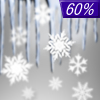
Saturday Night... Snow. Low around 15. Chance of precipitation is 100%. |
|
|
Sunday... Snow and freezing rain. High near 26. Chance of precipitation is 100%. |
|
 |
Sunday Night... Snow likely, possibly mixed with freezing rain before 1am, then a chance of snow. Mostly cloudy, with a low around 16. Chance of precipitation is 60%. |
|
|
Monday... Mostly sunny, with a high near 28. |
|
 |
Monday Night... Mostly clear, with a low around 3. |
|
|
Tuesday... Sunny, with a high near 28. |
|
|
Tuesday Night... Partly cloudy, with a low around 9. |
|
|
Wednesday... Partly sunny, with a high near 33. |
|
Current Radar Image
Sun Almanac for Taylors, Virginia
Sunrise: 07:20 AM
Sunset: 5:19 PM
Civil Sunrise:06:52 AM
Civil Sunset: 5:47 PM
Nautical Sunrise: 06:20 AM
Nautical Sunset: 6:19 PM
Astro Sunrise: 05:49 AM
Astro Sunset: 6:51 PM
Virginia's Current Temperatures
 Virginia's Satellite Image
 Virginia's Current Wind Direction
| National Summary |
of upper and lower values of current conditions amongst 6853 locations
in the contiguous United States |
|
High
Temp |
75° |
Keathley C 875, Louisiana
|
|
Low
Temp |
-8° |
Warroad, Minnesota
|
|
Wind
Speed |
33mph |
Oskaloosa Municipal A/P, Iowa
|
|
Wind
Gust |
46mph |
Davenport, Iowa
|
|
Wind
Chill |
-23° |
Bemidji, Minnesota
|
|
High
Pressure |
30.42Hg |
Richland, Washington
and 2 other locations
|
|
Low
Pressure |
29.63Hg |
Grand Marais, Minnesota
|
|
| # Locations Reporting Snow |
152 |
|
| # Locations Reporting Rain |
66 |
|
| # Locations Reporting Fog |
15 |
|
| Average Temperature in the Contiguous USA |
36° |
|
Any use of the information on this page is at your own risk. This information should not be relied upon in life-threatening situations, potential financial loss situations or in lieu of any officially disseminated information. Visit the
National Weather Service for official information.


