Tallahassee, Florida Weather
No Watches or Warnings for Tallahassee
Issued: 3:19 pm EDT May 4, 2024 Latitude: 30.4382559 Longitude: -84.2807329 View on Google Maps
|
|
|
|
|
|
|
|
|
|
 |
 |
 |
 |
 |
 |
|
 |
| High: °F |
Low: °F |
High: °F |
High: °F |
High: °F |
High: °F |
High: °F |
High: °F |
| Low: °F |
Low: °F |
Low: °F |
Low: °F |
Low: °F |
|
| Thunderstorms |
Thunderstorms |
Thunderstorms |
Thunderstorms |
Mostly Sunny |
Sunny |
Sunny |
Thunderstorms |
Current Conditions at
TALLAHASSEE - (KTLH)
Mostly Cloudy
as of 2:53 PM EDST
Rel. Humidity: 52%
Dew Point: 70°F
Visibility: 10 Miles
Pressure: 30.00 in.
Flight Rule: VFR
Wind Data
13 MPH
Gust: 24 MPH
190° South
Cloud Level(s): Scattered Towering Cumulus at 4100ft, Broken at 12000ft, Broken at 25000ft
Current Conditions at
BAINBRIDGE - (KBGE)
Partly Cloudy
as of 3:15 PM EDST
Rel. Humidity: 52%
Dew Point: 68°F
Visibility: 10 Miles
Pressure: 29.98 in.
Flight Rule: VFR
Cloud Level(s): Scattered at 6000ft
Current Conditions at
MOULTRIE - (KMGR)
84°
Cloudy
Thunderstorm In Vicinity
as of 3:35 PM EDST
Rel. Humidity: 58%
Dew Point: 68°F
Visibility: 10 Miles
Pressure: 29.98 in.
Flight Rule: VFR
Cloud Level(s): Scattered at 4800ft, Broken at 6500ft, Solid Overcast at 8000ft
|
This Afternoon... A 50 percent chance of showers and thunderstorms. Partly sunny, with a high near 87. South wind around 5 mph. New rainfall amounts between a tenth and quarter of an inch, except higher amounts possible in thunderstorms. |
|
|
Tonight... A 30 percent chance of showers and thunderstorms before 11pm. Patchy fog after 5am. Otherwise, partly cloudy, with a low around 69. South wind around 5 mph becoming calm. |
|
|
Sunday... A 20 percent chance of showers and thunderstorms after 2pm. Patchy fog before 10am. Otherwise, mostly sunny, with a high near 88. Calm wind becoming south southeast around 5 mph in the afternoon. |
|
 |
Sunday Night... Partly cloudy, with a low around 68. South wind around 5 mph becoming calm in the evening. |
|
|
Monday... A 30 percent chance of showers and thunderstorms after 2pm. Partly sunny, with a high near 88. Light southeast wind becoming south 5 to 10 mph in the afternoon. |
|
 |
Monday Night... A 30 percent chance of showers and thunderstorms before 8pm. Mostly clear, with a low around 68. |
|
|
Tuesday... Mostly sunny, with a high near 89. |
|
 |
Tuesday Night... Mostly clear, with a low around 69. |
|
|
Wednesday... Sunny, with a high near 90. |
|
|
Wednesday Night... Mostly clear, with a low around 71. |
|
|
Thursday... Sunny, with a high near 91. Breezy. |
|
|
Thursday Night... Partly cloudy, with a low around 72. |
|
|
Friday... A 20 percent chance of showers and thunderstorms. Mostly sunny, with a high near 92. Breezy. |
|
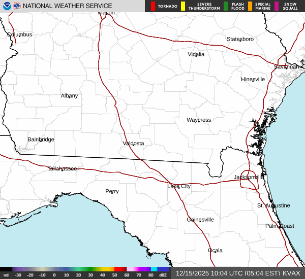
Current Radar Image
Sun Almanac for Tallahassee, Florida
Sunrise: 06:50 AM
Sunset: 8:17 PM
Civil Sunrise:06:25 AM
Civil Sunset: 8:43 PM
Nautical Sunrise: 05:54 AM
Nautical Sunset: 9:14 PM
Astro Sunrise: 05:22 AM
Astro Sunset: 9:46 PM
Florida's Current Temperatures
 Florida's Satellite Image
 Florida's Current Wind Direction
| National Summary |
of upper and lower values of current conditions amongst 6998 locations
in the contiguous United States |
|
High
Temp |
93° |
Plant City Municipal A/P, Florida
|
|
Low
Temp |
34° |
Klamath Falls, Oregon
and 2 other locations
|
|
Wind
Speed |
38mph |
Reno, Nevada
|
|
Wind
Gust |
55mph |
Reno, Nevada
|
|
Wind
Chill |
21° |
Berthoud Pass, Colorado
|
|
Heat
Index |
109° |
Ft Rucker/Hanche, Alabama
|
|
High
Pressure |
30.40Hg |
Rockland, Maine
and 2 other locations
|
|
Low
Pressure |
29.45Hg |
Pendleton, Oregon
and 1 other location
|
|
| # Locations Reporting Snow |
2 |
|
| # Locations Reporting Rain |
190 |
|
| # Locations Reporting Thunderstorms / Lightning |
21 |
|
| # Locations Reporting Fog |
7 |
|
| Average Temperature in the Contiguous USA |
67° |
|
Any use of the information on this page is at your own risk. This information should not be relied upon in life-threatening situations, potential financial loss situations or in lieu of any officially disseminated information. Visit the
National Weather Service for official information.