Strickland Acres, California Weather
Current Conditions at
CAMARILLO - (KCMA)
84°
Clear
as of 12:55 PM PDST
Rel. Humidity: 35%
Dew Point: 54°F
Visibility: 10 Miles
Pressure: 29.93 in.
Flight Rule: VFR
Wind Data
8 MPH
Gust: 21 MPH
210° Southwest
Cloud Level(s): Clear
Current Conditions at
OXNARD - (KOXR)
82°
Clear
as of 12:51 PM PDST
Rel. Humidity: 37%
Dew Point: 54°F
Visibility: 10 Miles
Pressure: 29.93 in.
Flight Rule: VFR
Cloud Level(s): Clear
Current Conditions at
POINT MUGU NAS - (KNTD)
79°
Mostly Clear
as of 12:55 PM PDST
Rel. Humidity: 47%
Dew Point: 57°F
Visibility: 10 Miles
Pressure: 29.94 in.
Flight Rule: VFR
Wind Data
7 MPH
220° Southwest
Cloud Level(s): Few at 28000ft
Current Conditions at
VAN NUYS - (KVNY)
93°
Clear
as of 12:51 PM PDST
Rel. Humidity: 15%
Dew Point: 39°F
Visibility: 10 Miles
Pressure: 29.95 in.
Flight Rule: VFR
Wind Data
8 MPH
320° Northwest
Cloud Level(s): Clear
Moon Almanac for Strickland Acres, California
Moon Phase: New Moon
Moon Illumination: 2%
Moon Age: 28.2 Days
Moon is currently above the horizon
Distance from Moon to Earth: 237,675 miles
Upcoming Lunar Events for
Strickland Acres: |
| Next Event | Event Time | Illum |
|
|
|
| Moonset: | 08:59 pm Tue | 1.3% |
| Moonrise: | 09:47 am Wed | 0.3% |
| High Moon: | 03:51 pm Wed | 0.1% |
| New Moon: | 09:24 pm Wed | 0.0% |
| Moonset: | 10:06 pm Wed | 0.0% |
 | New Moon: Tue Feb 17 |
 | First Quarter: Tue Feb 24 |
 | Full Moon: Tue Mar 3 |
 | Last Quarter: Wed Mar 11 |
| New Moon: Wed Mar 18 |
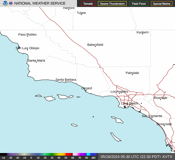
Current Radar Image
| California State Summary |
of upper and lower values of current conditions amongst 130 locations
in California |
|
High
Temp |
99° |
Palm Springs
and 1 other location
|
|
|
|
|
|
|
|
High
Pressure |
30.38Hg |
Mammoth Lakes
|
|
Low
Pressure |
29.89Hg |
Thermal
|
|
| Average temperature in California |
83° |
|
| # Locations Reporting Rain |
2 |
|
# Locations Reporting IFR
(Instrument Flight Rules) |
1 |
|
# Locations Reporting MVFR
(Marginal Visual Flight Rules) |
1 |
|
# Locations Reporting VFR
(Visual Flight Rules) |
128 |
|
California's Current Temperatures
 California's Satellite Image
 California's Current Wind Direction
| National Summary |
of upper and lower values of current conditions amongst 6772 locations
in the contiguous United States |
|
High
Temp |
99° |
Palm Springs, California
and 1 other location
|
|
Low
Temp |
10° |
Sault Ste Marie, Michigan
|
|
Wind
Speed |
39mph |
Malta, Montana
|
|
Wind
Gust |
55mph |
Buffalo, South Dakota
|
|
Wind
Chill |
-6° |
Hutson Field, North Dakota
and 2 other locations
|
|
High
Pressure |
30.45Hg |
Salida Mountain, Colorado
|
|
Low
Pressure |
29.40Hg |
Frenchville, Maine
|
|
| # Locations Reporting Snow |
109 |
|
| # Locations Reporting Rain |
19 |
|
| # Locations Reporting Fog |
6 |
|
| Average Temperature in the Contiguous USA |
47° |
|
Any use of the information on this page is at your own risk. This information should not be relied upon in life-threatening situations, potential financial loss situations or in lieu of any officially disseminated information. Visit the
National Weather Service for official information.