Skull Creek, Wyoming Weather
No Watches or Warnings for Skull Creek
Issued: 8:27 am MST Dec 16, 2025 Latitude: 44.1091487 Longitude: -104.3671697 View on Google Maps
|
|
|
|
|
|
|
|
|
|
 |
 |
 |
 |
 |
 |
|
|
| High: °F |
Low: °F |
High: °F |
High: °F |
High: °F |
High: °F |
High: °F |
High: °F |
| Low: °F |
Low: °F |
Low: °F |
Low: °F |
Low: °F |
|
| Mostly Sunny |
Cloudy |
Rain & Snow |
Partly Sunny |
Rain |
Snow |
Partly Sunny |
Mostly Sunny |
Current Conditions at
CUSTER - (KCUT)
43°
Clear
as of 7:53 AM MST
Rel. Humidity: 33%
Dew Point: 16°F
Visibility: 10 Miles
Pressure: 29.82 in.
Flight Rule: VFR
Wind Data
5 MPH
240° Southwest
Cloud Level(s): Clear
Current Conditions at
GILLETTE - (KGCC)
Clear
as of 7:53 AM MST
Rel. Humidity: 34%
Dew Point: 21°F
Visibility: 10 Miles
Pressure: 29.81 in.
Flight Rule: VFR
Cloud Level(s): Clear
Current Conditions at
ELLSWORTH AFB - (KRCA)
52°
Cloudy
as of 7:55 AM MST
Rel. Humidity: 34%
Dew Point: 25°F
Visibility: 10 Miles
Pressure: 29.70 in.
Flight Rule: VFR
Cloud Level(s): Solid Overcast at 21000ft
Current Conditions at
RAPID CITY - (KRAP)
46°
Clear
as of 7:52 AM MST
Rel. Humidity: 42%
Dew Point: 25°F
Visibility: 10 Miles
Pressure: 29.74 in.
Flight Rule: VFR
Wind Data
6 MPH
240° Southwest
Cloud Level(s): Clear
|
Today... Mostly sunny, with a high near 51. East wind 6 to 9 mph becoming northwest in the afternoon. Winds could gust as high as 18 mph. |
|
|
Tonight... Partly cloudy, with a low around 30. Southeast wind 5 to 9 mph, with gusts as high as 16 mph. |
|
|
Wednesday... Rain likely between 11am and 4pm, then snow likely after 4pm. Partly sunny, with a high near 53. Windy, with a south wind 11 to 21 mph becoming west 21 to 31 mph in the afternoon. Winds could gust as high as 43 mph. Chance of precipitation is 70%. New snow accumulation of less than a half inch possible. |
|
 |
Wednesday Night... A 40 percent chance of snow, mainly before 11pm. Mostly cloudy, with a low around 16. Wind chill values as low as 2. Breezy, with a northwest wind 24 to 28 mph, with gusts as high as 44 mph. New snow accumulation of less than a half inch possible. |
|
|
Thursday... Partly sunny, with a high near 33. Northwest wind 13 to 18 mph becoming south 6 to 11 mph in the afternoon. Winds could gust as high as 26 mph. |
|
 |
Thursday Night... Mostly cloudy, with a temperature rising to around 37 by 5am. South wind 8 to 10 mph, with gusts as high as 21 mph. |
|
|
Friday... A 10 percent chance of rain after 5pm. Mostly cloudy, with a high near 52. Southwest wind 10 to 14 mph, with gusts as high as 25 mph. |
|
 |
Friday Night... A slight chance of rain and snow before 9pm, then a chance of snow. Mostly cloudy, with a low around 26. West wind 7 to 9 mph, with gusts as high as 17 mph. |
|
|
Saturday... A chance of snow, mainly before 11am. Partly sunny, with a high near 37. |
|
 |
Saturday Night... A slight chance of snow before 11pm. Partly cloudy, with a low around 21. |
|
|
Sunday... Partly sunny, with a high near 40. |
|
|
Sunday Night... Mostly cloudy, with a low around 27. |
|
|
Monday... Mostly sunny, with a high near 50. |
|
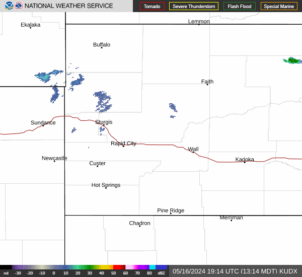
Current Radar Image
Sun Almanac for Skull Creek, Wyoming
Sunrise: 07:27 AM
Sunset: 4:20 PM
Civil Sunrise:06:54 AM
Civil Sunset: 4:53 PM
Nautical Sunrise: 06:17 AM
Nautical Sunset: 5:30 PM
Astro Sunrise: 05:42 AM
Astro Sunset: 6:05 PM
Wyoming's Current Temperatures
 Wyoming's Satellite Image
 Wyoming's Current Wind Direction
| National Summary |
of upper and lower values of current conditions amongst 7290 locations
in the contiguous United States |
|
High
Temp |
75° |
Homestead AFB, Florida
and 1 other location
|
|
Low
Temp |
0° |
Gunnison, Colorado
|
|
Wind
Speed |
43mph |
Plentywood, Montana
|
|
Wind
Gust |
55mph |
Plentywood, Montana
|
|
Wind
Chill |
1° |
Gwinn, Michigan
|
|
High
Pressure |
30.43Hg |
Salida Mountain, Colorado
|
|
Low
Pressure |
29.17Hg |
Flag Island, Minnesota
|
|
| # Locations Reporting Snow |
9 |
|
| # Locations Reporting Rain |
20 |
|
| # Locations Reporting Fog |
19 |
|
| Average Temperature in the Contiguous USA |
36° |
|
Any use of the information on this page is at your own risk. This information should not be relied upon in life-threatening situations, potential financial loss situations or in lieu of any officially disseminated information. Visit the
National Weather Service for official information.