Rough and Ready, New York Weather
No Watches or Warnings for Rough and Ready
Issued: 2:51 pm EST Dec 7, 2025 Latitude: 42.1075698 Longitude: -77.6522126 View on Google Maps
|
|
|
|
|
|
|
|
|
|
 |
|
 |
 |
 |
|
 |
 |
| High: °F |
Low: °F |
High: °F |
High: °F |
High: °F |
High: °F |
High: °F |
High: °F |
| Low: °F |
Low: °F |
Low: °F |
Low: °F |
Low: °F |
|
| Snow |
Snow |
Mostly Sunny |
Snow |
Rain & Snow |
Snow |
Snow |
Snow |
Current Conditions at
WELLSVILLE MUNI - (KELZ)
Cloudy
as of 1:56 PM EST
Rel. Humidity: 74%
Dew Point: 21°F
Visibility: 7 Miles
Pressure: 29.91 in.
Flight Rule: MVFR
Wind Data
9 MPH
Gust: 21 MPH
240° Southwest
Cloud Level(s): Solid Overcast at 1900ft
Current Conditions at
DANSVILLE - (KDSV)
37°
Cloudy
as of 1:54 PM EST
Rel. Humidity: 55%
Dew Point: 23°F
Visibility: 10 Miles
Pressure: 29.95 in.
Flight Rule: VFR
Cloud Level(s): Solid Overcast at 3200ft
Current Conditions at
ELMIRA - (KELM)
34°
Cloudy
Light Snow
as of 2:41 PM EST
Rel. Humidity: 69%
Dew Point: 25°F
Visibility: 2 1/2 Miles
Pressure: 29.95 in.
Flight Rule: IFR
Wind Data
8 MPH
240° Southwest
Cloud Level(s): Few at 2600ft, Scattered at 3100ft, Solid Overcast at 4200ft
Current Conditions at
ITHACA - (KITH)
Cloudy
Light Snow
as of 1:56 PM EST
Rel. Humidity: 74%
Dew Point: 25°F
Visibility: 3 Miles
Pressure: 29.95 in.
Flight Rule: MVFR
Wind Data
10 MPH
210° Southwest
Cloud Level(s): Solid Overcast at 2500ft
|
This Afternoon... A chance of snow showers after 4pm. Mostly cloudy, with a high near 29. West wind around 10 mph, with gusts as high as 20 mph. Chance of precipitation is 30%. Total daytime snow accumulation of less than a half inch possible. |
|
|
Tonight... A chance of snow showers, mainly before 7pm. Mostly cloudy, with a low around 6. Wind chill values as low as -4. Northwest wind 10 to 13 mph, with gusts as high as 23 mph. Chance of precipitation is 30%. New snow accumulation of less than a half inch possible. |
|
|
Monday... Mostly sunny, with a high near 17. Wind chill values as low as -5. Northeast wind 3 to 8 mph. |
|
 |
Monday Night... Partly cloudy, with a low around 3. Wind chill values as low as -7. Calm wind becoming south around 6 mph after midnight. |
|
|
Tuesday... A slight chance of snow showers after 1pm. Mostly cloudy, with a high near 29. South wind 9 to 16 mph, with gusts as high as 30 mph. Chance of precipitation is 20%. |
|
 |
Tuesday Night... Snow likely after 1am. Mostly cloudy, with a low around 24. Chance of precipitation is 60%. |
|
|
Wednesday... Snow before 1pm, then rain and snow. High near 36. Chance of precipitation is 100%. |
|
|
Wednesday Night... Snow likely before 1am. Mostly cloudy, with a low around 20. Chance of precipitation is 60%. |
|
|
Thursday... A chance of snow showers after 1pm. Mostly cloudy, with a high near 26. Chance of precipitation is 30%. |
|
|
Thursday Night... A chance of snow showers. Mostly cloudy, with a low around 16. Chance of precipitation is 40%. |
|
|
Friday... A chance of snow showers. Mostly cloudy, with a high near 24. Chance of precipitation is 40%. |
|
|
Friday Night... A chance of snow showers. Mostly cloudy, with a low around 12. Chance of precipitation is 40%. |
|
|
Saturday... A chance of snow showers. Mostly cloudy, with a high near 20. Chance of precipitation is 50%. |
|
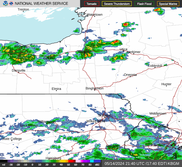
Current Radar Image
Sun Almanac for Rough and Ready, New York
Sunrise: 07:26 AM
Sunset: 4:39 PM
Civil Sunrise:06:54 AM
Civil Sunset: 5:10 PM
Nautical Sunrise: 06:19 AM
Nautical Sunset: 5:45 PM
Astro Sunrise: 05:45 AM
Astro Sunset: 6:19 PM
New York's Current Temperatures
 New York's Satellite Image
 New York's Current Wind Direction
| National Summary |
of upper and lower values of current conditions amongst 7009 locations
in the contiguous United States |
|
High
Temp |
86° |
Edinburg Intl Arpt, Texas
|
|
Low
Temp |
0° |
Oakes Municipal A/P, North Dakota
and 9 other locations
|
|
Wind
Speed |
36mph |
Dakota Hill, Colorado
|
|
Wind
Gust |
62mph |
Dakota Hill, Colorado
|
|
Wind
Chill |
-17° |
Berthoud Pass, Colorado
|
|
High
Pressure |
30.39Hg |
Wheaton Ndb, Minnesota
and 1 other location
|
|
Low
Pressure |
29.84Hg |
Bellingham, Washington
and 2 other locations
|
|
| # Locations Reporting Snow |
72 |
|
| # Locations Reporting Rain |
85 |
|
| # Locations Reporting Fog |
10 |
|
| Average Temperature in the Contiguous USA |
41° |
|
Any use of the information on this page is at your own risk. This information should not be relied upon in life-threatening situations, potential financial loss situations or in lieu of any officially disseminated information. Visit the
National Weather Service for official information.